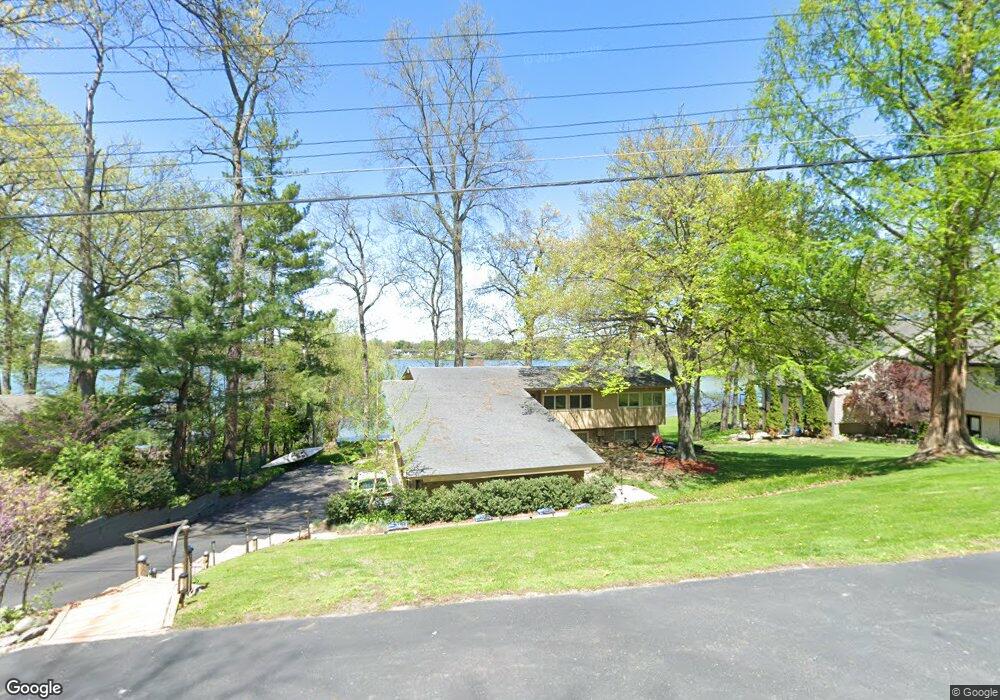
2000 S Hammond Lake Rd West Bloomfield, MI 48324
Estimated Value: $461,000 - $819,000
4
Beds
3
Baths
1,461
Sq Ft
$437/Sq Ft
Est. Value
About This Home
This home is located at 2000 S Hammond Lake Rd, West Bloomfield, MI 48324 and is currently estimated at $638,978, approximately $437 per square foot. 2000 S Hammond Lake Rd is a home located in Oakland County with nearby schools including Walt Whitman Elementary School, Pontiac Middle School, and Pontiac High School.
Ownership History
Date
Name
Owned For
Owner Type
Purchase Details
Closed on
Jan 6, 2021
Sold by
Campau Thomas E and Campau Kathryn A
Bought by
Campau Thomas E and Campau Kathryn A
Current Estimated Value
Home Financials for this Owner
Home Financials are based on the most recent Mortgage that was taken out on this home.
Original Mortgage
$461,618
Interest Rate
2.71%
Mortgage Type
VA
Purchase Details
Closed on
Dec 14, 2004
Sold by
Campau Thomas E and Campau Kathryn A
Bought by
Campau Thomas E and Campau Kathryn A
Create a Home Valuation Report for This Property
The Home Valuation Report is an in-depth analysis detailing your home's value as well as a comparison with similar homes in the area
Home Values in the Area
Average Home Value in this Area
Purchase History
| Date | Buyer | Sale Price | Title Company |
|---|---|---|---|
| Campau Thomas E | -- | None Available | |
| Campau Thomas E | -- | None Available |
Source: Public Records
Mortgage History
| Date | Status | Borrower | Loan Amount |
|---|---|---|---|
| Closed | Campau Thomas E | $461,618 |
Source: Public Records
Tax History Compared to Growth
Tax History
| Year | Tax Paid | Tax Assessment Tax Assessment Total Assessment is a certain percentage of the fair market value that is determined by local assessors to be the total taxable value of land and additions on the property. | Land | Improvement |
|---|---|---|---|---|
| 2024 | -- | $320,800 | $0 | $0 |
| 2023 | -- | $0 | $0 | $0 |
| 2022 | $0 | $0 | $0 | $0 |
| 2021 | $0 | $0 | $0 | $0 |
| 2020 | $0 | $0 | $0 | $0 |
| 2019 | $0 | $0 | $0 | $0 |
| 2018 | $0 | $267,864 | $0 | $0 |
| 2017 | $0 | $0 | $0 | $0 |
| 2016 | $0 | $0 | $0 | $0 |
| 2015 | -- | $0 | $0 | $0 |
| 2014 | -- | $190,710 | $0 | $0 |
| 2011 | -- | $174,440 | $0 | $0 |
Source: Public Records
Map
Nearby Homes
- 2314 Middlebelt Rd
- 2230 Middlebelt Rd
- 2216 Middlebelt Rd
- 2121 Uplong St
- 1968 Maplewood Ave
- 2665 Middlebelt Rd
- 1947 Maplewood Ave
- 2756 Turtle Bluff Dr
- 1831 Long Pointe Dr
- 2468 Walce Dr
- 2622 Pine Ridge Rd
- 2360 Pineview
- 2779 Turtle Lake Dr
- 2759 Turtle Ridge Dr
- 1675 Dell Rose Dr
- 2084 Woodrow Wilson Blvd Unit A6
- 2300 Pine Lake Rd
- 2630 Depew Dr
- 2954 Long Ridge Ct
- 2717 Turtle Shores Ranch Dr
- 1960 S Hammond Lake Dr
- 1960 S Hammond Lake Dr
- 1950 S Hammond Lake Dr
- 1950 S Hammond Lake Dr
- 2020 S Hammond Lake Rd
- 2020 S Hammond Lake Rd
- 1940 S Hammond Lake Dr
- 2024 S Hammond Lake Rd
- 2038 S Hammond Lake Rd
- 2052 S Hammond
- 1945 S Hammond Lake Dr
- 1945 S Hammond Lake Rd
- 1985 S Hammond Lake Dr
- 1920 S Hammond Lake Dr
- 1975 S Hammond Lake Rd
- 2052 S Hammond Lake Rd
- 1959 S Hammond Lake Dr
- 2045 S Hammond Lake Rd
- 1910 S Hammond Lake Rd
- 1910 S Hammond Lake Dr