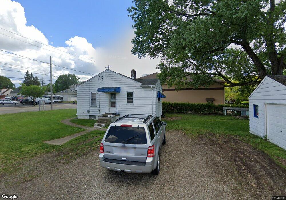
2000 S Main St Akron, OH 44301
Firestone Park NeighborhoodEstimated Value: $102,101 - $118,000
2
Beds
1
Bath
702
Sq Ft
$159/Sq Ft
Est. Value
About This Home
This home is located at 2000 S Main St, Akron, OH 44301 and is currently estimated at $111,525, approximately $158 per square foot. 2000 S Main St is a home located in Summit County with nearby schools including Kenmore Garfield Community Learning Center, Main Preparatory Academy, and Eagle Elementary.
Ownership History
Date
Name
Owned For
Owner Type
Purchase Details
Closed on
Aug 3, 2017
Sold by
Ferrell Cheryl L
Bought by
Parnell Angel Marie and Ferrell Carmen Lee Ann
Current Estimated Value
Purchase Details
Closed on
Jun 14, 2017
Sold by
Ferrell Cheryl L and Fonts Robert E
Bought by
Ferrell Cheryl L
Purchase Details
Closed on
Oct 26, 2011
Sold by
Fouts Robert E
Bought by
Fouts Robert E and Ferrell Cheryl L
Purchase Details
Closed on
Feb 17, 2009
Sold by
Estate Of Thelma Mae Thornton
Bought by
Fouts Robert E
Create a Home Valuation Report for This Property
The Home Valuation Report is an in-depth analysis detailing your home's value as well as a comparison with similar homes in the area
Home Values in the Area
Average Home Value in this Area
Purchase History
| Date | Buyer | Sale Price | Title Company |
|---|---|---|---|
| Parnell Angel Marie | -- | None Available | |
| Ferrell Cheryl L | -- | None Available | |
| Fouts Robert E | -- | Attorney | |
| Fouts Robert E | -- | None Available |
Source: Public Records
Tax History Compared to Growth
Tax History
| Year | Tax Paid | Tax Assessment Tax Assessment Total Assessment is a certain percentage of the fair market value that is determined by local assessors to be the total taxable value of land and additions on the property. | Land | Improvement |
|---|---|---|---|---|
| 2025 | $2,852 | $27,483 | $8,439 | $19,044 |
| 2024 | $1,832 | $27,483 | $8,439 | $19,044 |
| 2023 | $2,852 | $27,483 | $8,439 | $19,044 |
| 2022 | $1,660 | $19,796 | $5,985 | $13,811 |
| 2021 | $1,662 | $19,796 | $5,985 | $13,811 |
| 2020 | $1,641 | $19,800 | $5,990 | $13,810 |
| 2019 | $2,439 | $19,120 | $7,400 | $11,720 |
| 2018 | $1,702 | $19,120 | $7,400 | $11,720 |
| 2017 | $1,741 | $19,120 | $7,400 | $11,720 |
| 2016 | $1,742 | $19,350 | $7,400 | $11,950 |
| 2015 | $1,741 | $19,350 | $7,400 | $11,950 |
| 2014 | $1,729 | $19,350 | $7,400 | $11,950 |
| 2013 | $1,878 | $21,930 | $7,400 | $14,530 |
Source: Public Records
Map
Nearby Homes
- 21 W Linwood Ave
- 41 W Woodsdale Ave
- 40 E Dresden Ave
- 23 Selden Ave
- 88 E Dresden Ave
- 74 E Catawba Ave
- 1861 S Main St
- 41 E Rosewood Ave
- 75 W Dartmore Ave
- 1637 Rockford St
- 363 Lockwood St
- 364 Rexford St
- 197 E Wilbeth Rd
- 2513 Christensen Ave
- 227 Crescent Dr
- 1614 Glenmount Ave
- 132 Crescent Dr
- 739 S Firestone Blvd
- 249 Naomi St
- 361 Mission Dr
- 2012 S Main St
- 2018 S Main St
- 36 W Dresden Ave
- 36 W Dresden Ave
- 12 E Dresden Ave
- 25 W Linwood Ave
- 11 E Dresden Ave
- 29 W Linwood Ave
- 42 W Dresden Ave
- 37 W Linwood Ave
- 17 E Dresden Ave
- 22 E Dresden Ave
- 14 W Linwood Ave
- 20 W Linwood Ave
- 19 E Dresden Ave Unit 21
- 14 W Lindwood
- 25 E Linwood Ave
- 45 W Linwood Ave
- 26 W Linwood Ave
- 2027 S Main St