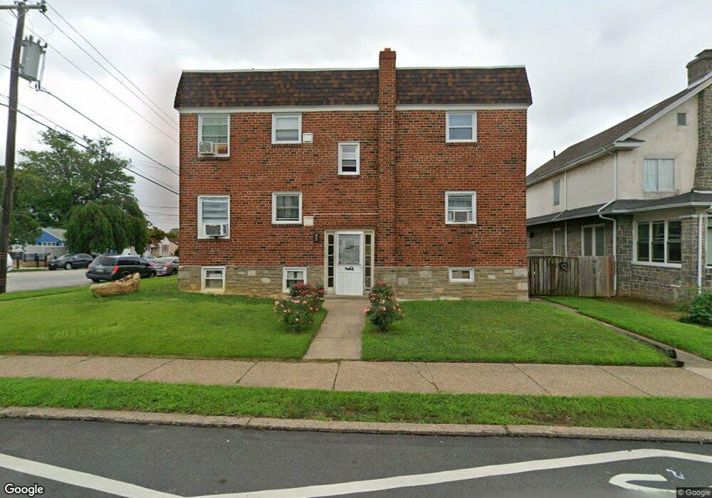
2000 Solly Ave Philadelphia, PA 19152
Rhawnhurst NeighborhoodEstimated Value: $250,848 - $354,000
4
Beds
2
Baths
1,558
Sq Ft
$191/Sq Ft
Est. Value
About This Home
This home is located at 2000 Solly Ave, Philadelphia, PA 19152 and is currently estimated at $296,949, approximately $190 per square foot. 2000 Solly Ave is a home with nearby schools including Farrell Louis H School, Northeast High School, and Tacony Academy Charter School.
Ownership History
Date
Name
Owned For
Owner Type
Purchase Details
Closed on
Dec 23, 2016
Sold by
Moreland Albert Anthony and Moreland Tanya Nicole
Bought by
Shehata Rich A
Current Estimated Value
Purchase Details
Closed on
Feb 28, 2000
Sold by
Zatz Susan
Bought by
Moreland Albert Anthony and Moreland Tanya Nicole
Home Financials for this Owner
Home Financials are based on the most recent Mortgage that was taken out on this home.
Original Mortgage
$109,942
Interest Rate
8.18%
Mortgage Type
Commercial
Create a Home Valuation Report for This Property
The Home Valuation Report is an in-depth analysis detailing your home's value as well as a comparison with similar homes in the area
Home Values in the Area
Average Home Value in this Area
Purchase History
| Date | Buyer | Sale Price | Title Company |
|---|---|---|---|
| Shehata Rich A | $132,000 | The Abstract Company | |
| Moreland Albert Anthony | $107,000 | -- |
Source: Public Records
Mortgage History
| Date | Status | Borrower | Loan Amount |
|---|---|---|---|
| Previous Owner | Moreland Albert Anthony | $109,942 |
Source: Public Records
Tax History Compared to Growth
Tax History
| Year | Tax Paid | Tax Assessment Tax Assessment Total Assessment is a certain percentage of the fair market value that is determined by local assessors to be the total taxable value of land and additions on the property. | Land | Improvement |
|---|---|---|---|---|
| 2025 | $3,667 | $342,800 | $68,560 | $274,240 |
| 2024 | $3,667 | $342,800 | $68,560 | $274,240 |
| 2023 | $3,667 | $262,000 | $52,400 | $209,600 |
| 2022 | $2,667 | $262,000 | $52,400 | $209,600 |
| 2021 | $2,667 | $0 | $0 | $0 |
| 2020 | $2,667 | $0 | $0 | $0 |
| 2019 | $2,497 | $0 | $0 | $0 |
| 2018 | $2,357 | $0 | $0 | $0 |
| 2017 | $2,357 | $0 | $0 | $0 |
| 2016 | $2,357 | $0 | $0 | $0 |
| 2015 | $2,257 | $0 | $0 | $0 |
| 2014 | -- | $168,400 | $29,952 | $138,448 |
| 2012 | -- | $27,168 | $2,975 | $24,193 |
Source: Public Records
Map
Nearby Homes
- 1931 33 Rhawn St
- 2155 Benson St
- 2029 Loney St
- 2162 Strahle St
- 2232 Stanwood St
- 2223 Emerson St
- 2230 Emerson St
- 2123 Loney St
- 1917 Griffith St
- 1702 Arthur St
- 1705 Solly Ave
- 1704 Stanwood St
- 1718 Rhawn St
- 2201 Strahle St Unit C302
- 7912 14 Loretto Ave
- 2302 Rhawn St
- 2321 Emerson St
- 2301 Ripley St
- 8127 Langdon St
- 1719 Loney St
- 2002 Solly Ave
- 2004 Solly Ave
- 8191 Castor Ave
- 2006 Solly Ave
- 2010 Solly Ave
- 8201 Castor Ave
- 2003 Arthur St
- 2012 Solly Ave
- 2011 Solly Ave
- 8207 Castor Ave
- 2011 Arthur St
- 2015 Solly Ave
- 1922 Solly Ave
- 2016 Solly Ave
- 8200 Castor Ave
- 8211 Castor Ave
- 1920 Solly Ave
- 8109-15 Castor Ave
- 8109 Castor Ave
- 2013 Arthur St