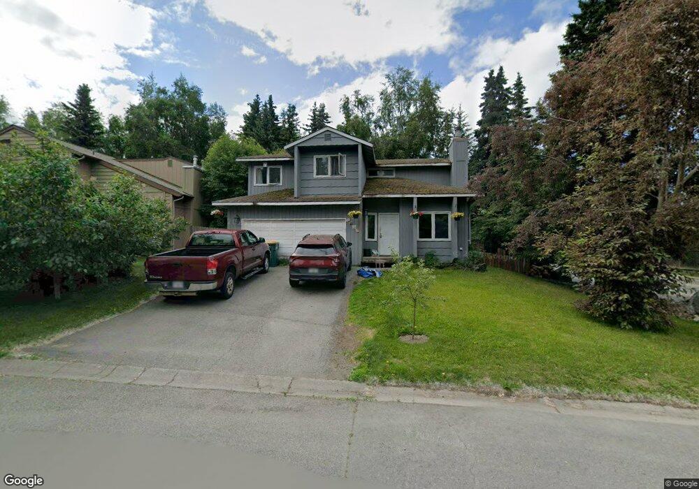
2000 Sturbridge Cir Anchorage, AK 99507
Abbott Loop NeighborhoodEstimated Value: $359,337 - $623,000
3
Beds
2
Baths
989
Sq Ft
$461/Sq Ft
Est. Value
About This Home
This home is located at 2000 Sturbridge Cir, Anchorage, AK 99507 and is currently estimated at $456,334, approximately $461 per square foot. 2000 Sturbridge Cir is a home located in Anchorage Municipality with nearby schools including Spring Hill Elementary School, Hanshew Middle School, and Service High School.
Ownership History
Date
Name
Owned For
Owner Type
Purchase Details
Closed on
Jun 2, 2011
Sold by
Crow Vickie
Bought by
Williams James L
Current Estimated Value
Home Financials for this Owner
Home Financials are based on the most recent Mortgage that was taken out on this home.
Original Mortgage
$210,426
Outstanding Balance
$145,878
Interest Rate
4.75%
Mortgage Type
FHA
Estimated Equity
$310,456
Purchase Details
Closed on
Nov 4, 1998
Sold by
Cook Richard Allen and Cook Belinda Kay
Bought by
Sieg Mark E
Home Financials for this Owner
Home Financials are based on the most recent Mortgage that was taken out on this home.
Original Mortgage
$119,500
Interest Rate
6.61%
Mortgage Type
VA
Create a Home Valuation Report for This Property
The Home Valuation Report is an in-depth analysis detailing your home's value as well as a comparison with similar homes in the area
Home Values in the Area
Average Home Value in this Area
Purchase History
| Date | Buyer | Sale Price | Title Company |
|---|---|---|---|
| Williams James L | -- | Atga | |
| Sieg Mark E | -- | -- |
Source: Public Records
Mortgage History
| Date | Status | Borrower | Loan Amount |
|---|---|---|---|
| Open | Williams James L | $210,426 | |
| Previous Owner | Sieg Mark E | $119,500 |
Source: Public Records
Tax History
| Year | Tax Paid | Tax Assessment Tax Assessment Total Assessment is a certain percentage of the fair market value that is determined by local assessors to be the total taxable value of land and additions on the property. | Land | Improvement |
|---|---|---|---|---|
| 2025 | $5,250 | $347,700 | $97,500 | $250,200 |
| 2024 | $5,250 | $325,200 | $97,500 | $227,700 |
| 2023 | $5,131 | $301,300 | $97,500 | $203,800 |
| 2022 | $4,761 | $282,700 | $97,500 | $185,200 |
| 2021 | $4,638 | $257,400 | $97,500 | $159,900 |
| 2020 | $4,466 | $262,700 | $97,500 | $165,200 |
| 2019 | $4,178 | $255,400 | $97,500 | $157,900 |
| 2018 | $4,080 | $248,800 | $93,500 | $155,300 |
| 2017 | $4,058 | $259,100 | $93,500 | $165,600 |
| 2016 | $3,425 | $242,000 | $90,000 | $152,000 |
| 2015 | $3,425 | $236,700 | $90,000 | $146,700 |
| 2014 | $3,425 | $232,100 | $90,000 | $142,100 |
Source: Public Records
Map
Nearby Homes
- 9750 Vanguard Dr Unit 54
- 9751 Newhaven Loop
- 9710 Vanguard Dr Unit 80
- 1900-1941 Marthas Vineyard Cir
- 9715 Independence Dr Unit B306
- 8000 Independence Park Dr
- 9599 Brayton Dr Unit 422
- 2211 Sentry Dr Unit B6
- 1962 Commodore Dr
- 2300 Sentry Dr Unit E102
- 2300 Sentry Dr Unit E106
- 1935 Commodore Dr
- 2430 Sentry Dr Unit B306
- 9499 Brayton Dr Unit 39
- 9499 Brayton Dr Unit 152
- 9499 Brayton Dr Unit 245
- 9387 Morningside Loop
- 9130 Golovin St
- 9610 Morningside Loop Unit B1
- 10240 Old Seward Hwy
- 2010 Sturbridge Cir
- TR A2A Independence Dr
- TR K2 Independence Dr
- TR S Independence Dr
- 8000 Independence Dr
- 2020 Sturbridge Cir
- 10230 Jamestown Dr Unit 5H
- 10230 Jamestown Dr Unit 5G
- 10230 Jamestown Dr Unit 5F
- 10230 Jamestown Dr Unit 5E
- 10230 Jamestown Dr Unit 5D
- 10230 Jamestown Dr Unit 5C
- 10230 Jamestown Dr Unit 5B
- 10230 Jamestown Dr Unit 5A
- 10230 Jamestown Dr
- 10230 Jamestown Dr Unit G
- 10230 Jamestown Dr Unit H5
- 10230 Jamestown Dr Unit E
- 10230 Jamestown Dr Unit H
- 10230 Jamestown Dr Unit D5
Your Personal Tour Guide
Ask me questions while you tour the home.