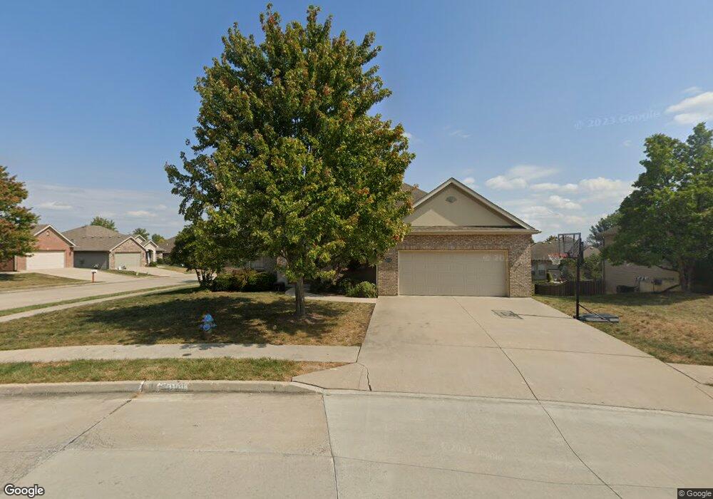
2000 Swindon Ave Columbia, MO 65203
Estimated Value: $418,499 - $582,000
4
Beds
3
Baths
3,410
Sq Ft
$139/Sq Ft
Est. Value
About This Home
This home is located at 2000 Swindon Ave, Columbia, MO 65203 and is currently estimated at $474,375, approximately $139 per square foot. 2000 Swindon Ave is a home located in Boone County with nearby schools including Beulah Ralph Elementary School, Jefferson Middle School, and Rock Bridge High School.
Ownership History
Date
Name
Owned For
Owner Type
Purchase Details
Closed on
Dec 15, 2010
Sold by
Shoultz Jeffrey David and Shoultz Kristi Ione
Bought by
Meyer John and Meyer Eastin
Current Estimated Value
Home Financials for this Owner
Home Financials are based on the most recent Mortgage that was taken out on this home.
Original Mortgage
$204,000
Outstanding Balance
$134,916
Interest Rate
4.24%
Mortgage Type
New Conventional
Estimated Equity
$339,459
Purchase Details
Closed on
Jan 21, 2005
Sold by
Mcvey Construction Llc
Bought by
Shoultz Jeffrey David and Shoultz Kristi Lone
Home Financials for this Owner
Home Financials are based on the most recent Mortgage that was taken out on this home.
Original Mortgage
$205,560
Interest Rate
4.75%
Mortgage Type
Adjustable Rate Mortgage/ARM
Create a Home Valuation Report for This Property
The Home Valuation Report is an in-depth analysis detailing your home's value as well as a comparison with similar homes in the area
Purchase History
| Date | Buyer | Sale Price | Title Company |
|---|---|---|---|
| Meyer John | -- | None Available | |
| Shoultz Jeffrey David | -- | None Available |
Source: Public Records
Mortgage History
| Date | Status | Borrower | Loan Amount |
|---|---|---|---|
| Open | Meyer John | $204,000 | |
| Previous Owner | Shoultz Jeffrey David | $205,560 |
Source: Public Records
Tax History Compared to Growth
Tax History
| Year | Tax Paid | Tax Assessment Tax Assessment Total Assessment is a certain percentage of the fair market value that is determined by local assessors to be the total taxable value of land and additions on the property. | Land | Improvement |
|---|---|---|---|---|
| 2025 | $3,888 | $59,375 | $6,422 | $52,953 |
| 2024 | $3,498 | $51,851 | $6,422 | $45,429 |
| 2023 | $3,469 | $51,851 | $6,422 | $45,429 |
| 2022 | $3,209 | $48,013 | $6,422 | $41,591 |
| 2021 | $3,215 | $48,013 | $6,422 | $41,591 |
| 2020 | $3,289 | $46,158 | $6,422 | $39,736 |
| 2019 | $3,289 | $46,158 | $6,422 | $39,736 |
| 2018 | $3,185 | $0 | $0 | $0 |
| 2017 | $3,141 | $44,384 | $6,422 | $37,962 |
| 2016 | $3,141 | $44,384 | $6,422 | $37,962 |
| 2015 | $2,885 | $44,384 | $6,422 | $37,962 |
| 2014 | $2,894 | $44,384 | $6,422 | $37,962 |
Source: Public Records
Map
Nearby Homes
- 1704 Stillpoint Ct
- 1700 Stillpoint Ct
- 5013 City Hill Ct
- 1416 W Georgetown Loop
- 4406 Gage Place
- 00 W Gillespie Bridge Rd
- 0 W Gillespie Bridge Rd
- 2506 Grandview Cir
- 1000 Louisville Dr
- 6041 Tamarack Dr
- 4205 Grant Ln
- 5105 Whitefish Dr
- 6050 Tamarack Dr
- 6015 W Swather Ct
- 6035 W Swather Ct
- 6051 Tamarack Dr
- 6031 Tamarack Dr
- 4016 Bent Oak Dr
- 805 Somerset Dr
- 820 Angels Rest Way
- 2002 Swindon Ave
- 2001 Tadley St
- 2001 Tradley St
- 4904 Craydon Dr
- 2004 Swindon Ave
- 4909 Craydon Dr
- 4911 Craydon Dr
- 2003 Tadley St
- 4907 Craydon Dr
- 5002 Craydon Dr
- 4905 Craydon Dr
- 5001 Craydon Dr
- 2006 Swindon Ave
- 5003 Craydon Dr
- 5003 Craydon Dr Unit 65203
- 2005 Tadley St
- 5005 Craydon Dr
- 2000 Tadley St
- 2008 Swindon Ave
- 2002 Tadley St