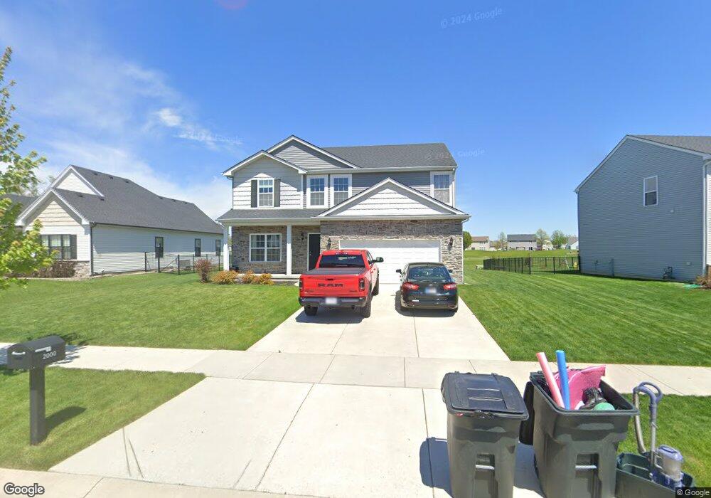
2000 W 132nd Ave Crown Point, IN 46307
Estimated Value: $442,395 - $517,000
4
Beds
3
Baths
2,563
Sq Ft
$185/Sq Ft
Est. Value
About This Home
This home is located at 2000 W 132nd Ave, Crown Point, IN 46307 and is currently estimated at $474,349, approximately $185 per square foot. 2000 W 132nd Ave is a home located in Lake County with nearby schools including Dwight D. Eisenhower Elementary School, Robert Taft Middle School, and Crown Point High School.
Ownership History
Date
Name
Owned For
Owner Type
Purchase Details
Closed on
Feb 28, 2018
Sold by
Providence Homes At Regency Inc
Bought by
Rocha Ramon A and Rocha Pamela A
Current Estimated Value
Home Financials for this Owner
Home Financials are based on the most recent Mortgage that was taken out on this home.
Original Mortgage
$319,646
Outstanding Balance
$272,402
Interest Rate
4.15%
Mortgage Type
New Conventional
Estimated Equity
$201,947
Purchase Details
Closed on
Jul 31, 2017
Sold by
The Regency Of Crown Point Llc
Bought by
Providence Homes At Regency Inc
Home Financials for this Owner
Home Financials are based on the most recent Mortgage that was taken out on this home.
Original Mortgage
$428,800
Interest Rate
3.96%
Mortgage Type
Future Advance Clause Open End Mortgage
Purchase Details
Closed on
Feb 24, 2011
Sold by
Lake County Trust
Bought by
The Regency Of Crown Point Llc
Create a Home Valuation Report for This Property
The Home Valuation Report is an in-depth analysis detailing your home's value as well as a comparison with similar homes in the area
Home Values in the Area
Average Home Value in this Area
Purchase History
| Date | Buyer | Sale Price | Title Company |
|---|---|---|---|
| Rocha Ramon A | -- | Chicago Title Insurance Co | |
| Providence Homes At Regency Inc | -- | Chicago Title Insurance Co | |
| The Regency Of Crown Point Llc | -- | Chicago Title Insurance Co |
Source: Public Records
Mortgage History
| Date | Status | Borrower | Loan Amount |
|---|---|---|---|
| Open | Rocha Ramon A | $319,646 | |
| Previous Owner | Providence Homes At Regency Inc | $428,800 |
Source: Public Records
Tax History Compared to Growth
Tax History
| Year | Tax Paid | Tax Assessment Tax Assessment Total Assessment is a certain percentage of the fair market value that is determined by local assessors to be the total taxable value of land and additions on the property. | Land | Improvement |
|---|---|---|---|---|
| 2024 | $10,155 | $405,100 | $57,400 | $347,700 |
| 2023 | $3,888 | $369,500 | $57,400 | $312,100 |
| 2022 | $3,888 | $348,100 | $57,400 | $290,700 |
| 2021 | $3,676 | $329,400 | $57,400 | $272,000 |
| 2020 | $3,488 | $312,900 | $57,400 | $255,500 |
| 2019 | $3,366 | $302,100 | $57,400 | $244,700 |
| 2018 | $5 | $200 | $200 | $0 |
| 2017 | $5 | $200 | $200 | $0 |
| 2016 | $5 | $200 | $200 | $0 |
| 2014 | $5 | $200 | $200 | $0 |
| 2013 | $5 | $200 | $200 | $0 |
Source: Public Records
Map
Nearby Homes
- 13182 Hayes St
- 13192 Hayes St
- 13085 Taft St
- 13089 Hayes St
- 12938 Hayes St
- 1790 W 134th Ct
- 2585 W 132nd Ln
- 2612 W 132nd Ln
- 12819 Grant St
- 2442 W 127th Ln
- 2800 W 133rd Ave
- 13031 Taney Place
- 2725 W 127th Ln
- 12918 Taney St
- 12768 Ellsworth Place
- 255 Nomo Place
- The Breckenridge Plan at Sawgrass
- The Keystone Plan at Sawgrass
- The Ganby Plan at Sawgrass
- The Monarch Plan at Sawgrass
- 2000 W 132nd Ave
- 1978 W 132nd Ave
- 2016 W 132nd Ave
- 2016 W 132nd Ave
- 1958 W 132nd Ave
- 2028 W 132nd Ave
- 13202 Mckinley Place
- 13169 Roosevelt Place
- 13208 Mckinley Place
- 13181 Roosevelt Place
- 1936 W 132nd Ave
- 2046 W 132nd Ave
- 13205 Mckinley Place
- 13214 Mckinley Place
- 2057 W 132nd Ave
- 13215 Mckinley Place
- 13195 Roosevelt Place
- 1916 W 132nd Ave
- 2060 W 132nd Ave
- 13220 Mckinley Place