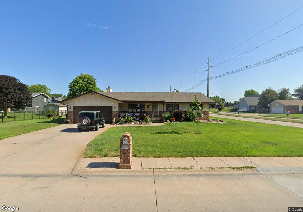
2000 W 14th St Hastings, NE 68901
Estimated Value: $292,000 - $378,000
3
Beds
2
Baths
1,728
Sq Ft
$182/Sq Ft
Est. Value
About This Home
This home is located at 2000 W 14th St, Hastings, NE 68901 and is currently estimated at $314,100, approximately $181 per square foot. 2000 W 14th St is a home located in Adams County with nearby schools including Hastings Senior High School, St. Michael's Preschool & Elementary School, and Zion Lutheran School.
Ownership History
Date
Name
Owned For
Owner Type
Purchase Details
Closed on
Oct 5, 2022
Sold by
Perry Daniel B and Perry Amanda R
Bought by
Goebel Everett M and Goebel Patricia G
Current Estimated Value
Purchase Details
Closed on
Jan 7, 2020
Sold by
Mangers Yvonne M Est
Bought by
Perry Daniel B and Perry Amanda R
Home Financials for this Owner
Home Financials are based on the most recent Mortgage that was taken out on this home.
Original Mortgage
$188,000
Interest Rate
3.6%
Mortgage Type
New Conventional
Create a Home Valuation Report for This Property
The Home Valuation Report is an in-depth analysis detailing your home's value as well as a comparison with similar homes in the area
Home Values in the Area
Average Home Value in this Area
Purchase History
| Date | Buyer | Sale Price | Title Company |
|---|---|---|---|
| Goebel Everett M | $250,000 | Adams Land Title | |
| Perry Daniel B | $188,000 | None Available |
Source: Public Records
Mortgage History
| Date | Status | Borrower | Loan Amount |
|---|---|---|---|
| Previous Owner | Perry Daniel B | $188,000 |
Source: Public Records
Tax History Compared to Growth
Tax History
| Year | Tax Paid | Tax Assessment Tax Assessment Total Assessment is a certain percentage of the fair market value that is determined by local assessors to be the total taxable value of land and additions on the property. | Land | Improvement |
|---|---|---|---|---|
| 2024 | $4,115 | $257,294 | $31,725 | $225,569 |
| 2023 | $4,990 | $241,823 | $31,725 | $210,098 |
| 2022 | $3,949 | $175,320 | $31,725 | $143,595 |
| 2021 | $3,787 | $172,676 | $29,081 | $143,595 |
| 2020 | $3,723 | $172,676 | $29,081 | $143,595 |
| 2019 | $3,684 | $172,676 | $29,081 | $143,595 |
| 2018 | $3,533 | $164,745 | $21,150 | $143,595 |
| 2017 | $3,470 | $161,930 | $0 | $0 |
| 2016 | $3,275 | $152,720 | $21,150 | $131,570 |
| 2011 | -- | $141,860 | $19,035 | $122,825 |
Source: Public Records
Map
Nearby Homes
- 1402 Arapahoe Ave
- 1314 N Laird Ave
- 1802 Westchester Dr
- 1225 Heritage Dr
- 1330 Heritage Dr
- 1513 Crane Ave
- 1505 Crane Ave
- 1201 Pershing Rd
- 2616 Butterfoot Ln
- 1223 Westwood Terrace
- 1911 W 11th St
- 2708 Edgewood Ln
- 2330 W 11th St
- 2501 W 10th St
- 2416 W 9th St
- 1814 Boyce St
- 1108 N Baltimore Ave
- 1334 W 12th St
- 736 N Barnes Ave
- 904 N Washington Ave
- 1413 Crane Ave
- 1402 Apache Ave
- 1406 Apache Ave
- 1936 W 14th St Unit 1938
- 1340 Apache Ave
- 1406 Crane Ave
- 1414 Apache Ave
- 1331 Crane Ave
- 1424 Crane Ave
- 1330 Crane Ave
- 1332 Apache Ave
- 1401 Apache Ave
- 1420 Apache Ave
- 1405 Apache Ave
- 1323 Crane Ave
- 1324 Crane Ave
- 1339 Apache Ave
- 1326 Apache Ave
- 1415 Apache Ave
- 1319 Crane Ave