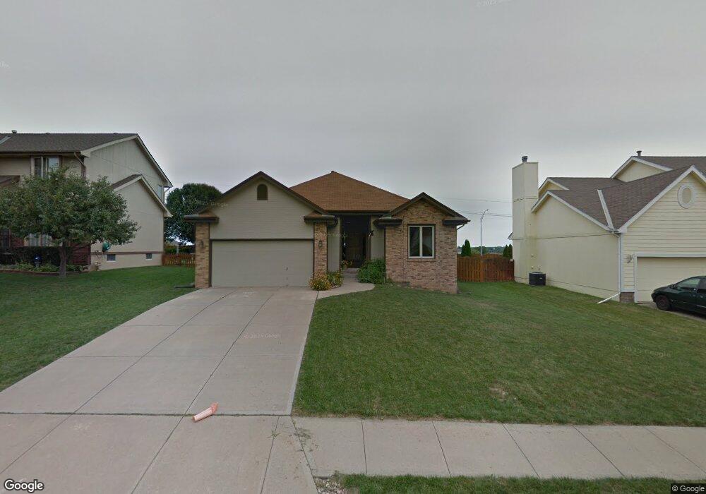
2000 Windcrest Ave Papillion, NE 68133
Estimated Value: $331,000 - $398,000
3
Beds
5
Baths
2,080
Sq Ft
$173/Sq Ft
Est. Value
About This Home
This home is located at 2000 Windcrest Ave, Papillion, NE 68133 and is currently estimated at $360,734, approximately $173 per square foot. 2000 Windcrest Ave is a home located in Sarpy County with nearby schools including Rumsey Station Elementary School, La Vista Middle School, and Papillion La Vista Senior High School.
Ownership History
Date
Name
Owned For
Owner Type
Purchase Details
Closed on
Mar 16, 2012
Sold by
Ulses Gene J and Radel Monica M
Bought by
Ulses Gene J and Ulses Monica M
Current Estimated Value
Home Financials for this Owner
Home Financials are based on the most recent Mortgage that was taken out on this home.
Original Mortgage
$123,000
Interest Rate
3.9%
Mortgage Type
New Conventional
Purchase Details
Closed on
Nov 7, 2003
Sold by
Wehner Kristen and Harlan Gary L
Bought by
Ulses Gene J and Radel Monica M
Home Financials for this Owner
Home Financials are based on the most recent Mortgage that was taken out on this home.
Original Mortgage
$156,600
Interest Rate
5.94%
Mortgage Type
Purchase Money Mortgage
Create a Home Valuation Report for This Property
The Home Valuation Report is an in-depth analysis detailing your home's value as well as a comparison with similar homes in the area
Home Values in the Area
Average Home Value in this Area
Purchase History
| Date | Buyer | Sale Price | Title Company |
|---|---|---|---|
| Ulses Gene J | -- | Dri Title & Escrow | |
| Ulses Gene J | $165,000 | -- |
Source: Public Records
Mortgage History
| Date | Status | Borrower | Loan Amount |
|---|---|---|---|
| Closed | Ulses Gene J | $123,000 | |
| Closed | Ulses Gene J | $156,600 |
Source: Public Records
Tax History Compared to Growth
Tax History
| Year | Tax Paid | Tax Assessment Tax Assessment Total Assessment is a certain percentage of the fair market value that is determined by local assessors to be the total taxable value of land and additions on the property. | Land | Improvement |
|---|---|---|---|---|
| 2025 | $4,435 | $299,585 | $55,000 | $244,585 |
| 2024 | $4,895 | $295,473 | $55,000 | $240,473 |
| 2023 | $4,895 | $259,954 | $48,000 | $211,954 |
| 2022 | $4,839 | $237,140 | $42,000 | $195,140 |
| 2021 | $4,521 | $217,180 | $42,000 | $175,180 |
| 2020 | $4,354 | $207,054 | $36,000 | $171,054 |
| 2019 | $4,289 | $204,110 | $36,000 | $168,110 |
| 2018 | $4,665 | $192,960 | $36,000 | $156,960 |
| 2017 | $4,462 | $184,647 | $26,000 | $158,647 |
| 2016 | $4,289 | $177,188 | $26,000 | $151,188 |
| 2015 | $4,281 | $176,749 | $26,000 | $150,749 |
| 2014 | $3,996 | $171,594 | $26,000 | $145,594 |
| 2012 | -- | $174,490 | $26,000 | $148,490 |
Source: Public Records
Map
Nearby Homes
- 2004 Windcrest Ave
- 2115 Skyhawk Ave
- 605 Fleetwood Dr
- 1912 Franklin Dr
- 2001 Liberty Ln
- 2110 Aberdeen Plaza
- 2107 John St
- 1507 Charleston Dr
- 401 Castle Pine Dr
- 109 Summerset Cir
- 6313 Harvest Dr
- 207 Hilton Head Dr
- 2207 Kara Dr
- 6227 Harvest Dr
- 6320 Harvest Dr
- 6223 Harvest Dr
- 6219 Harvest Dr
- 6215 Harvest Dr
- 6211 Harvest Dr
- 6437 Clear Creek St
- 2002 Windcrest Ave
- 1910 Windcrest Ave
- 1908 Windcrest Ave
- 2001 Windcrest Ave
- 2003 Windcrest Ave
- 1909 Windcrest Ave
- 2006 Windcrest Ave
- 1906 Windcrest Ave
- 2005 Windcrest Ave
- 1907 Windcrest Ave
- 2001 Aberdeen Dr
- 1911 Aberdeen Dr
- 2003 Aberdeen Dr
- 2008 Windcrest Ave
- 2007 Windcrest Ave
- 1904 Windcrest Ave
- 1909 Aberdeen Dr
- 1905 Windcrest Ave
- 1910 Sky Hawk Ave
- 2005 Aberdeen Dr