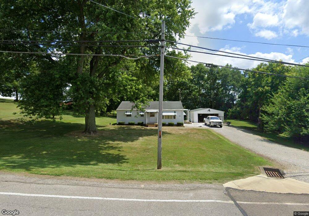
2000 Windsor Rd Mansfield, OH 44905
Estimated Value: $147,000 - $180,000
2
Beds
1
Bath
1,040
Sq Ft
$152/Sq Ft
Est. Value
About This Home
This home is located at 2000 Windsor Rd, Mansfield, OH 44905 and is currently estimated at $157,950, approximately $151 per square foot. 2000 Windsor Rd is a home located in Richland County with nearby schools including Madison High School, St. Mary Catholic School, and Temple-Christian School.
Ownership History
Date
Name
Owned For
Owner Type
Purchase Details
Closed on
May 31, 2007
Sold by
Mckim Ethel G and Mckim Donald H
Bought by
Schwartz Thomas J
Current Estimated Value
Home Financials for this Owner
Home Financials are based on the most recent Mortgage that was taken out on this home.
Original Mortgage
$89,000
Outstanding Balance
$54,547
Interest Rate
6.22%
Mortgage Type
Purchase Money Mortgage
Estimated Equity
$103,403
Purchase Details
Closed on
May 10, 2007
Sold by
Backensto Betty and Backensto Betty L
Bought by
Mckim Ethel G
Home Financials for this Owner
Home Financials are based on the most recent Mortgage that was taken out on this home.
Original Mortgage
$89,000
Outstanding Balance
$54,547
Interest Rate
6.22%
Mortgage Type
Purchase Money Mortgage
Estimated Equity
$103,403
Create a Home Valuation Report for This Property
The Home Valuation Report is an in-depth analysis detailing your home's value as well as a comparison with similar homes in the area
Home Values in the Area
Average Home Value in this Area
Purchase History
| Date | Buyer | Sale Price | Title Company |
|---|---|---|---|
| Schwartz Thomas J | $89,000 | Chicago Title | |
| Mckim Ethel G | -- | Chicago Title |
Source: Public Records
Mortgage History
| Date | Status | Borrower | Loan Amount |
|---|---|---|---|
| Open | Schwartz Thomas J | $89,000 |
Source: Public Records
Tax History
| Year | Tax Paid | Tax Assessment Tax Assessment Total Assessment is a certain percentage of the fair market value that is determined by local assessors to be the total taxable value of land and additions on the property. | Land | Improvement |
|---|---|---|---|---|
| 2024 | $1,014 | $30,850 | $3,160 | $27,690 |
| 2023 | $1,065 | $30,850 | $3,160 | $27,690 |
| 2022 | $1,139 | $20,670 | $2,530 | $18,140 |
| 2021 | $1,139 | $20,670 | $2,530 | $18,140 |
| 2020 | $1,147 | $20,670 | $2,530 | $18,140 |
| 2019 | $1,038 | $17,550 | $2,120 | $15,430 |
| 2018 | $1,029 | $17,550 | $2,120 | $15,430 |
| 2017 | $1,021 | $17,550 | $2,120 | $15,430 |
| 2016 | $1,032 | $17,520 | $2,020 | $15,500 |
| 2015 | $1,032 | $17,520 | $2,020 | $15,500 |
| 2014 | $1,012 | $17,520 | $2,020 | $15,500 |
| 2012 | $487 | $18,430 | $2,120 | $16,310 |
Source: Public Records
Map
Nearby Homes
- 2202 Lakewood Dr
- 1742 Windsor Rd
- 2244 Pavonia North Rd
- 1990 Woodmont Rd
- 690 Ashland Rd
- 1696 Township Road 1419
- 1672 Township Road 1419
- 954 Mayflower Ave
- 944 Mayflower Ave
- 1187 -1189 Fleming Falls Rd
- 1359 N Stewart Rd
- 1495 Timber Rd
- 961 Neil Cir N
- 1674 Honeysuckle Dr
- 1098 Stewart Rd N
- 781 N Mcelroy Rd
- 640 Running Brook Way
- 620 Running Brook Way
- 937 Expressview Dr
- 698 Hoover Rd
- 2000 Windsor Rd
- 2000 Windsor Rd
- 2000 Windsor Rd
- 2011 Windsor Rd
- 2070 Windsor Rd
- 1999 Windsor Rd
- 1999 Windsor Rd
- 2037 Windsor Rd
- 1991 Windsor Rd
- 1985 Windsor Rd
- 1982 Windsor Rd
- 1981 Windsor Rd
- 2053 Windsor Rd
- 1973 Windsor Rd
- 2075 Windsor Rd
- 2090 Windsor Rd
- 2064 Pavonia Rd
- 1959 Windsor Rd
- 1950 Windsor Rd
- 1950 Windsor Rd
Your Personal Tour Guide
Ask me questions while you tour the home.