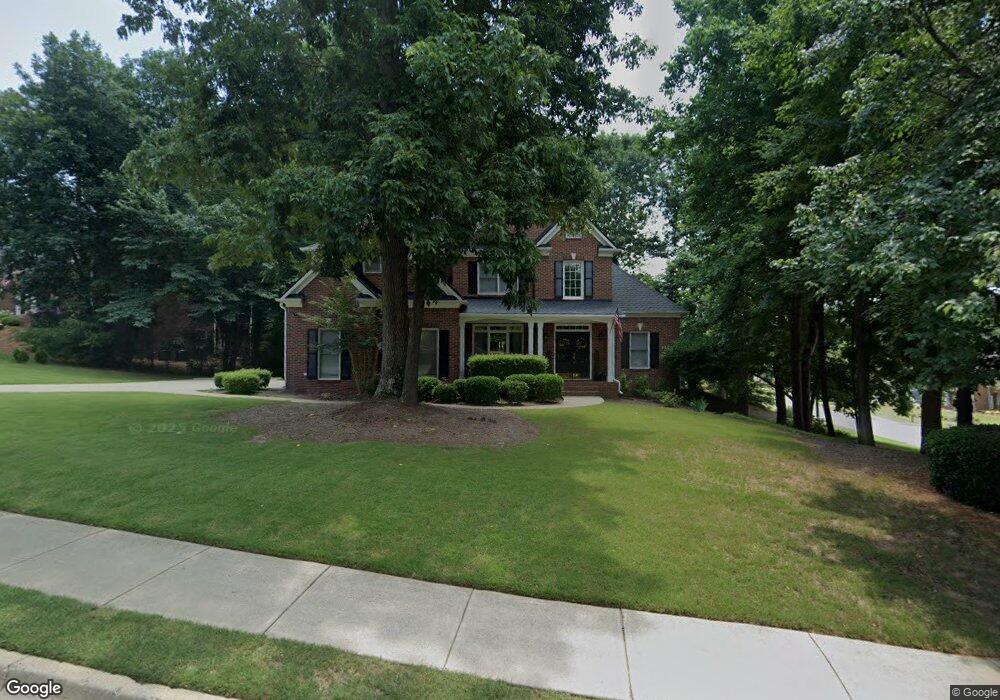
2000 Woodside Park Dr Unit 5A Woodstock, GA 30188
Union Hill NeighborhoodEstimated Value: $696,687 - $706,000
5
Beds
3
Baths
4,257
Sq Ft
$165/Sq Ft
Est. Value
About This Home
This home is located at 2000 Woodside Park Dr Unit 5A, Woodstock, GA 30188 and is currently estimated at $701,344, approximately $164 per square foot. 2000 Woodside Park Dr Unit 5A is a home located in Cherokee County with nearby schools including Hickory Flat Elementary School, Rusk Middle School, and Sequoyah High School.
Ownership History
Date
Name
Owned For
Owner Type
Purchase Details
Closed on
May 24, 2005
Sold by
Davis Michael F and Davis Anne
Bought by
Lang David M and Lang Anita
Current Estimated Value
Home Financials for this Owner
Home Financials are based on the most recent Mortgage that was taken out on this home.
Original Mortgage
$25,000
Outstanding Balance
$12,868
Interest Rate
5.74%
Mortgage Type
Unknown
Estimated Equity
$688,476
Purchase Details
Closed on
May 7, 1999
Sold by
Sharp Development Inc
Bought by
Davis Michael F and Davis Anne S
Home Financials for this Owner
Home Financials are based on the most recent Mortgage that was taken out on this home.
Original Mortgage
$191,200
Interest Rate
6.98%
Mortgage Type
New Conventional
Create a Home Valuation Report for This Property
The Home Valuation Report is an in-depth analysis detailing your home's value as well as a comparison with similar homes in the area
Home Values in the Area
Average Home Value in this Area
Purchase History
| Date | Buyer | Sale Price | Title Company |
|---|---|---|---|
| Lang David M | $327,000 | -- | |
| Davis Michael F | $239,000 | -- |
Source: Public Records
Mortgage History
| Date | Status | Borrower | Loan Amount |
|---|---|---|---|
| Open | Lang David M | $25,000 | |
| Open | Lang David M | $261,600 | |
| Previous Owner | Davis Michael F | $191,200 |
Source: Public Records
Tax History Compared to Growth
Tax History
| Year | Tax Paid | Tax Assessment Tax Assessment Total Assessment is a certain percentage of the fair market value that is determined by local assessors to be the total taxable value of land and additions on the property. | Land | Improvement |
|---|---|---|---|---|
| 2025 | $1,296 | $247,880 | $47,200 | $200,680 |
| 2024 | $2,118 | $248,280 | $47,200 | $201,080 |
| 2023 | $1,777 | $247,440 | $44,800 | $202,640 |
| 2022 | $1,452 | $195,520 | $36,000 | $159,520 |
| 2021 | $1,136 | $165,640 | $29,000 | $136,640 |
| 2020 | $1,108 | $156,840 | $29,000 | $127,840 |
| 2019 | $1,103 | $155,720 | $27,600 | $128,120 |
| 2018 | $1,088 | $146,840 | $27,600 | $119,240 |
| 2017 | $1,092 | $351,800 | $27,600 | $113,120 |
| 2016 | $1,104 | $337,900 | $23,600 | $111,560 |
| 2015 | $1,121 | $325,800 | $23,600 | $106,720 |
| 2014 | $1,086 | $301,000 | $23,600 | $96,800 |
Source: Public Records
Map
Nearby Homes
- 1039 Avery Creek Dr
- 401 Trotters Run Unit 2
- 2065 Fairway Crossing Dr Unit IVA
- 528 Wisteria Dr
- 3015 Bradshaw Club Dr Unit 1B
- 1053 Walnut Creek Dr Unit I
- 132 Little Brook Dr
- 4103 Hickory Fairway Dr
- 802 Clubhouse Pointe
- 318 Heritage Overlook
- 106 Village Ct
- 4592 Waters Rd
- 505 Silo View Ct
- 374 Heritage Overlook
- 312 Lady Slipper Ln
- 306 Avery Creek Way
- 112 Glenmill Way
- 5020 Hickory Hills Dr
- 1039 Bradshaw Estates Dr Unit 1
- 1000 River Plantation Dr Unit I
- 2002 Woodside Park Dr
- 1005 Avery Creek Dr
- 2001 Woodside Park Dr
- 2004 Woodside Park Dr
- 1008 Avery Creek Dr
- 2003 Woodside Park Dr
- 2003 Woodside Park Dr Unit 508
- 2001 Fairway Crossing Dr
- 2002 Fairway Crossing Dr
- 1007 Avery Creek Dr
- 2005 Woodside Park Dr
- 0 Woodside Park Dr Unit 8702762
- 0 Woodside Park Dr Unit 8491667
- 0 Woodside Park Dr Unit 9020516
- 0 Woodside Park Dr Unit 8876090
- 0 Woodside Park Dr Unit 8881458
- 0 Woodside Park Dr Unit 3105217
- 0 Woodside Park Dr Unit 3167124
- 0 Woodside Park Dr Unit 7575309
- 0 Woodside Park Dr Unit 7627473