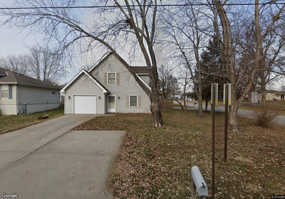
2000 Wornall Rd Excelsior Springs, MO 64024
Estimated Value: $311,000 - $541,000
3
Beds
4
Baths
2,580
Sq Ft
$158/Sq Ft
Est. Value
About This Home
This home is located at 2000 Wornall Rd, Excelsior Springs, MO 64024 and is currently estimated at $408,667, approximately $158 per square foot. 2000 Wornall Rd is a home located in Clay County with nearby schools including Excelsior Springs High School.
Ownership History
Date
Name
Owned For
Owner Type
Purchase Details
Closed on
Aug 13, 2025
Sold by
Investment Resources Inc and Investment Resources Llc
Bought by
Investment Resources Llc
Current Estimated Value
Home Financials for this Owner
Home Financials are based on the most recent Mortgage that was taken out on this home.
Original Mortgage
$1,000,000
Outstanding Balance
$919,184
Interest Rate
6.67%
Mortgage Type
Construction
Estimated Equity
-$510,517
Purchase Details
Closed on
Mar 26, 2014
Sold by
Mcelwee James Brent
Bought by
Investment Resources Inc
Purchase Details
Closed on
Jun 28, 2000
Sold by
Palmer Mark E and Palmer Pamela J
Bought by
Mcelwee James Brent
Home Financials for this Owner
Home Financials are based on the most recent Mortgage that was taken out on this home.
Original Mortgage
$103,920
Interest Rate
9.5%
Create a Home Valuation Report for This Property
The Home Valuation Report is an in-depth analysis detailing your home's value as well as a comparison with similar homes in the area
Home Values in the Area
Average Home Value in this Area
Purchase History
| Date | Buyer | Sale Price | Title Company |
|---|---|---|---|
| Investment Resources Llc | -- | Stewart Title Company | |
| Investment Resources Llc | -- | Stewart Title Company | |
| Investment Resources Inc | -- | Stewart Title Company | |
| Mcelwee James Brent | -- | First American Title Ins Co |
Source: Public Records
Mortgage History
| Date | Status | Borrower | Loan Amount |
|---|---|---|---|
| Open | Investment Resources Llc | $1,000,000 | |
| Closed | Investment Resources Llc | $1,000,000 | |
| Previous Owner | Mcelwee James Brent | $103,920 |
Source: Public Records
Tax History Compared to Growth
Tax History
| Year | Tax Paid | Tax Assessment Tax Assessment Total Assessment is a certain percentage of the fair market value that is determined by local assessors to be the total taxable value of land and additions on the property. | Land | Improvement |
|---|---|---|---|---|
| 2025 | $2,708 | $41,480 | -- | -- |
| 2024 | $2,708 | $38,610 | -- | -- |
| 2023 | $2,691 | $38,610 | $0 | $0 |
| 2022 | $2,344 | $33,080 | $0 | $0 |
| 2021 | $2,353 | $33,079 | $3,800 | $29,279 |
| 2020 | $2,437 | $33,310 | $0 | $0 |
| 2019 | $2,435 | $56,096 | $5,760 | $50,336 |
| 2018 | $1,970 | $26,870 | $0 | $0 |
| 2017 | $1,922 | $26,870 | $3,420 | $23,450 |
| 2016 | $1,922 | $26,870 | $3,420 | $23,450 |
| 2015 | $1,940 | $26,870 | $3,420 | $23,450 |
| 2014 | $1,900 | $26,090 | $3,420 | $22,670 |
Source: Public Records
Map
Nearby Homes
- 1904 Karlton Way
- 1908 Lesa Place
- 609 Kimberly Dr
- 2017 Karlton Way
- 617 Lodwick Ln
- 402 Leslie Ln
- 2081 Rock Bridge Pkwy
- 2017 Wornall Rd
- Lot 2 Wornall Rd
- 240 Rock Bridge Pkwy
- 2021 Riverstone Dr
- 402 Greenspire St
- 125 Crown Hill Rd
- 00000 NE 144th St
- 2207 Ashford St
- 1318 Kristie Cir
- 2210 Piedmont Place
- 2305 Arbor Ln
- 106 Helen St
- 304 Waller Ave
- 2002 Wornall Rd
- 2001 Karlton Way
- 2004 Wornall Rd
- 1914 Wornall Rd
- 2003 Karlton Way
- 2005 Karlton Way
- 1915 Karlton Way
- 2006 Wornall Rd
- 1912 Wornall Rd
- 2007 Karlton Way
- 2008 Wornall Rd
- 1913 Karlton Way
- 1910 Wornall Rd
- 2000 Karlton Way
- 2010 Wornall Rd
- 2002 Karlton Way
- 1911 Karlton Way
- 2004 Karlton Way
- 1914 Karlton Way
- 2011 Karlton Way