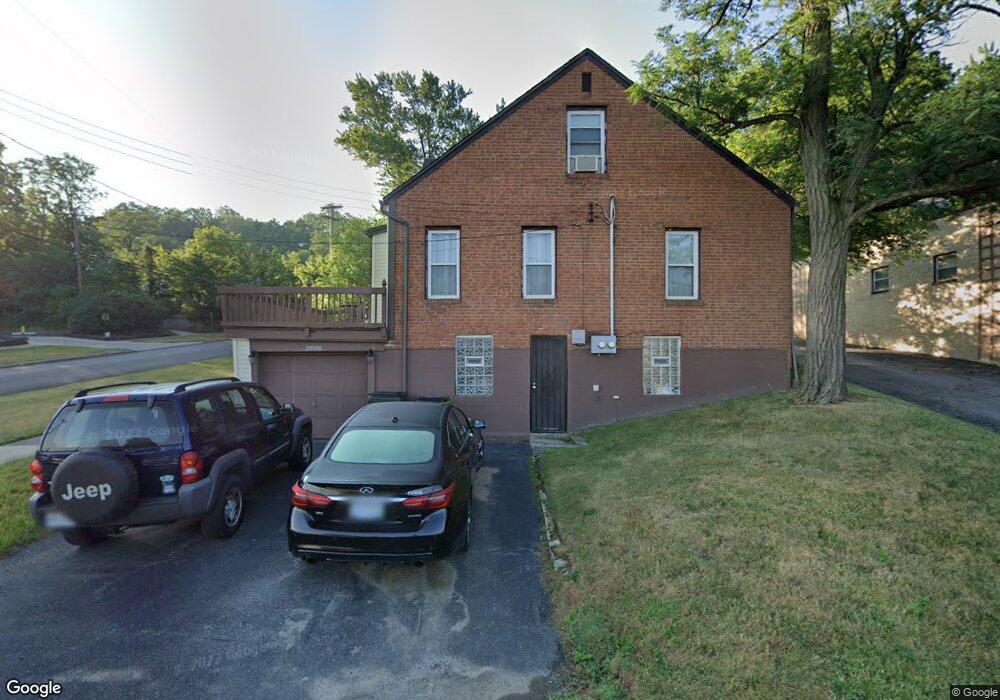
20000 Euclid Ave Euclid, OH 44117
Estimated Value: $122,000 - $145,000
3
Beds
2
Baths
1,267
Sq Ft
$104/Sq Ft
Est. Value
About This Home
This home is located at 20000 Euclid Ave, Euclid, OH 44117 and is currently estimated at $132,368, approximately $104 per square foot. 20000 Euclid Ave is a home located in Cuyahoga County with nearby schools including Bluestone Elementary School, Euclid Middle School, and Euclid High School.
Ownership History
Date
Name
Owned For
Owner Type
Purchase Details
Closed on
Jun 23, 2003
Sold by
Griffin Hardy
Bought by
Griffin Vera
Current Estimated Value
Purchase Details
Closed on
Jun 26, 2002
Sold by
Lincoln David J and Lincoln Carolyn P
Bought by
Griffin Vera and Griffin Hardy
Home Financials for this Owner
Home Financials are based on the most recent Mortgage that was taken out on this home.
Original Mortgage
$67,740
Outstanding Balance
$29,164
Interest Rate
6.93%
Estimated Equity
$103,204
Purchase Details
Closed on
May 31, 1984
Sold by
Ozan Terry C
Bought by
Lincoln David J
Purchase Details
Closed on
Dec 28, 1976
Sold by
Seelinger Vivian
Bought by
Ozan Terry C
Purchase Details
Closed on
Jan 1, 1975
Bought by
Seelinger Vivian
Create a Home Valuation Report for This Property
The Home Valuation Report is an in-depth analysis detailing your home's value as well as a comparison with similar homes in the area
Home Values in the Area
Average Home Value in this Area
Purchase History
| Date | Buyer | Sale Price | Title Company |
|---|---|---|---|
| Griffin Vera | -- | -- | |
| Griffin Vera | $79,700 | Americas Choice Title Agency | |
| Lincoln David J | $42,000 | -- | |
| Ozan Terry C | $38,500 | -- | |
| Seelinger Vivian | -- | -- |
Source: Public Records
Mortgage History
| Date | Status | Borrower | Loan Amount |
|---|---|---|---|
| Open | Griffin Vera | $67,740 |
Source: Public Records
Tax History
| Year | Tax Paid | Tax Assessment Tax Assessment Total Assessment is a certain percentage of the fair market value that is determined by local assessors to be the total taxable value of land and additions on the property. | Land | Improvement |
|---|---|---|---|---|
| 2024 | $2,942 | $41,825 | $8,855 | $32,970 |
| 2023 | $2,564 | $28,910 | $7,770 | $21,140 |
| 2022 | $2,462 | $28,910 | $7,770 | $21,140 |
| 2021 | $2,740 | $28,910 | $7,770 | $21,140 |
| 2020 | $2,600 | $24,920 | $6,690 | $18,240 |
| 2019 | $2,337 | $71,200 | $19,100 | $52,100 |
| 2018 | $2,278 | $24,920 | $6,690 | $18,240 |
| 2017 | $2,383 | $21,010 | $4,870 | $16,140 |
| 2016 | $2,388 | $21,010 | $4,870 | $16,140 |
| 2015 | $2,176 | $21,010 | $4,870 | $16,140 |
| 2014 | $2,176 | $21,010 | $4,870 | $16,140 |
Source: Public Records
Map
Nearby Homes
- 1721 Grand Blvd
- 1734 Glenridge Rd
- 1524 E 204th St
- 19871 Upper Valley Dr
- 19201 Genesee Rd
- 19201 Shawnee Rd
- 19151 Genesee Rd
- 19210 Firwood Rd
- 1563 Clermont Rd
- 24 Washington Square
- 1476 Clermont Rd
- 1290 E 188th St
- 1545 E 214th St
- 20211 Blackfoot Ave
- 1707 Catalpa Rd
- 1387 Clearaire Rd
- 21950 Euclid Ave
- 22580 Chardon Rd
- 1501 E 174h
- 22601 Harms Rd
- 20021 Grand Blvd
- 20001 Grand Blvd
- 20050 Euclid Ave
- 19970 Euclid Ave Unit 4
- 19970 Euclid Ave Unit 3
- 19970 Euclid Ave Unit 6
- 19970 Euclid Ave Unit 5
- 19970 Euclid Ave Unit 2
- 19981 Grand Blvd
- 20051 Concordia Dr
- 20061 Concordia Dr
- 20071 Concordia Dr
- 19971 Grand Blvd
- 20101 Concordia Dr
- 20000 Grand Blvd
- 20020 Grand Blvd
- 19994 Grand Blvd
- 20150 Euclid Ave
- 20111 Concordia Dr
- 19990 Grand Blvd
Your Personal Tour Guide
Ask me questions while you tour the home.