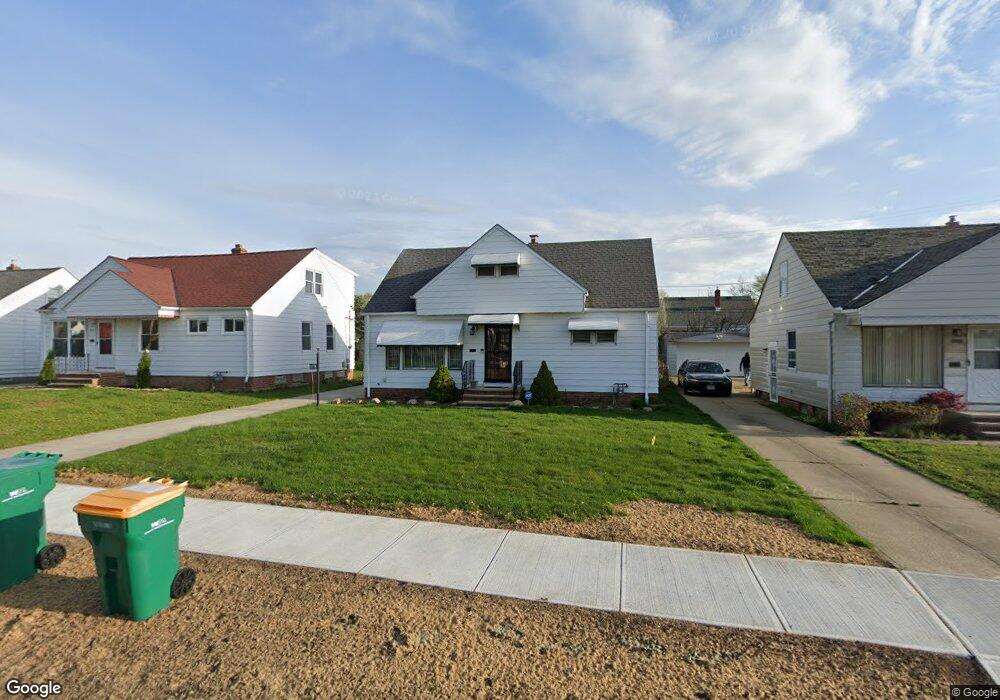
20001 Stockton Ave Maple Heights, OH 44137
Estimated Value: $117,774 - $145,000
3
Beds
1
Bath
1,224
Sq Ft
$107/Sq Ft
Est. Value
About This Home
This home is located at 20001 Stockton Ave, Maple Heights, OH 44137 and is currently estimated at $131,444, approximately $107 per square foot. 20001 Stockton Ave is a home located in Cuyahoga County with nearby schools including Abraham Lincoln Elementary School, Rockside/ J.F. Kennedy School, and Italy High School.
Ownership History
Date
Name
Owned For
Owner Type
Purchase Details
Closed on
Apr 16, 2004
Sold by
Carter Violet F
Bought by
Granville Victoria Properties Llc
Current Estimated Value
Purchase Details
Closed on
Jun 15, 1988
Sold by
Pauley Virginia
Bought by
Carter Violet F
Purchase Details
Closed on
Oct 26, 1987
Sold by
Pauley Virginia
Bought by
Pauley Virginia
Purchase Details
Closed on
Nov 5, 1984
Sold by
Pauley Virginia
Bought by
Pauley Virginia
Purchase Details
Closed on
Jan 1, 1975
Bought by
Pauley Virginia
Create a Home Valuation Report for This Property
The Home Valuation Report is an in-depth analysis detailing your home's value as well as a comparison with similar homes in the area
Home Values in the Area
Average Home Value in this Area
Purchase History
| Date | Buyer | Sale Price | Title Company |
|---|---|---|---|
| Granville Victoria Properties Llc | -- | None Available | |
| Carter Violet F | $54,000 | -- | |
| Pauley Virginia | -- | -- | |
| Pauley Virginia | -- | -- | |
| Pauley Virginia | -- | -- |
Source: Public Records
Tax History Compared to Growth
Tax History
| Year | Tax Paid | Tax Assessment Tax Assessment Total Assessment is a certain percentage of the fair market value that is determined by local assessors to be the total taxable value of land and additions on the property. | Land | Improvement |
|---|---|---|---|---|
| 2024 | $2,662 | $39,480 | $7,070 | $32,410 |
| 2023 | $1,724 | $25,100 | $5,040 | $20,060 |
| 2022 | $1,756 | $25,100 | $5,040 | $20,060 |
| 2021 | $1,871 | $25,100 | $5,040 | $20,060 |
| 2020 | $1,375 | $19,010 | $3,820 | $15,190 |
| 2019 | $1,361 | $54,300 | $10,900 | $43,400 |
| 2018 | $1,353 | $19,010 | $3,820 | $15,190 |
| 2017 | $1,270 | $18,030 | $4,970 | $13,060 |
| 2016 | $1,223 | $18,030 | $4,970 | $13,060 |
| 2015 | $1,306 | $18,030 | $4,970 | $13,060 |
| 2014 | $1,306 | $19,810 | $5,460 | $14,350 |
Source: Public Records
Map
Nearby Homes
- 20107 Libby Rd
- 19812 Stockton Ave
- 20510 Mountville Dr
- 19806 Mountville Dr
- 19289 Stafford Ave
- 19807 Gardenview Dr
- 20701 Kenyon Dr
- 19520 Maple Heights Blvd
- 20814 Kenyon Dr
- 20625 Centuryway Rd
- 19221 Stafford Ave
- 5165 Camden Rd
- 5265 Bellview St
- 19309 Nitra Ave
- 18909 Maple Heights Blvd
- 20814 Watson Rd
- 20715 Watson Rd
- 21102 Raymond St
- 21416 Gardenview Dr
- 5409 Hollywood Ave
- 20005 Stockton Ave
- 19917 Stockton Ave
- 20009 Stockton Ave
- 19913 Stockton Ave
- 20012 Libby Rd
- 20008 Libby Rd
- 20016 Libby Rd
- 20004 Libby Rd
- 20100 Libby Rd
- 20013 Stockton Ave
- 19909 Stockton Ave
- 20000 Stockton Ave
- 20004 Stockton Ave
- 20000 Libby Rd
- 19916 Stockton Ave
- 20104 Libby Rd
- 19912 Stockton Ave
- 19916 Libby Rd
- 20108 Libby Rd
- 20017 Stockton Ave