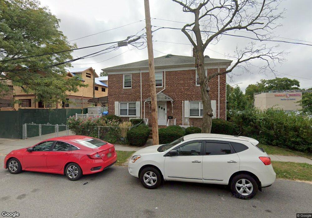
20004 36th Ave Bayside, NY 11361
Auburndale NeighborhoodEstimated Value: $768,000 - $922,000
Studio
--
Bath
1,088
Sq Ft
$777/Sq Ft
Est. Value
About This Home
This home is located at 20004 36th Ave, Bayside, NY 11361 and is currently estimated at $845,631, approximately $777 per square foot. 20004 36th Ave is a home located in Queens County with nearby schools including P.S. 159 Queens, I.S. 25 Adrien Block, and Bayside High School.
Ownership History
Date
Name
Owned For
Owner Type
Purchase Details
Closed on
Feb 24, 2021
Sold by
Ng Lai-Ting and Ng Wilson
Bought by
Hong Yuhua and Huang Xinhui
Current Estimated Value
Home Financials for this Owner
Home Financials are based on the most recent Mortgage that was taken out on this home.
Original Mortgage
$497,000
Outstanding Balance
$445,525
Interest Rate
2.7%
Mortgage Type
Purchase Money Mortgage
Estimated Equity
$400,106
Purchase Details
Closed on
Mar 16, 1990
Sold by
Lin Mei Chong and Lin Min Kuan
Bought by
Ng Lai-Ting and Ng Wilson
Create a Home Valuation Report for This Property
The Home Valuation Report is an in-depth analysis detailing your home's value as well as a comparison with similar homes in the area
Home Values in the Area
Average Home Value in this Area
Purchase History
| Date | Buyer | Sale Price | Title Company |
|---|---|---|---|
| Hong Yuhua | $710,000 | -- | |
| Ng Lai-Ting | -- | -- |
Source: Public Records
Mortgage History
| Date | Status | Borrower | Loan Amount |
|---|---|---|---|
| Open | Hong Yuhua | $497,000 |
Source: Public Records
Tax History
| Year | Tax Paid | Tax Assessment Tax Assessment Total Assessment is a certain percentage of the fair market value that is determined by local assessors to be the total taxable value of land and additions on the property. | Land | Improvement |
|---|---|---|---|---|
| 2025 | $7,556 | $39,878 | $8,326 | $31,552 |
| 2024 | $7,556 | $37,621 | $8,041 | $29,580 |
| 2023 | $7,556 | $37,621 | $7,704 | $29,917 |
| 2022 | $7,454 | $44,640 | $10,260 | $34,380 |
| 2021 | $7,413 | $42,480 | $10,260 | $32,220 |
| 2020 | $6,738 | $46,740 | $10,260 | $36,480 |
| 2019 | $6,260 | $51,480 | $10,260 | $41,220 |
| 2018 | $6,093 | $31,351 | $7,593 | $23,758 |
| 2017 | $6,043 | $31,114 | $8,445 | $22,669 |
| 2016 | $5,558 | $31,114 | $8,445 | $22,669 |
| 2015 | $3,321 | $27,693 | $10,849 | $16,844 |
| 2014 | $3,321 | $26,126 | $9,091 | $17,035 |
Source: Public Records
Map
Nearby Homes
- 37-02 Francis Lewis Blvd
- 37-08 Francis Lewis Blvd
- 37-6 Francis Lewis Blvd
- 36- 40 201st St Unit A, B, C
- 195-31 39th Ave
- 3617 194th St
- 195-33 39th Ave
- 36-20 194th St Unit 3r
- 35-27 203rd St
- 194-23 Station Rd
- 20403 36th Ave Unit 397
- 193-02 39th Ave Unit 1
- 35-05 204th St Unit 245
- 35-42 205th St Unit 288
- 35-42 205th St Unit 287
- 204-12 35th Ave Unit 254
- 35-12 205th St Unit 259
- 35-31 205th St Unit 302
- 35-31 205th St Unit 299
- 35-29 205th St Unit 304
- 36-05 200th St
- 3605 200th St
- 36-23 200th St
- 200-08 36th Ave
- 3609 200th St
- 0 36th Ave Unit P1314895
- 20008 36th Ave
- 20003 36th Ave
- 20012 36th Ave
- 3611 200th St
- 3521 200th St
- 200-16 36th Ave
- 20016 36th Ave
- 3615 200th St
- 20007 36th Ave
- 3519 200th St
- 20011 36th Ave
- 3617 200th St Unit 2Fl
- 3617 200th St
- 3612 201st St
Your Personal Tour Guide
Ask me questions while you tour the home.