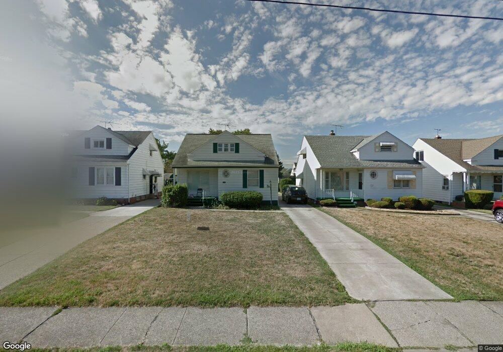
20008 Libby Rd Maple Heights, OH 44137
Estimated Value: $126,000 - $156,000
3
Beds
2
Baths
1,240
Sq Ft
$109/Sq Ft
Est. Value
About This Home
This home is located at 20008 Libby Rd, Maple Heights, OH 44137 and is currently estimated at $134,839, approximately $108 per square foot. 20008 Libby Rd is a home located in Cuyahoga County with nearby schools including Abraham Lincoln Elementary School, Rockside/ J.F. Kennedy School, and Barack Obama School.
Ownership History
Date
Name
Owned For
Owner Type
Purchase Details
Closed on
Aug 13, 2020
Sold by
Thomas Pamela Y and Medanell Pamela
Bought by
Miles Michelle
Current Estimated Value
Purchase Details
Closed on
Feb 25, 2009
Sold by
Secretary Of Housing & Urban Development
Bought by
Mcdowell Pamela Y
Purchase Details
Closed on
Oct 18, 2007
Sold by
Dobbins Angela D
Bought by
Hud
Purchase Details
Closed on
Apr 27, 1999
Sold by
Cassell Joyce E
Bought by
Dobbins Angela D
Home Financials for this Owner
Home Financials are based on the most recent Mortgage that was taken out on this home.
Original Mortgage
$73,364
Interest Rate
7.04%
Mortgage Type
FHA
Purchase Details
Closed on
Jan 1, 1975
Bought by
Michaels Margaret M
Create a Home Valuation Report for This Property
The Home Valuation Report is an in-depth analysis detailing your home's value as well as a comparison with similar homes in the area
Home Values in the Area
Average Home Value in this Area
Purchase History
| Date | Buyer | Sale Price | Title Company |
|---|---|---|---|
| Miles Michelle | $55,000 | None Available | |
| Mcdowell Pamela Y | $12,500 | Lakeside Title & Escrow Agen | |
| Hud | $52,667 | Attorney | |
| Dobbins Angela D | $74,000 | Executive Title Agency Corp | |
| Michaels Margaret M | -- | -- |
Source: Public Records
Mortgage History
| Date | Status | Borrower | Loan Amount |
|---|---|---|---|
| Previous Owner | Dobbins Angela D | $73,364 |
Source: Public Records
Tax History
| Year | Tax Paid | Tax Assessment Tax Assessment Total Assessment is a certain percentage of the fair market value that is determined by local assessors to be the total taxable value of land and additions on the property. | Land | Improvement |
|---|---|---|---|---|
| 2024 | $3,564 | $40,040 | $5,250 | $34,790 |
| 2023 | $2,690 | $25,730 | $4,240 | $21,490 |
| 2022 | $2,680 | $25,730 | $4,240 | $21,490 |
| 2021 | $2,860 | $25,730 | $4,240 | $21,490 |
| 2020 | $2,490 | $19,500 | $3,220 | $16,280 |
| 2019 | $2,479 | $55,700 | $9,200 | $46,500 |
| 2018 | $2,380 | $19,500 | $3,220 | $16,280 |
| 2017 | $2,469 | $19,080 | $4,170 | $14,910 |
| 2016 | $2,389 | $19,080 | $4,170 | $14,910 |
| 2015 | $2,404 | $19,080 | $4,170 | $14,910 |
| 2014 | $2,404 | $20,970 | $4,590 | $16,380 |
Source: Public Records
Map
Nearby Homes
- 19289 Stafford Ave
- 19520 Maple Heights Blvd
- 5147 Warrensville Center Rd
- 20806 Clare Ave
- 19931 Raymond St
- 20905 Clare Ave
- 5165 Camden Rd
- 20517 Raymond St
- 20600 Watson Rd
- 21202 Gardenview Dr
- 5194 Homewood Ave
- 21202 Hillgrove Ave
- 18909 Maple Heights Blvd
- 20715 Watson Rd
- 18715 Libby Rd
- 20705 Hansen Rd
- 5409 Hollywood Ave
- 18990 Raymond St
- 21207 Franklin Rd
- 18851 Raymond St
- 20004 Libby Rd
- 20012 Libby Rd
- 20000 Libby Rd
- 20016 Libby Rd
- 19917 Stockton Ave
- 20001 Stockton Ave
- 19916 Libby Rd
- 20100 Libby Rd
- 19913 Stockton Ave
- 20005 Stockton Ave
- 19912 Libby Rd
- 19909 Stockton Ave
- 20104 Libby Rd
- 20009 Stockton Ave
- 19905 Stockton Ave
- 19908 Libby Rd
- 20108 Libby Rd
- 20009 Libby Rd
- 20013 Libby Rd
- 20003 Libby Rd
Your Personal Tour Guide
Ask me questions while you tour the home.