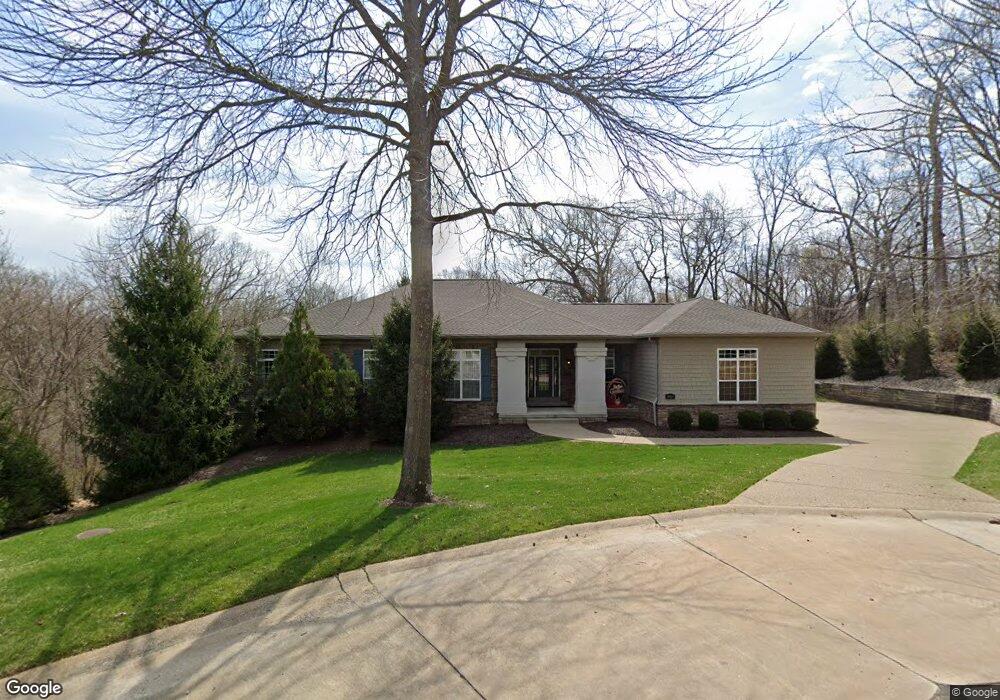
2001 Andraes Ln Chesterfield, MO 63005
Estimated Value: $911,241 - $1,079,000
4
Beds
4
Baths
5,000
Sq Ft
$200/Sq Ft
Est. Value
About This Home
This home is located at 2001 Andraes Ln, Chesterfield, MO 63005 and is currently estimated at $1,000,560, approximately $200 per square foot. 2001 Andraes Ln is a home located in St. Louis County with nearby schools including Kehrs Mill Elementary, Crestview Middle School, and Marquette Sr. High School.
Ownership History
Date
Name
Owned For
Owner Type
Purchase Details
Closed on
Jan 11, 2010
Sold by
Stirmlinger Thomas G and Stirmlinger Katherine I
Bought by
Walter B Reisinger Ii Revocable Trust
Current Estimated Value
Purchase Details
Closed on
Oct 11, 2007
Sold by
Dowling Michael T and Dowling Cynthia A
Bought by
Stirmlinger Thomas G and Stirmlinger Katherine I
Home Financials for this Owner
Home Financials are based on the most recent Mortgage that was taken out on this home.
Original Mortgage
$209,000
Interest Rate
6.48%
Mortgage Type
Purchase Money Mortgage
Purchase Details
Closed on
Oct 12, 2006
Sold by
Carter Howard and Carter Nancy J
Bought by
Dowling Michael T and Dowling Cynthia A
Create a Home Valuation Report for This Property
The Home Valuation Report is an in-depth analysis detailing your home's value as well as a comparison with similar homes in the area
Home Values in the Area
Average Home Value in this Area
Purchase History
| Date | Buyer | Sale Price | Title Company |
|---|---|---|---|
| Walter B Reisinger Ii Revocable Trust | $650,000 | Investors Title Company | |
| Stirmlinger Thomas G | $259,000 | None Available | |
| Dowling Michael T | $250,000 | None Available |
Source: Public Records
Mortgage History
| Date | Status | Borrower | Loan Amount |
|---|---|---|---|
| Previous Owner | Stirmlinger Thomas G | $209,000 |
Source: Public Records
Tax History
| Year | Tax Paid | Tax Assessment Tax Assessment Total Assessment is a certain percentage of the fair market value that is determined by local assessors to be the total taxable value of land and additions on the property. | Land | Improvement |
|---|---|---|---|---|
| 2025 | $8,740 | $220,500 | $55,160 | $165,340 |
| 2024 | $8,740 | $122,760 | $26,770 | $95,990 |
| 2023 | $8,513 | $122,760 | $26,770 | $95,990 |
| 2022 | $8,921 | $119,650 | $34,050 | $85,600 |
| 2021 | $8,870 | $119,650 | $34,050 | $85,600 |
| 2020 | $10,245 | $133,490 | $31,710 | $101,780 |
| 2019 | $10,188 | $133,490 | $31,710 | $101,780 |
| 2018 | $10,006 | $123,620 | $20,200 | $103,420 |
| 2017 | $9,781 | $123,620 | $20,200 | $103,420 |
| 2016 | $9,903 | $120,270 | $20,200 | $100,070 |
Source: Public Records
Map
Nearby Homes
- 16401 Wilson Farm Dr
- 16427 Brandsford Point
- 16507 Kingspointe Lake Ln
- 409 Griffith Ln
- 1255 Walnut Hill Farm Dr
- 2133 Hunters Way Ct
- 375 Griffith Ln
- 1401 Fox Hill Farms Ct
- 16291 Upper Chesterfield Ridge Dr
- 2102 Kehrs Ridge Dr
- 1645 Trotting Trail Rd
- 16025 Hunters Way Dr
- 1 Monarch Trace Ct Unit 301
- 1 Monarch Trace Ct Unit 307
- 16437 Cobbleskille Dr
- 16839 Kehrsbrooke Ct
- 460 Shetland Valley Ct
- 1726 Blue Oak Dr
- 16176 Lea Oak Ct
- 2142 Heather Glen Dr
- 2000 Andraes Ln
- 2008 Andraes Ln
- 16439 Wilson Farm Dr
- 16445 Wilson Farm Dr
- 2009 Andraes Ln
- 16451 Wilson Farm Dr
- 16433 Wilson Farm Dr
- 1822 Parsonage Dr
- 2017 Andraes Ln
- 1810 Parsonage Dr
- 16427 Wilson Farm Dr
- 16457 Wilson Farm Dr
- 16440 Wilson Farm Dr
- 16446 Wilson Farm Dr
- 7 Wheatley Ct
- 16463 Wilson Farm Dr
- 16452 Wilson Farm Dr
- 16421 Wilson Farm Dr
- 1 Wheatley Ct
- 1804 Parsonage Dr
Your Personal Tour Guide
Ask me questions while you tour the home.