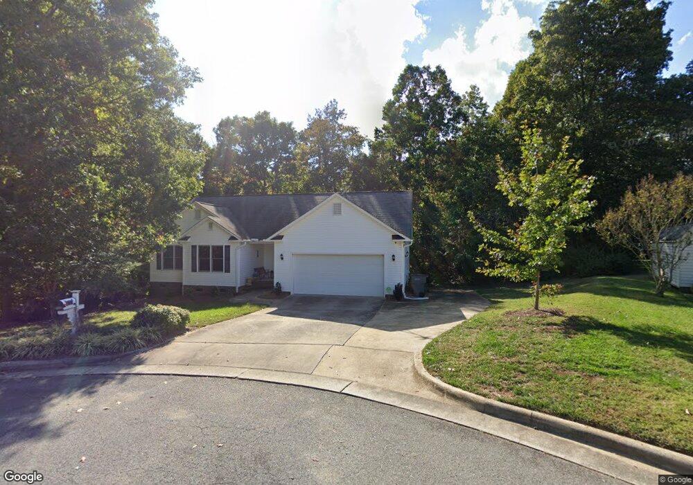
2001 Bunker Ct Kannapolis, NC 28081
Estimated Value: $336,282 - $430,000
Studio
2
Baths
1,886
Sq Ft
$204/Sq Ft
Est. Value
About This Home
This home is located at 2001 Bunker Ct, Kannapolis, NC 28081 and is currently estimated at $384,321, approximately $203 per square foot. 2001 Bunker Ct is a home located in Rowan County with nearby schools including Landis Elementary School, Corriher Lipe Middle School, and South Rowan High School.
Ownership History
Date
Name
Owned For
Owner Type
Purchase Details
Closed on
May 31, 2007
Sold by
Comes Vaughn W
Bought by
Mason William Joseph and Mason Melissa Victoria
Current Estimated Value
Home Financials for this Owner
Home Financials are based on the most recent Mortgage that was taken out on this home.
Original Mortgage
$200,000
Outstanding Balance
$121,914
Interest Rate
6.12%
Mortgage Type
Purchase Money Mortgage
Estimated Equity
$262,407
Create a Home Valuation Report for This Property
The Home Valuation Report is an in-depth analysis detailing your home's value as well as a comparison with similar homes in the area
Home Values in the Area
Average Home Value in this Area
Purchase History
| Date | Buyer | Sale Price | Title Company |
|---|---|---|---|
| Mason William Joseph | $200,000 | None Available |
Source: Public Records
Mortgage History
| Date | Status | Borrower | Loan Amount |
|---|---|---|---|
| Open | Mason William Joseph | $200,000 |
Source: Public Records
Tax History
| Year | Tax Paid | Tax Assessment Tax Assessment Total Assessment is a certain percentage of the fair market value that is determined by local assessors to be the total taxable value of land and additions on the property. | Land | Improvement |
|---|---|---|---|---|
| 2025 | $3,715 | $306,987 | $40,000 | $266,987 |
| 2024 | $3,715 | $306,987 | $40,000 | $266,987 |
| 2023 | $3,715 | $306,987 | $40,000 | $266,987 |
| 2022 | $2,769 | $215,062 | $32,500 | $182,562 |
| 2021 | $2,769 | $215,062 | $32,500 | $182,562 |
| 2020 | $2,769 | $215,062 | $32,500 | $182,562 |
| 2019 | $2,769 | $215,062 | $32,500 | $182,562 |
| 2018 | $2,353 | $184,850 | $32,500 | $152,350 |
| 2017 | $2,353 | $184,850 | $32,500 | $152,350 |
| 2016 | $2,379 | $186,850 | $34,500 | $152,350 |
| 2015 | $2,415 | $186,850 | $34,500 | $152,350 |
| 2014 | $2,208 | $176,631 | $34,500 | $142,131 |
Source: Public Records
Map
Nearby Homes
- 991 Fairway Dr
- 1061 Fairway Dr
- 737 Jack St
- 731 Jack St
- 959 Tamary Way Unit 29
- 959 Tamary Way Unit 29/30
- 919 Tamary Way
- 567 W 22nd St
- 2274 Tullymore Dr Unit 14
- 371 Copes Ct
- 563 W 22nd St
- 2319 Tullymore Dr Unit 39
- 2319 Tully More Dr Unit Lot 39
- 515 Rosemont Ave
- 2400 Callaghan Ct Unit Lot 70
- 1409 Arden Ave
- Lot 2 Arden Ave
- 2885 Vale Ave
- 2703 Glendale Ave
- 2806 Glendale Ave
Your Personal Tour Guide
Ask me questions while you tour the home.