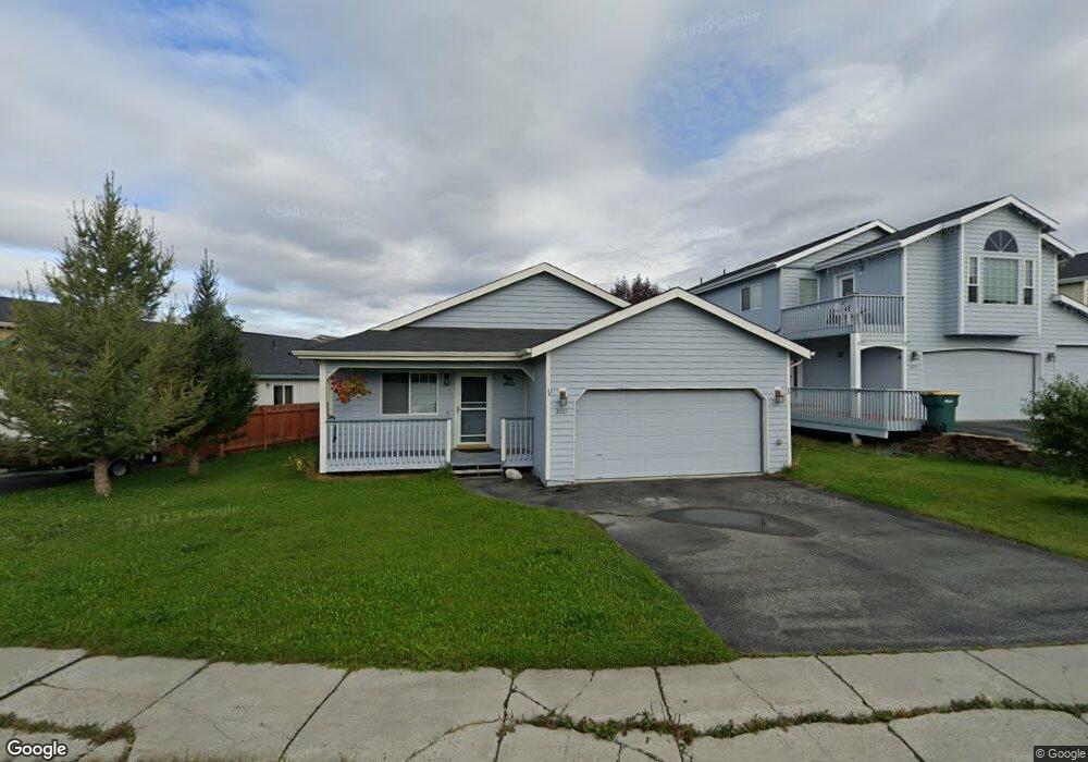
2001 Cannoneer Cir Anchorage, AK 99507
Abbott Loop NeighborhoodEstimated Value: $413,488 - $623,000
3
Beds
2
Baths
1,453
Sq Ft
$338/Sq Ft
Est. Value
About This Home
This home is located at 2001 Cannoneer Cir, Anchorage, AK 99507 and is currently estimated at $490,872, approximately $337 per square foot. 2001 Cannoneer Cir is a home located in Anchorage Municipality with nearby schools including Spring Hill Elementary School, Hanshew Middle School, and Service High School.
Ownership History
Date
Name
Owned For
Owner Type
Purchase Details
Closed on
May 19, 2022
Sold by
Price Vicki D and Price Stephen D
Bought by
Hendricks Zachary A
Current Estimated Value
Home Financials for this Owner
Home Financials are based on the most recent Mortgage that was taken out on this home.
Original Mortgage
$160,000
Outstanding Balance
$150,537
Interest Rate
4.72%
Mortgage Type
New Conventional
Estimated Equity
$340,335
Purchase Details
Closed on
Apr 27, 2022
Sold by
Nona Rhodus
Bought by
Price Vicki
Home Financials for this Owner
Home Financials are based on the most recent Mortgage that was taken out on this home.
Original Mortgage
$160,000
Outstanding Balance
$150,537
Interest Rate
4.72%
Mortgage Type
New Conventional
Estimated Equity
$340,335
Purchase Details
Closed on
Aug 20, 2003
Sold by
Woodbuilt Homes Inc
Bought by
Rhodus Murray and Rhodus Nona
Purchase Details
Closed on
Jan 23, 2003
Sold by
Gross Leonard
Bought by
Quigley Steven and Quigley Linda
Purchase Details
Closed on
Jan 22, 2003
Sold by
Gross Leonard
Bought by
Quigley Steven and Quigley Linda
Create a Home Valuation Report for This Property
The Home Valuation Report is an in-depth analysis detailing your home's value as well as a comparison with similar homes in the area
Home Values in the Area
Average Home Value in this Area
Purchase History
| Date | Buyer | Sale Price | Title Company |
|---|---|---|---|
| Hendricks Zachary A | -- | First American Title | |
| Price Vicki | -- | None Listed On Document | |
| Rhodus Murray | -- | First American Title Of Alas | |
| Woodbuilt Homes Inc | -- | First American Title Of Alas | |
| Quigley Steven | -- | -- | |
| Quigley Steven | -- | First American Title Of Alas |
Source: Public Records
Mortgage History
| Date | Status | Borrower | Loan Amount |
|---|---|---|---|
| Open | Hendricks Zachary A | $160,000 |
Source: Public Records
Tax History
| Year | Tax Paid | Tax Assessment Tax Assessment Total Assessment is a certain percentage of the fair market value that is determined by local assessors to be the total taxable value of land and additions on the property. | Land | Improvement |
|---|---|---|---|---|
| 2025 | $6,169 | $389,900 | $88,700 | $301,200 |
| 2024 | $6,169 | $382,100 | $88,700 | $293,400 |
| 2023 | $5,981 | $351,200 | $88,700 | $262,500 |
| 2022 | $6,170 | $366,400 | $88,700 | $277,700 |
| 2021 | $5,853 | $324,800 | $88,700 | $236,100 |
| 2020 | $5,416 | $318,600 | $88,700 | $229,900 |
| 2019 | $5,145 | $314,500 | $88,700 | $225,800 |
| 2018 | $4,961 | $302,500 | $76,100 | $226,400 |
| 2017 | $2,134 | $306,300 | $76,100 | $230,200 |
| 2016 | $1,677 | $311,700 | $72,200 | $239,500 |
| 2015 | $1,677 | $297,900 | $72,200 | $225,700 |
| 2014 | $1,677 | $293,900 | $72,200 | $221,700 |
Source: Public Records
Map
Nearby Homes
- 9710 Vanguard Dr Unit 80
- 9725 Independence Dr Unit A201
- 9750 Vanguard Dr Unit 54
- 9715 Independence Dr Unit B306
- 2211 Sentry Dr Unit 10
- 2211 Sentry Dr Unit B6
- 2300 Sentry Dr Unit E106
- 2430 Sentry Dr Unit B306
- 9130 Golovin St
- 9599 Brayton Dr Unit 422
- 9499 Brayton Dr Unit 39
- 9499 Brayton Dr Unit 152
- 9499 Brayton Dr Unit 245
- 1900-1941 Marthas Vineyard Cir
- 9387 Morningside Loop
- 8000 Independence Park Dr
- 9610 Morningside Loop Unit B1
- 1962 Commodore Dr
- 1935 Commodore Dr
- 2708 Snug Harbor Cir
- 1951 Cannoneer Cir
- 2015 Cannoneer Cir
- L48B17 Cannoneer Cir
- L49-75 Cannoneer Cir
- 27 Lots Cannoneer Cir
- L61 B17 Cannoneer Cir
- 1941 Cannoneer Cir
- 2029 Cannoneer Cir
- 2019 Cannoneer Cir
- 1920 Powder Horn Cir
- 2043 Cannoneer Cir
- 1910 Powder Horn Cir
- 1931 Cannoneer Cir
- 2000 Cannoneer Cir
- 1950 Cannoneer Cir
- 1930 Powder Horn Cir
- 2012 Cannoneer Cir
- 2018 Cannoneer Cir
- 2006 Cannoneer Cir
- 2101 Cannoneer Cir
Your Personal Tour Guide
Ask me questions while you tour the home.