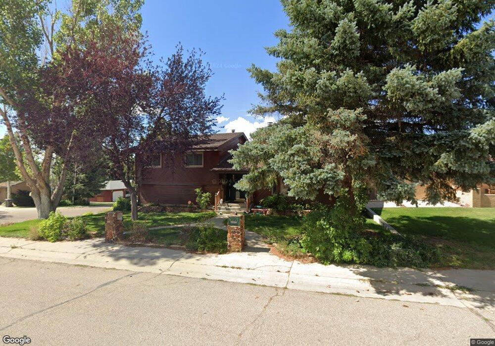
2001 Carson St Rock Springs, WY 82901
Estimated Value: $178,000 - $408,000
3
Beds
3
Baths
1,474
Sq Ft
$220/Sq Ft
Est. Value
About This Home
This home is located at 2001 Carson St, Rock Springs, WY 82901 and is currently estimated at $324,774, approximately $220 per square foot. 2001 Carson St is a home located in Sweetwater County with nearby schools including Rock Springs Junior High School, Rock Springs High School, and Holy Spirit Catholic School.
Ownership History
Date
Name
Owned For
Owner Type
Purchase Details
Closed on
Jul 29, 2020
Sold by
Reed Roger B and Reed Linda C
Bought by
Wonnacott Nathan P
Current Estimated Value
Home Financials for this Owner
Home Financials are based on the most recent Mortgage that was taken out on this home.
Original Mortgage
$244,000
Outstanding Balance
$216,845
Interest Rate
3.1%
Mortgage Type
Construction
Estimated Equity
$107,929
Purchase Details
Closed on
Feb 15, 2019
Sold by
Kent Family Trust
Bought by
Reed Roger B
Create a Home Valuation Report for This Property
The Home Valuation Report is an in-depth analysis detailing your home's value as well as a comparison with similar homes in the area
Home Values in the Area
Average Home Value in this Area
Purchase History
| Date | Buyer | Sale Price | Title Company |
|---|---|---|---|
| Wonnacott Nathan P | $305,000 | -- | |
| Reed Roger B | -- | First American Title |
Source: Public Records
Mortgage History
| Date | Status | Borrower | Loan Amount |
|---|---|---|---|
| Open | Wonnacott Nathan P | $244,000 |
Source: Public Records
Tax History Compared to Growth
Tax History
| Year | Tax Paid | Tax Assessment Tax Assessment Total Assessment is a certain percentage of the fair market value that is determined by local assessors to be the total taxable value of land and additions on the property. | Land | Improvement |
|---|---|---|---|---|
| 2025 | $2,071 | $21,843 | $4,446 | $17,397 |
| 2024 | $2,071 | $28,004 | $5,700 | $22,304 |
| 2023 | $2,055 | $28,383 | $5,700 | $22,683 |
| 2022 | $2,125 | $29,088 | $5,700 | $23,388 |
| 2021 | $2,182 | $29,783 | $5,700 | $24,083 |
| 2020 | $2,166 | $29,594 | $5,700 | $23,894 |
| 2019 | $2,114 | $29,114 | $5,700 | $23,414 |
| 2018 | $2,193 | $30,126 | $5,700 | $24,426 |
| 2017 | $2,144 | $29,333 | $5,700 | $23,633 |
| 2015 | -- | $28,150 | $0 | $0 |
| 2014 | -- | $27,578 | $0 | $0 |
Source: Public Records
Map
Nearby Homes
- 2030 Carson St
- South Belt Loop N Belt Loop
- 230 Jade St
- 1805 Carson St
- 2058 Skyview St
- 1820 Collins St
- South Belt Loop S Belt Loop
- 413 Hay St
- 1545 Edgar St
- 1525 Edgar St
- 506 R St
- 416 R St
- 1408 Collins St
- 206 R St
- 1210 Mccabe St
- 220 Liberty St
- 1500 James Dr
- 1300 New Hampshire St
- 705 Pennsylvania Ave
- 1306 Liberty Dr
- 2001 Carson St Unit Parkview Ave
- 2001 Carson St Unit Parkview
- 2009 Carson St
- 325 Jade St
- 325 Jade St Unit Parkview
- 321 Jade St
- 321 Jade St Unit Parkview
- 1932 Parkview Ave
- 1932 Parkview Ave Unit Carson
- 2017 Carson St
- 2005 Parkview Ave
- 1928 Parkview Ave
- 2008 Carson St
- 317 Jade St
- 2004 Parkview Ave
- 2023 Carson St
- 1924 Parkview Ave
- 2016 Carson St
- 2008 Parkview Ave
- 322 Jade St