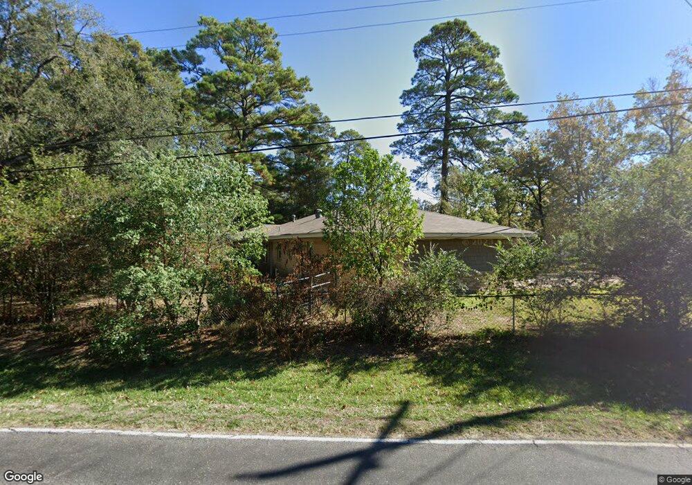
2001 Carter St West Monroe, LA 71291
Claiborne NeighborhoodEstimated Value: $179,000 - $201,000
3
Beds
2
Baths
1,718
Sq Ft
$112/Sq Ft
Est. Value
About This Home
This home is located at 2001 Carter St, West Monroe, LA 71291 and is currently estimated at $192,428, approximately $112 per square foot. 2001 Carter St is a home located in Ouachita Parish with nearby schools including Highland Elementary School, West Ridge Middle School, and West Monroe High School.
Ownership History
Date
Name
Owned For
Owner Type
Purchase Details
Closed on
Jun 29, 2007
Sold by
Iberia Bank
Bought by
Beaty Rickey Lee and Beaty Wanda L
Current Estimated Value
Home Financials for this Owner
Home Financials are based on the most recent Mortgage that was taken out on this home.
Original Mortgage
$105,000
Outstanding Balance
$62,995
Interest Rate
6.19%
Mortgage Type
New Conventional
Estimated Equity
$129,433
Purchase Details
Closed on
Jun 14, 2006
Sold by
Harrison Donald Gregory and Harrison Angela C
Bought by
Fiebelkorn Jack L
Create a Home Valuation Report for This Property
The Home Valuation Report is an in-depth analysis detailing your home's value as well as a comparison with similar homes in the area
Home Values in the Area
Average Home Value in this Area
Purchase History
| Date | Buyer | Sale Price | Title Company |
|---|---|---|---|
| Beaty Rickey Lee | $105,000 | None Available | |
| Fiebelkorn Jack L | $465 | None Available |
Source: Public Records
Mortgage History
| Date | Status | Borrower | Loan Amount |
|---|---|---|---|
| Open | Beaty Rickey Lee | $105,000 |
Source: Public Records
Tax History
| Year | Tax Paid | Tax Assessment Tax Assessment Total Assessment is a certain percentage of the fair market value that is determined by local assessors to be the total taxable value of land and additions on the property. | Land | Improvement |
|---|---|---|---|---|
| 2025 | $1,191 | $13,090 | $2,000 | $11,090 |
| 2024 | $1,191 | $13,090 | $2,000 | $11,090 |
| 2023 | $1,206 | $11,526 | $2,000 | $9,526 |
| 2022 | $1,023 | $11,506 | $2,000 | $9,506 |
| 2021 | $1,035 | $11,526 | $2,000 | $9,526 |
| 2020 | $1,035 | $11,526 | $2,000 | $9,526 |
| 2019 | $868 | $9,695 | $1,500 | $8,195 |
| 2018 | $197 | $9,695 | $1,500 | $8,195 |
| 2017 | $868 | $9,695 | $1,500 | $8,195 |
| 2016 | $868 | $9,695 | $1,500 | $8,195 |
| 2015 | $196 | $9,695 | $1,500 | $8,195 |
| 2014 | $196 | $9,695 | $1,500 | $8,195 |
| 2013 | $195 | $9,695 | $1,500 | $8,195 |
Source: Public Records
Map
Nearby Homes
- 115 Thompson Rd
- 2300 Rainbow Dr
- 2211 Wellerman Rd
- 1827 Wellerman Rd
- 1509 Dean Chapel Rd
- 112 Willow Branch Dr
- 119 Fairlane Dr
- 694 Norris Ln
- 2342 Arkansas Rd Unit 2350 ARKANSAS ROAD
- 103 Sadie Ln
- 114 Sadie Ln
- 117 Carriage Way
- 123 Belle Vue Dr
- 121 Belle Vue Dr
- 100 Sadie Ln
- 206 Chadwick Dr
- 126 Steeplechase Cir
- 127 Piney Cove
- 125 Piney Cove
- 101 Piney Cove
- 1205 Dean Chapel Rd
- 2003 Carter St
- 2000 Carter St
- 1013 Dean Chapel Rd
- 1015 Dean Chapel Rd
- 2002 Carter St
- 2002 Carter Dr
- 1017 Dean Chapel Rd
- 1017 Dean Chapel Rd
- 2007 Carter St
- 1005 Dean Chapel Rd
- 2002 Rainbow Dr
- 2006 Carter St
- 1201 Dean Chapel Rd
- 2101 Carter St
- 1016 Dean Chapel Rd
- 2100 Carter St
- 1003 Dean Chapel Rd
- 2001 Rainbow Dr
- 2003 Rainbow Dr
Your Personal Tour Guide
Ask me questions while you tour the home.