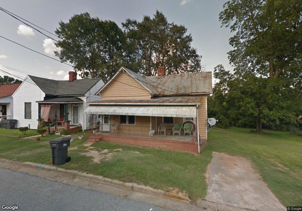
2001 Division St Augusta, GA 30904
West End NeighborhoodEstimated Value: $71,000 - $89,000
About This Home
This home is located at 2001 Division St, Augusta, GA 30904 and is currently estimated at $80,585, approximately $75 per square foot. 2001 Division St is a home located in Richmond County with nearby schools including Lamar Elementary School, W.S. Hornsby Elementary School, and Johnson Magnet.
Ownership History
We collect this data history from publicly available records. To have your information removed, we recommend requesting removal directly through your county’s website.
Purchase Details
Purchase Details
Purchase Details
Purchase Details
Home Values in the Area
Average Home Value in this Area
Purchase History
We collect this data history from publicly available records. To have your information removed, we recommend requesting removal directly through your county’s website.
| Date | Buyer | Sale Price | Title Company |
|---|---|---|---|
| $3,000 | -- | ||
| -- | -- | ||
| -- | None Available | ||
| -- | None Available |
Mortgage History
We collect this data history from publicly available records. To have your information removed, we recommend requesting removal directly through your county’s website.
| Date | Status | Borrower | Loan Amount |
|---|---|---|---|
| Closed | $17,600 |
Tax History
We collect this data history from publicly available records. To have your information removed, we recommend requesting removal directly through your county’s website.
| Year | Tax Paid | Tax Assessment Tax Assessment Total Assessment is a certain percentage of the fair market value that is determined by local assessors to be the total taxable value of land and additions on the property. | Land | Improvement |
|---|---|---|---|---|
| 2025 | $950 | $19,556 | $1,797 | $17,759 |
| 2024 | $950 | $25,948 | $1,797 | $24,151 |
| 2023 | $1,069 | $24,992 | $1,797 | $23,195 |
| 2022 | $906 | $19,486 | $1,797 | $17,689 |
| 2021 | $615 | $9,060 | $1,802 | $7,258 |
| 2020 | $682 | $11,258 | $4,000 | $7,258 |
| 2019 | $709 | $11,258 | $4,000 | $7,258 |
| 2018 | $353 | $11,258 | $4,000 | $7,258 |
| 2017 | $311 | $11,258 | $4,000 | $7,258 |
| 2016 | $311 | $11,258 | $4,000 | $7,258 |
| 2015 | $216 | $11,258 | $4,000 | $7,258 |
| 2014 | $311 | $11,258 | $4,000 | $7,258 |
Map
- 23 Curry St
- 2025 Ellis St
- 2018 Greene St
- 1933 Telfair St
- 1934 Battle Row
- 1916 Walker St
- 413 Crawford Ave
- 1929 Watkins St
- 1645 Saint Luke St
- 1643 Saint Luke St
- 531 Carr St
- 1915 Watkins St
- 2166 Greene St
- 2168 Telfair St
- 1702&1706 Hicks St
- 1740 Walker St
- 2048 Battle Row Unit C, D
- 513 Beaufort Dr
- 631 Crawford Ave
- 2200 Country Club Ct
- 1929 Division St
- 1931 Division St
- 1927 Division St
- 0 Curry St Unit 5437983-9558951
- 0 Curry St Unit 5437983-8094865
- 0 Curry St Unit 5437983-11313877
- 1925 Division St
- 2003 Division St
- 2010 Division St
- 1923 Division St
- 2005 Division St
- 102 Curry St
- 105 Curry St
- 2006 Division St
- 2007 Division St
- 1921 Division St
- 2002 Division St
- 106 Curry St
- 2009 Division St
- 36 Curry St
Ask me questions while you tour the home.