Estimated Value: $159,000 - $182,000
3
Beds
1
Bath
896
Sq Ft
$189/Sq Ft
Est. Value
About This Home
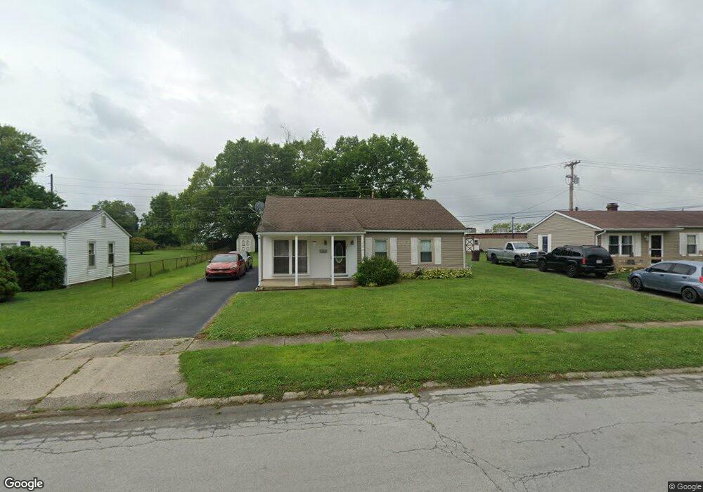
This home is located at 2001 Drake Dr, Xenia, OH 45385 and is currently estimated at $169,115, approximately $188 per square foot. 2001 Drake Dr is a home located in Greene County with nearby schools including Xenia High School, Summit Academy Community School for Alternative Learners - Xenia, and Legacy Christian Academy.
Ownership History
Date
Name
Owned For
Owner Type
Purchase Details
Closed on
May 12, 2020
Sold by
Greene Brent W
Bought by
Speck Heath
Current Estimated Value
Home Financials for this Owner
Home Financials are based on the most recent Mortgage that was taken out on this home.
Original Mortgage
$105,369
Outstanding Balance
$93,372
Interest Rate
3.3%
Mortgage Type
VA
Estimated Equity
$75,743
Purchase Details
Closed on
May 24, 2004
Sold by
Allen Laura N
Bought by
Greene Brent W
Home Financials for this Owner
Home Financials are based on the most recent Mortgage that was taken out on this home.
Original Mortgage
$68,000
Interest Rate
10.74%
Mortgage Type
Unknown
Purchase Details
Closed on
Aug 8, 1995
Sold by
Jackson Nancy A
Bought by
Greene Brent W and Greene Allen N
Home Financials for this Owner
Home Financials are based on the most recent Mortgage that was taken out on this home.
Original Mortgage
$55,624
Interest Rate
7.56%
Mortgage Type
FHA
Create a Home Valuation Report for This Property
The Home Valuation Report is an in-depth analysis detailing your home's value as well as a comparison with similar homes in the area
Home Values in the Area
Average Home Value in this Area
Purchase History
| Date | Buyer | Sale Price | Title Company |
|---|---|---|---|
| Speck Heath | $103,000 | None Available | |
| Greene Brent W | -- | -- | |
| Greene Brent W | $55,500 | -- |
Source: Public Records
Mortgage History
| Date | Status | Borrower | Loan Amount |
|---|---|---|---|
| Open | Speck Heath | $105,369 | |
| Previous Owner | Greene Brent W | $68,000 | |
| Previous Owner | Greene Brent W | $55,624 |
Source: Public Records
Tax History Compared to Growth
Tax History
| Year | Tax Paid | Tax Assessment Tax Assessment Total Assessment is a certain percentage of the fair market value that is determined by local assessors to be the total taxable value of land and additions on the property. | Land | Improvement |
|---|---|---|---|---|
| 2024 | $1,770 | $41,360 | $10,770 | $30,590 |
| 2023 | $1,770 | $41,360 | $10,770 | $30,590 |
| 2022 | $1,447 | $28,840 | $7,700 | $21,140 |
| 2021 | $1,466 | $26,010 | $7,700 | $18,310 |
| 2020 | $1,234 | $26,010 | $7,700 | $18,310 |
| 2019 | $1,109 | $22,000 | $5,660 | $16,340 |
| 2018 | $1,113 | $22,000 | $5,660 | $16,340 |
| 2017 | $1,080 | $22,000 | $5,660 | $16,340 |
| 2016 | $1,071 | $20,780 | $5,660 | $15,120 |
| 2015 | $1,074 | $20,780 | $5,660 | $15,120 |
| 2014 | $1,027 | $20,780 | $5,660 | $15,120 |
Source: Public Records
Map
Nearby Homes
- 121 S Progress Dr
- 1568 Cheyenne Dr
- 1144 Rockwell Dr
- 161 Montana Dr
- 1391 June Dr
- 2758 Wyoming Dr
- 1342 Kylemore Dr
- 1618 Navajo Dr
- 1653 Seneca Dr
- 1283 June Dr
- 219 Kansas Dr
- 1233 June Dr
- 1223 June Dr
- 1351 Omard Dr
- 1778 Arapaho Dr
- 414 Whisper Ln
- 343 Sheelin Rd
- 1769 Gayhart Dr
- 1208 Bellbrook Ave
- 1272 Bellbrook Ave