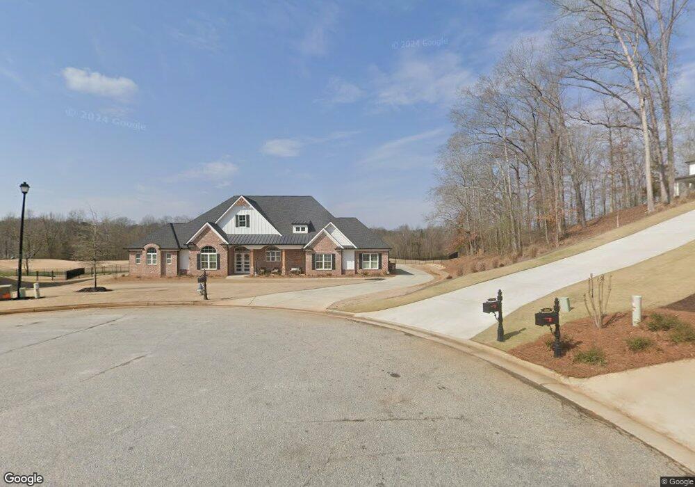
2001 Duncans Mill Rd Jefferson, GA 30549
Estimated Value: $786,000 - $1,110,836
Studio
2
Baths
4,164
Sq Ft
$240/Sq Ft
Est. Value
About This Home
This home is located at 2001 Duncans Mill Rd, Jefferson, GA 30549 and is currently estimated at $999,209, approximately $239 per square foot. 2001 Duncans Mill Rd is a home located in Jackson County with nearby schools including Gum Springs Elementary School, West Jackson Middle School, and Jackson County High School.
Ownership History
Date
Name
Owned For
Owner Type
Purchase Details
Closed on
Apr 10, 2019
Sold by
Mangan John David
Bought by
Dorouth Jennifer and Dorough Madison
Current Estimated Value
Purchase Details
Closed on
Aug 19, 2010
Sold by
Branch Banking
Bought by
Mangan John David
Purchase Details
Closed on
May 5, 2009
Sold by
Gemandi Properties Of Bras
Bought by
Branch Banking
Purchase Details
Closed on
Sep 29, 2006
Sold by
Not Provided
Bought by
Mangan John David and Mangan Suzanne B
Home Financials for this Owner
Home Financials are based on the most recent Mortgage that was taken out on this home.
Original Mortgage
$210,798
Interest Rate
6.36%
Mortgage Type
New Conventional
Purchase Details
Closed on
May 18, 2005
Sold by
Bluegreen Communities
Bought by
Parker Chandler Homes Inc
Create a Home Valuation Report for This Property
The Home Valuation Report is an in-depth analysis detailing your home's value as well as a comparison with similar homes in the area
Home Values in the Area
Average Home Value in this Area
Purchase History
| Date | Buyer | Sale Price | Title Company |
|---|---|---|---|
| Dorouth Jennifer | $93,000 | -- | |
| Mangan John David | $24,000 | -- | |
| Branch Banking | $85,000 | -- | |
| Mangan John David | $104,500 | -- | |
| Parker Chandler Homes Inc | $1,247,100 | -- |
Source: Public Records
Mortgage History
| Date | Status | Borrower | Loan Amount |
|---|---|---|---|
| Previous Owner | Mangan John David | $210,798 |
Source: Public Records
Tax History
| Year | Tax Paid | Tax Assessment Tax Assessment Total Assessment is a certain percentage of the fair market value that is determined by local assessors to be the total taxable value of land and additions on the property. | Land | Improvement |
|---|---|---|---|---|
| 2025 | $10,561 | $424,600 | $87,000 | $337,600 |
| 2024 | $10,561 | $391,600 | $54,000 | $337,600 |
| 2023 | $10,102 | $346,200 | $54,000 | $292,200 |
| 2022 | $8,023 | $277,760 | $48,600 | $229,160 |
| 2021 | $7,956 | $273,560 | $48,600 | $224,960 |
| 2020 | $7,744 | $243,520 | $48,600 | $194,920 |
| 2019 | $598 | $18,400 | $18,400 | $0 |
| 2018 | $606 | $18,400 | $18,400 | $0 |
| 2017 | $611 | $18,400 | $18,400 | $0 |
| 2016 | $214 | $6,400 | $6,400 | $0 |
| 2015 | $213 | $6,400 | $6,400 | $0 |
| 2014 | $214 | $6,400 | $6,400 | $0 |
| 2013 | -- | $4,000 | $4,000 | $0 |
Source: Public Records
Map
Nearby Homes
- 1990 Duncans Mill Ln
- 2240 N Pear Grove Ct
- 1960 Duncans Mill Ln
- 1960 Duncans Mill Ln Unit 38N
- 1937 Duncans Mill Ln
- 2091 Cleveland Ct
- 3199 Brush Arbor Ct
- 3202 Brush Arbor Ct
- 2046 Mill Pond Ct
- 959 Old Forge Ln
- 1909 Duncans Mill Ln
- 2717 Roller Mill Dr
- 43 Baker Pond Ct
- 33 Baker Pond Ct
- 1178 Antrim Glen Dr
- 70 Baker Pond Ct
- 1570 Traditions Way
- 2478 Traditions Way
- 2881 Traditions Way
- 905 Old Forge Ln
- 1997 Duncans Mill Rd
- 2006 Duncan Mills Rd
- 1993 Duncans Mill Rd
- 2002 Duncans Mill Ln
- 2002 Duncans Mill Rd
- 1996 Duncans Mill Rd
- 2006 Duncans Mill Rd
- 1990 Duncans Mill Rd
- 1985 Duncans Mill Rd
- 1984 Duncans Mill Rd
- 1989 Duncans Mill Ln
- 1981 Duncans Mill Rd
- 1984 Duncans Mill Ln
- 1977 Duncans Mill Ln
- 1977 Duncans Mill Rd
- 2241 N Pear Grove Ct
- 1976 Duncans Mill Rd
- 1973 Duncans Mill Rd
- 1973 Duncans Mill Rd
- 1973 Duncans Mill Rd
Your Personal Tour Guide
Ask me questions while you tour the home.