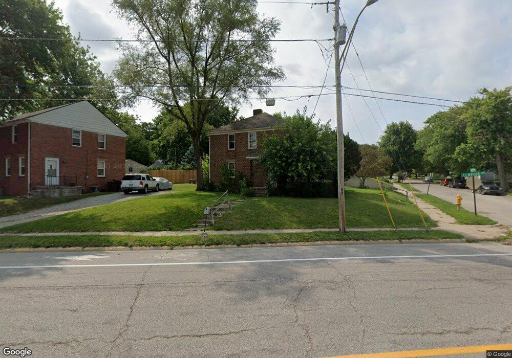
2001 Elmwood Ave Lafayette, IN 47904
Elmwood NeighborhoodEstimated Value: $210,000
--
Bed
2
Baths
1,344
Sq Ft
$156/Sq Ft
Est. Value
About This Home
This home is located at 2001 Elmwood Ave, Lafayette, IN 47904 and is currently estimated at $210,000, approximately $156 per square foot. 2001 Elmwood Ave is a home located in Tippecanoe County with nearby schools including Vinton Elementary School, Sunnyside Intermediate School, and Lafayette Tecumseh Junior High School.
Ownership History
Date
Name
Owned For
Owner Type
Purchase Details
Closed on
Feb 28, 2005
Sold by
Bottrell Torrin J
Bought by
Simms William D and Simms Michele M
Current Estimated Value
Home Financials for this Owner
Home Financials are based on the most recent Mortgage that was taken out on this home.
Original Mortgage
$77,400
Outstanding Balance
$39,733
Interest Rate
5.8%
Mortgage Type
Commercial
Estimated Equity
$170,267
Purchase Details
Closed on
Feb 8, 2002
Sold by
Bottrell Gay L
Bought by
Bottrell Torrin J
Create a Home Valuation Report for This Property
The Home Valuation Report is an in-depth analysis detailing your home's value as well as a comparison with similar homes in the area
Home Values in the Area
Average Home Value in this Area
Purchase History
| Date | Buyer | Sale Price | Title Company |
|---|---|---|---|
| Simms William D | -- | -- | |
| Bottrell Torrin J | -- | -- |
Source: Public Records
Mortgage History
| Date | Status | Borrower | Loan Amount |
|---|---|---|---|
| Open | Simms William D | $77,400 |
Source: Public Records
Tax History Compared to Growth
Tax History
| Year | Tax Paid | Tax Assessment Tax Assessment Total Assessment is a certain percentage of the fair market value that is determined by local assessors to be the total taxable value of land and additions on the property. | Land | Improvement |
|---|---|---|---|---|
| 2024 | $2,096 | $104,800 | $13,000 | $91,800 |
| 2023 | $1,998 | $99,900 | $13,000 | $86,900 |
| 2022 | $1,950 | $97,500 | $13,000 | $84,500 |
| 2021 | $1,912 | $95,600 | $13,000 | $82,600 |
| 2020 | $1,912 | $95,600 | $13,000 | $82,600 |
| 2019 | $1,912 | $95,600 | $12,000 | $83,600 |
| 2018 | $1,912 | $95,600 | $12,000 | $83,600 |
| 2017 | $1,860 | $93,000 | $12,000 | $81,000 |
| 2016 | $1,842 | $92,110 | $12,000 | $80,110 |
| 2014 | $1,746 | $87,300 | $12,000 | $75,300 |
| 2013 | $1,730 | $86,500 | $12,000 | $74,500 |
Source: Public Records
Map
Nearby Homes
- 1931 Morton St
- 1803 Pierce St
- 2103 Union St
- 1904 Greenbush St
- 1925 Maple St
- 2410 Union St
- 60 Sunrise Dr
- 1430 N 16th St
- 640 Perrin Ave
- 2131 Vinton St
- 2707 Union St
- 2205 Vinton St
- 1411 N 14th St
- 2127 Perrine St
- 420 Tinkler St
- 2711 Sleepy Hollow Dr
- 1400 N 28th St
- 1729 Arlington Rd
- 1000 Hartford St
- 1000 Berkley Rd
- 2005 Elmwood Ave
- 1031 N 20th St Unit 10
- 1031 N 20th St Unit 1031 and 1033
- 1931 Elmwood Ave
- 1027 N 20th St
- 1032 N 21st St
- 1036 N 21st St
- 1022 N 21st St
- 1028 N 20th St
- 1023 N 20th St
- 1020 N 21st St
- 1020 N 20th St
- 1019 N 20th St
- 1018 N 21st St
- 1018 N 20th St
- 1927 Elmwood Ave
- 1015 N 20th St
- 1010 N 21st St
- 1014 N 20th St
- 1011 N 20th St