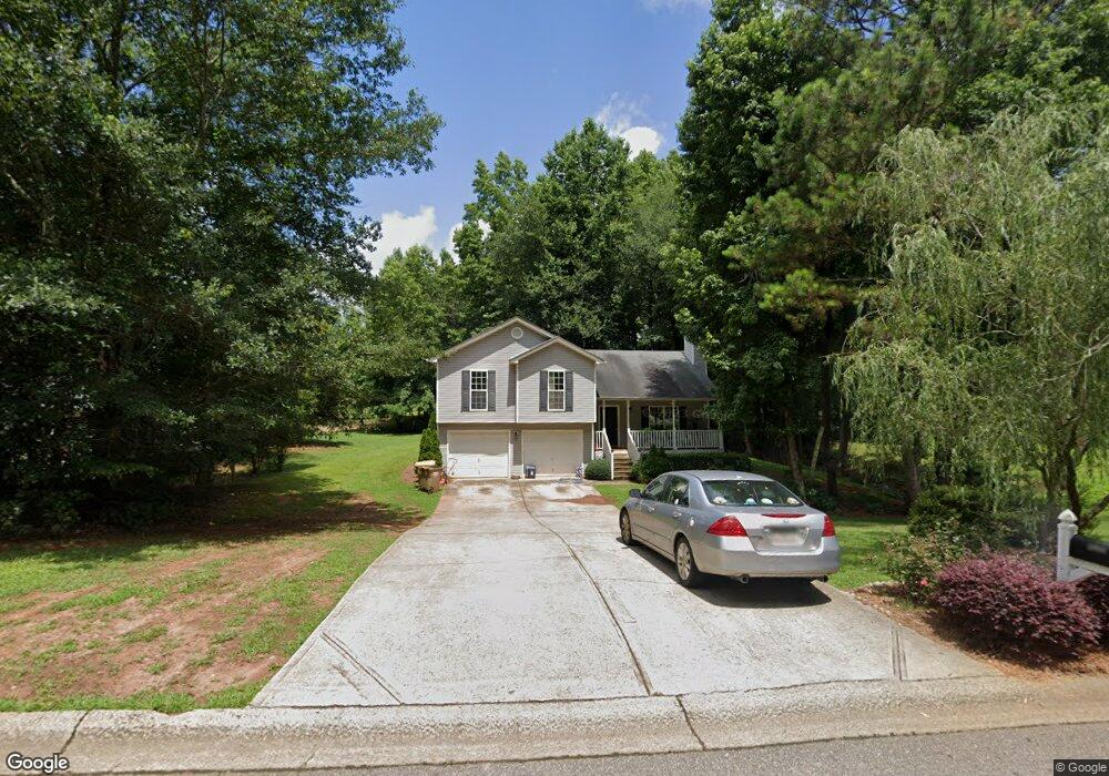
2001 Emerald Pointe Dr Winder, GA 30680
Estimated Value: $304,721 - $347,000
4
Beds
3
Baths
1,662
Sq Ft
$197/Sq Ft
Est. Value
About This Home
This home is located at 2001 Emerald Pointe Dr, Winder, GA 30680 and is currently estimated at $327,180, approximately $196 per square foot. 2001 Emerald Pointe Dr is a home located in Barrow County with nearby schools including Statham Elementary School, Bear Creek Middle School, and Winder-Barrow High School.
Ownership History
Date
Name
Owned For
Owner Type
Purchase Details
Closed on
Oct 29, 2004
Sold by
Southfork Hms Inc
Bought by
Galdamez Silvia E
Current Estimated Value
Home Financials for this Owner
Home Financials are based on the most recent Mortgage that was taken out on this home.
Original Mortgage
$119,367
Outstanding Balance
$57,852
Interest Rate
5.66%
Mortgage Type
New Conventional
Estimated Equity
$269,328
Purchase Details
Closed on
Jun 25, 2004
Sold by
Sierra Development Inc
Bought by
Southfork Homes Inc
Purchase Details
Closed on
Jun 18, 2002
Sold by
Davis George H
Bought by
Sierra Development Inc
Create a Home Valuation Report for This Property
The Home Valuation Report is an in-depth analysis detailing your home's value as well as a comparison with similar homes in the area
Home Values in the Area
Average Home Value in this Area
Purchase History
| Date | Buyer | Sale Price | Title Company |
|---|---|---|---|
| Galdamez Silvia E | $125,700 | -- | |
| Southfork Homes Inc | $30,000 | -- | |
| Sierra Development Inc | $419,200 | -- |
Source: Public Records
Mortgage History
| Date | Status | Borrower | Loan Amount |
|---|---|---|---|
| Open | Galdamez Silvia E | $119,367 |
Source: Public Records
Tax History
| Year | Tax Paid | Tax Assessment Tax Assessment Total Assessment is a certain percentage of the fair market value that is determined by local assessors to be the total taxable value of land and additions on the property. | Land | Improvement |
|---|---|---|---|---|
| 2025 | $2,529 | $108,532 | $18,400 | $90,132 |
| 2024 | $2,620 | $105,928 | $18,400 | $87,528 |
| 2023 | $2,220 | $106,528 | $18,400 | $88,128 |
| 2022 | $2,335 | $81,959 | $18,400 | $63,559 |
| 2021 | $2,140 | $71,164 | $16,000 | $55,164 |
| 2020 | $2,140 | $71,164 | $16,000 | $55,164 |
| 2019 | $1,857 | $60,652 | $16,000 | $44,652 |
| 2018 | $1,657 | $54,852 | $10,200 | $44,652 |
| 2017 | $1,215 | $41,736 | $10,200 | $31,536 |
| 2016 | $1,186 | $40,520 | $10,200 | $30,320 |
| 2015 | $1,201 | $40,850 | $10,200 | $30,650 |
| 2014 | $1,086 | $36,860 | $5,880 | $30,980 |
| 2013 | -- | $34,906 | $5,880 | $29,026 |
Source: Public Records
Map
Nearby Homes
- 1303 Post Oak Ct
- 1740 Highway 211 NE
- 1006 English Oak Ln
- 1453 Solomon Dr
- 1948 Hearthstone Ct
- 16 Fox Dr
- 1295 Double Bridges Rd
- 311 Anchors Way
- 416 Corbin Ct
- 1264 Highway 211 NE
- 113 Platte St
- 1703 Bismarck Cir
- 1415 Blanding Way
- 207 Cedar Grove Church Rd
- 41 Meagan St
- 2028 Highway 211 NE
- 0
- 3 Cedar Grove Church Rd
- 5 Cedar Grove Church Rd
- 1308 Georgia 82
- 1570 Emerald Pointe Dr
- 2005 Emerald Pointe Dr
- 2007 Emerald Pointe Dr
- 2009 Emerald Pointe Dr Unit 2009
- 2009 Emerald Pointe Dr
- 2009 Emerald Pointe Dr Unit A
- 2009 Emerald Point
- 2009 Emerald Pte
- 1570 Brush Creek Dr
- 1572 Brush Creek Dr
- 2011 Emerald Pointe Dr
- 2011 Emerald Pointe Lot6
- 1655 Highway 211 NE
- 1574 Brush Creek Dr Unit 40
- 1574 Brush Creek Dr
- 2013 Emerald Pointe Dr
- 1571 Brush Creek Dr
- 1576 Brush Creek Dr
- 1642 Highway 211 NE
- 1576 Brush Cr Dr (39)
Your Personal Tour Guide
Ask me questions while you tour the home.