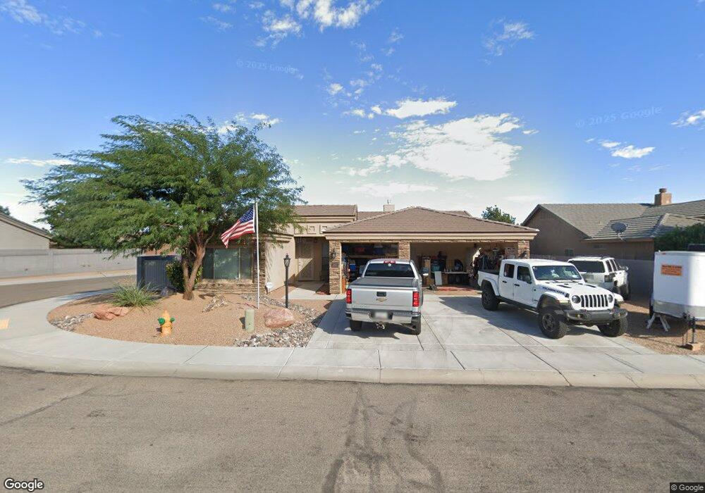
2001 John Wayne Dr Kingman, AZ 86409
Estimated Value: $360,748 - $410,000
Studio
--
Bath
1,943
Sq Ft
$198/Sq Ft
Est. Value
About This Home
This home is located at 2001 John Wayne Dr, Kingman, AZ 86409 and is currently estimated at $385,437, approximately $198 per square foot. 2001 John Wayne Dr is a home with nearby schools including Manzanita Elementary School, Kingman Middle School, and Kingman High School.
Ownership History
Date
Name
Owned For
Owner Type
Purchase Details
Closed on
May 25, 2018
Sold by
Cantrell Development Inc
Bought by
Hansen Cheryl L
Current Estimated Value
Home Financials for this Owner
Home Financials are based on the most recent Mortgage that was taken out on this home.
Original Mortgage
$157,800
Interest Rate
4.9%
Mortgage Type
New Conventional
Purchase Details
Closed on
Mar 10, 2018
Sold by
Pioneer Title Agency Inc
Bought by
Cantrell Development Inc
Home Financials for this Owner
Home Financials are based on the most recent Mortgage that was taken out on this home.
Original Mortgage
$36,000
Interest Rate
4.5%
Mortgage Type
Stand Alone First
Create a Home Valuation Report for This Property
The Home Valuation Report is an in-depth analysis detailing your home's value as well as a comparison with similar homes in the area
Home Values in the Area
Average Home Value in this Area
Purchase History
| Date | Buyer | Sale Price | Title Company |
|---|---|---|---|
| Hansen Cheryl L | $256,500 | Pioneer Title Agency Inc | |
| Cantrell Development Inc | $36,000 | Pioneer Title Agency Inc |
Source: Public Records
Mortgage History
| Date | Status | Borrower | Loan Amount |
|---|---|---|---|
| Previous Owner | Hansen Cheryl L | $157,800 | |
| Previous Owner | Cantrell Development Inc | $36,000 |
Source: Public Records
Tax History
| Year | Tax Paid | Tax Assessment Tax Assessment Total Assessment is a certain percentage of the fair market value that is determined by local assessors to be the total taxable value of land and additions on the property. | Land | Improvement |
|---|---|---|---|---|
| 2026 | $815 | -- | -- | -- |
| 2025 | $1,667 | $30,890 | $0 | $0 |
| 2024 | $1,667 | $30,369 | $0 | $0 |
| 2023 | $1,667 | $28,641 | $0 | $0 |
| 2022 | $1,273 | $23,145 | $0 | $0 |
| 2021 | $1,350 | $21,952 | $0 | $0 |
| 2019 | $289 | $4,593 | $0 | $0 |
| 2018 | $299 | $4,573 | $0 | $0 |
| 2017 | $127 | $1,244 | $0 | $0 |
Source: Public Records
Map
Nearby Homes
- 1996 Rex Allen Dr
- 1999 Alan Ladd Dr
- 2063 Rex Allen Dr
- 2049 Alan Ladd Dr
- 2086 Alan Ladd Dr
- 3797 Henry Fonda Way
- 3937 Rex Allen Dr
- 2085 Alan Ladd Dr
- 3890 Walleck Ranch Dr
- 2121 Dale Evans Way
- 2189 Alan Ladd Dr
- 2201 Alan Ladd Dr
- 2131 Alan Ladd Dr
- 3943 Rex Allen Bay
- 10.73 Ac Stockton Hill Rd
- 00 Stockton Hill Rd
- 1087 Stockton Hill Rd
- 3955 Rex Allen Cir
- 3916 Lindsey Ave
- 3962 Rex Allen Cir
- 2003 John Wayne Dr
- 1972 Rex Allen Dr
- 1987 John Wayne Dr
- 1992 John Wayne Dr
- 1996 John Wayne Dr
- 2007 John Wayne Dr
- 3951 Sorenson Dr
- 3951 Sorenson Dr
- 1984 Rex Allen Dr
- 1975 Gene Autry Dr
- 1988 John Wayne Dr
- 2000 John Wayne Dr
- 1988 John Wayne Dr
- 1983 John Wayne Dr
- 1983 Gene Autry Dr
- 2004 John Wayne Dr
- 1980 John Wayne Dr
- 1980 John Wayne Dr
- 3957 Sorenson Dr
- 2011 John Wayne Dr
Your Personal Tour Guide
Ask me questions while you tour the home.