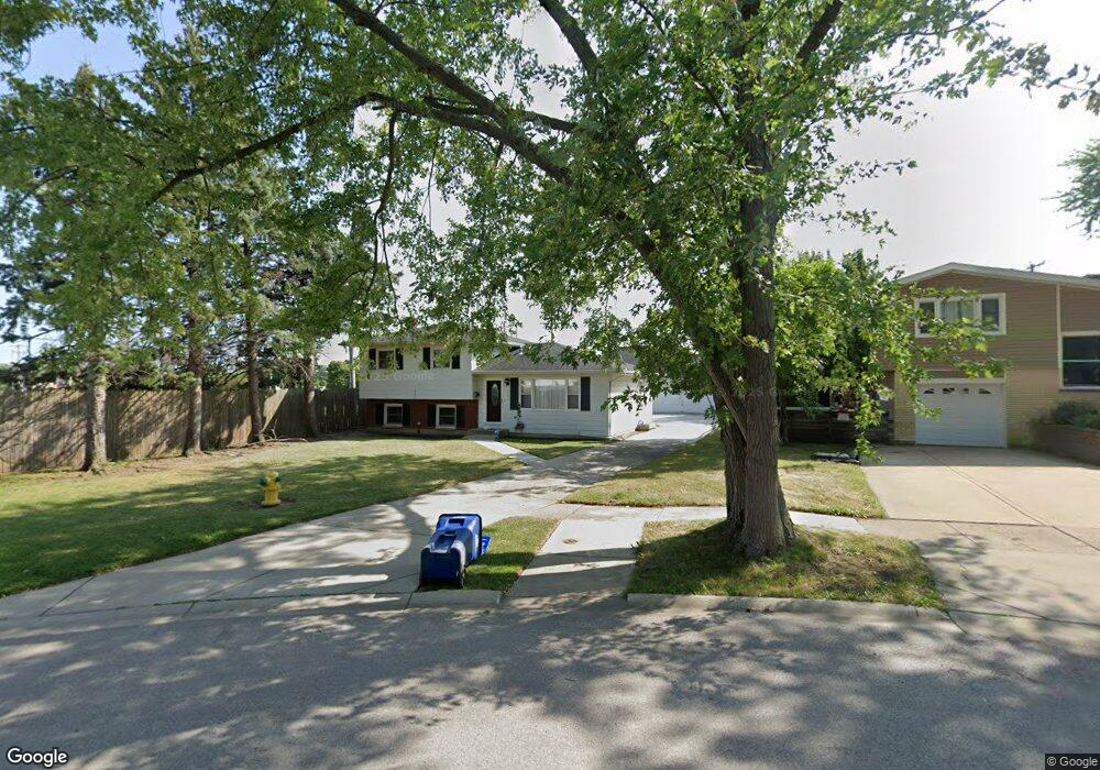
2001 Kingston Rd Waukegan, IL 60087
Estimated Value: $263,000 - $310,758
2
Beds
2
Baths
1,087
Sq Ft
$254/Sq Ft
Est. Value
About This Home
This home is located at 2001 Kingston Rd, Waukegan, IL 60087 and is currently estimated at $275,940, approximately $253 per square foot. 2001 Kingston Rd is a home located in Lake County with nearby schools including H R McCall Elementary School, Jack Benny Middle School, and Waukegan High School.
Ownership History
Date
Name
Owned For
Owner Type
Purchase Details
Closed on
May 13, 2002
Sold by
Martinez Salomon
Bought by
Lucio Sandra N and Martinez Sandra N
Current Estimated Value
Home Financials for this Owner
Home Financials are based on the most recent Mortgage that was taken out on this home.
Original Mortgage
$116,500
Outstanding Balance
$49,194
Interest Rate
6.93%
Estimated Equity
$226,746
Purchase Details
Closed on
Feb 4, 1998
Sold by
Voights Evan R and Voights Dianne L
Bought by
Martinez Salomon and Martinez Sandra N
Home Financials for this Owner
Home Financials are based on the most recent Mortgage that was taken out on this home.
Original Mortgage
$117,945
Interest Rate
6.99%
Mortgage Type
FHA
Create a Home Valuation Report for This Property
The Home Valuation Report is an in-depth analysis detailing your home's value as well as a comparison with similar homes in the area
Home Values in the Area
Average Home Value in this Area
Purchase History
| Date | Buyer | Sale Price | Title Company |
|---|---|---|---|
| Lucio Sandra N | -- | -- | |
| Martinez Salomon | $119,000 | -- |
Source: Public Records
Mortgage History
| Date | Status | Borrower | Loan Amount |
|---|---|---|---|
| Open | Lucio Sandra N | $116,500 | |
| Closed | Martinez Salomon | $117,945 |
Source: Public Records
Tax History Compared to Growth
Tax History
| Year | Tax Paid | Tax Assessment Tax Assessment Total Assessment is a certain percentage of the fair market value that is determined by local assessors to be the total taxable value of land and additions on the property. | Land | Improvement |
|---|---|---|---|---|
| 2024 | $6,801 | $88,692 | $11,959 | $76,733 |
| 2023 | $6,358 | $80,125 | $10,805 | $69,320 |
| 2022 | $6,358 | $71,036 | $9,066 | $61,970 |
| 2021 | $6,157 | $65,058 | $8,634 | $56,424 |
| 2020 | $6,190 | $60,610 | $8,044 | $52,566 |
| 2019 | $6,180 | $55,539 | $7,371 | $48,168 |
| 2018 | $5,087 | $45,700 | $9,482 | $36,218 |
| 2017 | $4,901 | $40,432 | $8,389 | $32,043 |
| 2016 | $4,505 | $35,134 | $7,290 | $27,844 |
| 2015 | $4,298 | $31,446 | $6,525 | $24,921 |
| 2014 | $3,659 | $27,167 | $6,135 | $21,032 |
| 2012 | $4,755 | $29,432 | $6,646 | $22,786 |
Source: Public Records
Map
Nearby Homes
- 3211 Rugby Ct
- 37966 N Cornell Rd
- 3411 N Lewis Ave
- 1636 Rice St
- 3101 Country Club Ln
- 1612 Whitney St
- 2613 N Lewis Ave
- 38127 N Shore Ave
- 1730 W Beach Rd
- 38362 N Manor Ave
- 37905 N Loyola Ave
- 38683 N Lewis Ave
- 12312 W Audrey Ave
- 2350 N Lewis Ave
- 2708 Dana Ave
- 2705 Dana Ave
- 38697 N Cedar Ave
- 11345 W Carnahan Ave
- 2713 Varonen Ave
- 12582 W Beach Rd
- 2005 Kingston Rd
- 2009 Kingston Rd
- 2004 Kingston Rd
- 2013 Kingston Rd
- 2008 Kingston Rd
- 2017 Kingston Rd
- 3216 Bristol Rd
- 3232 N Lewis Ave
- 2012 Kingston Rd
- 2021 Kingston Rd
- 3220 Bristol Rd
- 3143 E Newcastle Ct
- 3215 Rugby Ct
- 3147 E Newcastle Ct
- 2025 Kingston Rd
- 3224 Bristol Rd
- 3219 Rugby Ct
- 3151 E Newcastle Ct
- 2029 Kingston Rd
- 3139 E Newcastle Ct