
Seller's Agent in 2025
Debbie Fulford
Re/Max Of Albany
6 in this area
150 Total Sales
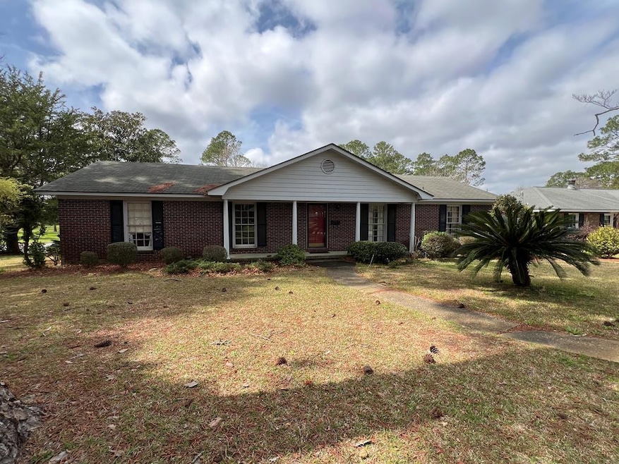
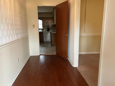
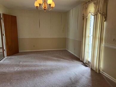
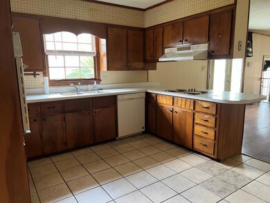
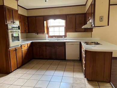
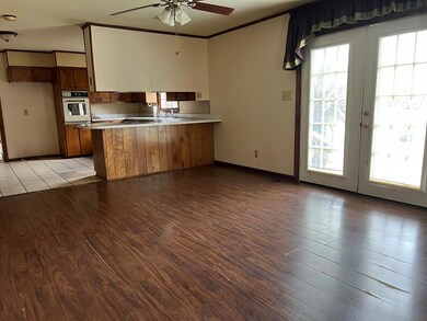
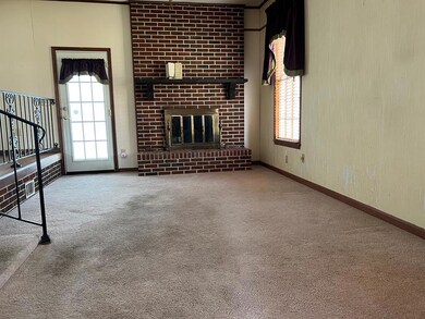
ESTATE OFFERS ONE OWNER HOME IN GREAT LAKE PARK LOCATION. At this great price, buyer can update with their choice of decor, hardwood floors in all bedrooms could be beautifully refinished, large kitchen/dining room, separate den/fireplace, living room, double carport and storage room on corner lot. Great opportunity in prime northwest subdivision just blocks from Lake Park School.
Last Agent to Sell the Property
Re/Max Of Albany Brokerage Phone: 2294341600 License #127976 Listed on: 02/11/2025
Last Buyer's Agent
Re/Max Of Albany Brokerage Phone: 2294341600 License #127976 Listed on: 02/11/2025
| Date | Type | Sale Price | Title Company |
|---|---|---|---|
| Limited Warranty Deed | $123,000 | -- | |
| Warranty Deed | -- | -- | |
| Warranty Deed | -- | -- | |
| Administrators Deed | -- | -- | |
| Quit Claim Deed | -- | -- | |
| Deed | -- | -- |
| Date | Event | Price | List to Sale | Price per Sq Ft |
|---|---|---|---|---|
| 05/05/2025 05/05/25 | Off Market | $154,500 | -- | -- |
| 05/02/2025 05/02/25 | Sold | $123,000 | -20.4% | $77 / Sq Ft |
| 03/20/2025 03/20/25 | Pending | -- | -- | -- |
| 03/06/2025 03/06/25 | Price Changed | $154,500 | -3.1% | $96 / Sq Ft |
| 02/11/2025 02/11/25 | For Sale | $159,500 | -- | $99 / Sq Ft |
| Year | Tax Paid | Tax Assessment Tax Assessment Total Assessment is a certain percentage of the fair market value that is determined by local assessors to be the total taxable value of land and additions on the property. | Land | Improvement |
|---|---|---|---|---|
| 2025 | $2,031 | $46,240 | $8,080 | $38,160 |
| 2024 | $2,031 | $46,240 | $8,080 | $38,160 |
| 2023 | $1,021 | $46,240 | $8,080 | $38,160 |
| 2022 | $1,867 | $46,240 | $8,080 | $38,160 |
| 2021 | $2,005 | $46,240 | $8,080 | $38,160 |
| 2020 | $1,726 | $46,240 | $8,080 | $38,160 |
| 2019 | $1,733 | $46,240 | $8,080 | $38,160 |
| 2018 | $1,740 | $46,240 | $8,080 | $38,160 |
| 2017 | $1,613 | $46,240 | $8,080 | $38,160 |
| 2016 | $1,614 | $46,240 | $8,080 | $38,160 |
| 2015 | $1,617 | $46,240 | $8,080 | $38,160 |
| 2014 | $1,675 | $48,280 | $10,120 | $38,160 |
Seller's Agent in 2025
Debbie Fulford
Re/Max Of Albany
6 in this area
150 Total Sales
Source: Albany Board of REALTORS®
MLS Number: 164363
APN: 0000P-00009-010
Ask me questions while you tour the home.