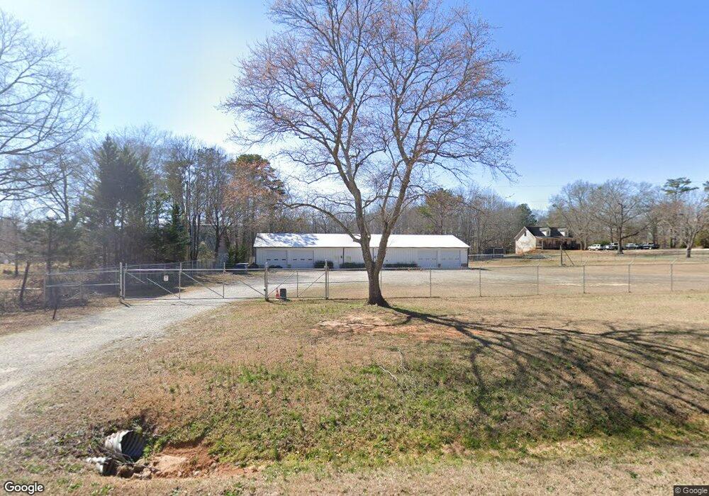
2001 Malcom Bridge Rd Bogart, GA 30622
Estimated Value: $960,850
--
Bed
--
Bath
98,881
Sq Ft
$10/Sq Ft
Est. Value
About This Home
This home is located at 2001 Malcom Bridge Rd, Bogart, GA 30622 and is currently estimated at $960,850, approximately $9 per square foot. 2001 Malcom Bridge Rd is a home located in Oconee County with nearby schools including Malcom Bridge Elementary School, Malcom Bridge Middle School, and North Oconee High School.
Ownership History
Date
Name
Owned For
Owner Type
Purchase Details
Closed on
Jun 5, 2018
Sold by
Riddle
Bought by
Wiw Holdings Llc
Current Estimated Value
Purchase Details
Closed on
Apr 15, 2008
Sold by
Not Provided
Bought by
Athens Malcom Property Llc
Home Financials for this Owner
Home Financials are based on the most recent Mortgage that was taken out on this home.
Original Mortgage
$194,250
Interest Rate
5.84%
Mortgage Type
Commercial
Create a Home Valuation Report for This Property
The Home Valuation Report is an in-depth analysis detailing your home's value as well as a comparison with similar homes in the area
Home Values in the Area
Average Home Value in this Area
Purchase History
| Date | Buyer | Sale Price | Title Company |
|---|---|---|---|
| Wiw Holdings Llc | $100,000 | -- | |
| Athens Malcom Property Llc | $350,000 | -- | |
| Athens Malcom Property Llc | -- | -- |
Source: Public Records
Mortgage History
| Date | Status | Borrower | Loan Amount |
|---|---|---|---|
| Previous Owner | Athens Malcom Property Llc | $194,250 | |
| Previous Owner | Athens Malcom Property Llc | $201,000 |
Source: Public Records
Tax History Compared to Growth
Tax History
| Year | Tax Paid | Tax Assessment Tax Assessment Total Assessment is a certain percentage of the fair market value that is determined by local assessors to be the total taxable value of land and additions on the property. | Land | Improvement |
|---|---|---|---|---|
| 2024 | $6,950 | $331,907 | $149,820 | $182,087 |
| 2023 | $6,202 | $311,297 | $149,820 | $161,477 |
| 2022 | $5,521 | $257,318 | $99,880 | $157,438 |
| 2021 | $3,865 | $166,957 | $90,800 | $76,157 |
| 2020 | $2,467 | $106,408 | $76,272 | $30,136 |
| 2019 | $2,664 | $114,916 | $76,272 | $38,644 |
| 2018 | $2,781 | $117,398 | $76,272 | $41,126 |
| 2017 | $2,781 | $117,398 | $76,272 | $41,126 |
| 2016 | $2,590 | $109,354 | $69,462 | $39,892 |
| 2015 | $2,645 | $111,417 | $69,462 | $41,955 |
| 2014 | $2,706 | $111,417 | $69,462 | $41,955 |
| 2013 | -- | $113,604 | $69,462 | $44,142 |
Source: Public Records
Map
Nearby Homes
- 2165 Harperfield Dr
- 1105 Harperfield Dr
- 1010 Long Creek Dr
- 1479 Mcfall Ct
- 1071 Oaklake Cir
- 1496 Malcom Estates Dr
- 1224 Malcom Estates Point Unit Lot 67
- 1021 Bedford Trail
- 1491 Virgil Langford Rd
- 1895 Vintage Place
- 1190 Wareview Ct
- 1336 Prince Place
- 1010 Oaklake Terrace
- 1100 Manjula Ln
- 1300 Manjula Ln
- 1175 Manjula Ln
- 1981 Malcom Bridge Rd
- 2021 Malcom Bridge Rd
- 1951 Malcom Bridge Rd
- 1931 Malcom Bridge Rd
- 2061 Malcom Bridge Rd
- 1960 Malcom Bridge Rd
- 2031 Malcom Bridge Rd
- 2101 Malcom Bridge Rd
- 0 Lenru Rd
- 00 Lenru Rd
- 0 Lenru Rd Unit CM979783
- 0 Lenru Rd Unit CM926312
- 0 Lenru Rd Unit CM903380
- 0 Lenru Rd Unit CM919950
- 0 Lenru Rd Unit CM929443
- 0 Lenru Rd Unit CM916037
- 0 Lenru Rd Unit 921953
- 0 Lenru Rd Unit 2944619
- 0 Lenru Rd Unit 3282252
- 0 Lenru Rd Unit 7267077