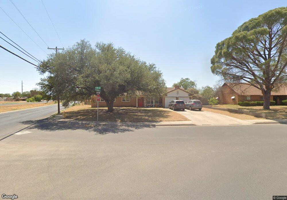
2001 N B St Midland, TX 79705
Estimated Value: $283,000 - $328,000
Studio
2
Baths
2,037
Sq Ft
$151/Sq Ft
Est. Value
About This Home
This home is located at 2001 N B St, Midland, TX 79705 and is currently estimated at $307,437, approximately $150 per square foot. 2001 N B St is a home located in Midland County with nearby schools including Fannin Elementary School, San Jacinto Junior High School, and Midland High School.
Ownership History
Date
Name
Owned For
Owner Type
Purchase Details
Closed on
Dec 15, 2022
Sold by
Dr Horton-Texas Ltd
Bought by
Awondo Nelson Tabou
Current Estimated Value
Home Financials for this Owner
Home Financials are based on the most recent Mortgage that was taken out on this home.
Original Mortgage
$295,770
Outstanding Balance
$286,598
Interest Rate
6.95%
Mortgage Type
New Conventional
Estimated Equity
$20,839
Purchase Details
Closed on
Mar 31, 1980
Bought by
Nelson Jimmy Ray
Create a Home Valuation Report for This Property
The Home Valuation Report is an in-depth analysis detailing your home's value as well as a comparison with similar homes in the area
Purchase History
| Date | Buyer | Sale Price | Title Company |
|---|---|---|---|
| Awondo Nelson Tabou | -- | Simplifile | |
| Nelson Jimmy Ray | -- | -- |
Source: Public Records
Mortgage History
| Date | Status | Borrower | Loan Amount |
|---|---|---|---|
| Open | Awondo Nelson Tabou | $295,770 |
Source: Public Records
Tax History
| Year | Tax Paid | Tax Assessment Tax Assessment Total Assessment is a certain percentage of the fair market value that is determined by local assessors to be the total taxable value of land and additions on the property. | Land | Improvement |
|---|---|---|---|---|
| 2025 | $3,965 | $261,090 | $27,370 | $233,720 |
| 2024 | $1,708 | $269,440 | $27,370 | $242,070 |
| 2023 | $1,646 | $267,980 | $27,370 | $240,610 |
| 2022 | $3,705 | $237,110 | $27,370 | $209,740 |
| 2021 | $4,120 | $236,470 | $27,370 | $209,100 |
| 2019 | $3,982 | $210,340 | $27,370 | $200,550 |
| 2018 | $3,718 | $191,220 | $27,370 | $163,850 |
| 2017 | $3,758 | $193,300 | $27,370 | $165,930 |
| 2016 | $3,746 | $192,330 | $27,370 | $164,960 |
| 2015 | -- | $192,330 | $27,370 | $164,960 |
| 2014 | -- | $186,670 | $0 | $0 |
Source: Public Records
Map
Nearby Homes
- 800 Gulf Ave
- 810 Stanolind Ave
- 809 Sinclair Ave
- 806 Stanolind Ave
- 715 Shell Ave
- 1001 Neely Ave
- 1112 Humble Ave
- 1114 Humble Ave
- 1805 N D St
- 709 Sinclair Ave
- 1200 W Scharbauer Dr
- TBD Bonham St
- 1202 W Scharbauer Dr
- 2105 Oaklawn Dr
- 1210 W Scharbauer Dr
- 1609 N C St
- 501 W Scharbauer Dr Unit 12
- 1209 W Pecan Ave
- 2109 Western Dr
- 600 Liddon Ave Unit 71
Your Personal Tour Guide
Ask me questions while you tour the home.