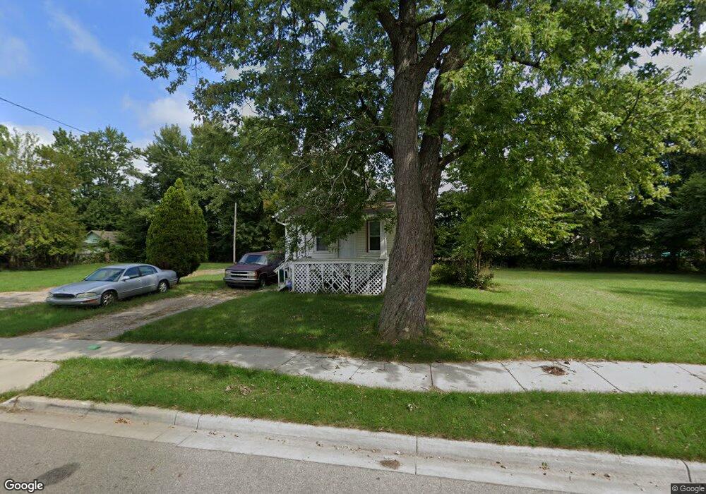
2001 Osband Ave Lansing, MI 48910
Greencroft Park NeighborhoodEstimated Value: $61,000 - $94,000
2
Beds
1
Bath
600
Sq Ft
$134/Sq Ft
Est. Value
About This Home
This home is located at 2001 Osband Ave, Lansing, MI 48910 and is currently estimated at $80,455, approximately $134 per square foot. 2001 Osband Ave is a home located in Ingham County with nearby schools including Averill Elementary School, Attwood School, and J.W. Sexton High School.
Ownership History
Date
Name
Owned For
Owner Type
Purchase Details
Closed on
Apr 24, 2018
Sold by
Coon Max A
Bought by
Speese Michael L
Current Estimated Value
Purchase Details
Closed on
Jan 19, 2016
Sold by
Matthews Jarrell L and Matthews Loren A
Bought by
Max And Max Llc
Purchase Details
Closed on
May 30, 2001
Sold by
Matthews Loren A
Bought by
Matthews Loren A and Matthews Jerrell L
Purchase Details
Closed on
Mar 23, 2001
Sold by
Household Finance Corp Iii
Bought by
Matthews Loren A
Purchase Details
Closed on
Nov 30, 2000
Sold by
Turner Bobby E and Turner Stella
Bought by
Household Finance Corp Iii
Purchase Details
Closed on
May 1, 1992
Create a Home Valuation Report for This Property
The Home Valuation Report is an in-depth analysis detailing your home's value as well as a comparison with similar homes in the area
Home Values in the Area
Average Home Value in this Area
Purchase History
| Date | Buyer | Sale Price | Title Company |
|---|---|---|---|
| Speese Michael L | -- | None Available | |
| Max And Max Llc | $11,677 | None Available | |
| Matthews Loren A | -- | None Available | |
| Matthews Loren A | $20,000 | -- | |
| Household Finance Corp Iii | $23,039 | -- | |
| -- | $20,900 | -- |
Source: Public Records
Tax History Compared to Growth
Tax History
| Year | Tax Paid | Tax Assessment Tax Assessment Total Assessment is a certain percentage of the fair market value that is determined by local assessors to be the total taxable value of land and additions on the property. | Land | Improvement |
|---|---|---|---|---|
| 2025 | $1,985 | $27,200 | $4,000 | $23,200 |
| 2024 | $16 | $26,100 | $4,000 | $22,100 |
| 2023 | $1,870 | $24,000 | $4,000 | $20,000 |
| 2022 | $1,710 | $23,100 | $5,500 | $17,600 |
| 2021 | $2,301 | $21,000 | $4,600 | $16,400 |
| 2020 | $3,576 | $20,200 | $4,600 | $15,600 |
| 2019 | $2,862 | $19,800 | $4,600 | $15,200 |
| 2018 | $1,519 | $18,800 | $4,600 | $14,200 |
| 2017 | $1,468 | $18,800 | $4,600 | $14,200 |
| 2016 | $1,318 | $18,500 | $4,600 | $13,900 |
| 2015 | $1,318 | $18,000 | $9,142 | $8,858 |
| 2014 | $1,318 | $17,000 | $4,968 | $12,032 |
Source: Public Records
Map
Nearby Homes
- 2011 Osband Ave
- 511 W Mount Hope Ave
- 1836 Osband Ave
- 712 Lenore Ave
- 2313 S Rundle Ave
- 1723 Osband Ave
- 907 Lenore Ave
- 1913 Stirling Ave
- 815 Woodbine Ave
- 2112 Stirling Ave
- 2406 Markley Place
- 2310 Stirling Ave
- 2421 Stirling Ave
- 917 W Barnes Ave
- 1721 Fletcher St
- 1032 Kelsey Ave
- 1722 S Washington Ave
- 1010 W Barnes Ave
- 0 Rickle
- 1114 Goodrich St
- 0 V/L Osband 099 Ave
- 0 V/L Osband 098 Ave
- 1917 Osband Ave
- 0 V/L Osband 100 Ave
- 2000 Osband Ave
- 0 V L Osband Ave Pn#100 Ave
- 2004 Osband Ave
- 1918 Osband Ave
- 2012 Osband Ave
- 2016 Osband Ave
- 1912 Osband Ave
- 529 W Mount Hope Ave
- 611 Lenore Ave
- 1908 Osband Ave
- 2018 Osband Ave
- 612 Lenore Ave
- 523 W Mt Hope Ave
- 0 V/L W Mount Hope 094 Ave
- 515 W Mount Hope Ave
- 615 Lenore Ave