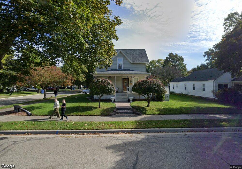
2001 Pattengill Ave Lansing, MI 48910
Colonial Village NeighborhoodEstimated Value: $162,390 - $205,000
Studio
--
Bath
1,628
Sq Ft
$115/Sq Ft
Est. Value
About This Home
This home is located at 2001 Pattengill Ave, Lansing, MI 48910 and is currently estimated at $187,848, approximately $115 per square foot. 2001 Pattengill Ave is a home located in Ingham County with nearby schools including Averill Elementary School, Attwood School, and J.W. Sexton High School.
Ownership History
Date
Name
Owned For
Owner Type
Purchase Details
Closed on
Feb 1, 2025
Sold by
Palacio Fidencio
Bought by
Palacio Fidencio and Brickley Jordan
Current Estimated Value
Purchase Details
Closed on
Sep 30, 1998
Sold by
Shigley Kenneth Scott and Shigley Lana D
Bought by
Hein Kelly J
Create a Home Valuation Report for This Property
The Home Valuation Report is an in-depth analysis detailing your home's value as well as a comparison with similar homes in the area
Home Values in the Area
Average Home Value in this Area
Purchase History
| Date | Buyer | Sale Price | Title Company |
|---|---|---|---|
| Palacio Fidencio | -- | None Listed On Document | |
| Hein Kelly J | $77,900 | -- |
Source: Public Records
Tax History
| Year | Tax Paid | Tax Assessment Tax Assessment Total Assessment is a certain percentage of the fair market value that is determined by local assessors to be the total taxable value of land and additions on the property. | Land | Improvement |
|---|---|---|---|---|
| 2025 | $4,425 | $89,600 | $13,500 | $76,100 |
| 2024 | $37 | $85,100 | $13,500 | $71,600 |
| 2023 | $4,162 | $78,100 | $13,500 | $64,600 |
| 2022 | $2,946 | $70,400 | $13,500 | $56,900 |
| 2021 | $2,885 | $66,600 | $12,900 | $53,700 |
| 2020 | $2,868 | $62,600 | $12,900 | $49,700 |
| 2019 | $2,750 | $59,100 | $12,900 | $46,200 |
| 2018 | $2,576 | $55,000 | $12,900 | $42,100 |
| 2017 | $2,466 | $55,000 | $12,900 | $42,100 |
| 2016 | $2,358 | $54,100 | $12,900 | $41,200 |
| 2015 | $2,358 | $52,700 | $25,815 | $26,885 |
| 2014 | $2,358 | $51,400 | $28,897 | $22,503 |
Source: Public Records
Map
Nearby Homes
- 1323 Cooper Ave
- 1517 Lenore Ave
- 1534 Lenore Ave
- 1312 W Mount Hope Ave
- 2001 S Martin Luther King Junior Blvd
- 1116 George St
- 2519 Marion Ave
- 1618 Loraine Ave
- 1740 Wellington Rd Unit 103
- 900 W Mount Hope Ave
- 1309 Hammond St
- 1017 W Barnes Ave
- 2421 Stirling Ave
- 1511 Pattengill Ave
- 815 Woodbine Ave
- 815 Smith Ave
- 712 Lenore Ave
- 717 Smith Ave
- 1120 Alsdorf St
- 2505 Fairfax Rd
- 2009 Pattengill Ave
- 1415 Lenore Ave
- 1420 Lenore Ave
- 1411 Lenore Ave
- 1424 Lenore Ave
- 2015 Pattengill Ave
- 1418 Cooper Ave
- 1414 Cooper Ave
- 1416 Lenore Ave
- 1407 Lenore Ave
- 1412 Lenore Ave
- 1410 Cooper Ave
- 1911 Pattengill Ave
- 1408 Lenore Ave
- 1403 Lenore Ave
- 2012 Pattengill Ave
- 1406 Cooper Ave
- 1404 Lenore Ave
- 2016 Pattengill Ave
- 1325 Lenore Ave
Your Personal Tour Guide
Ask me questions while you tour the home.