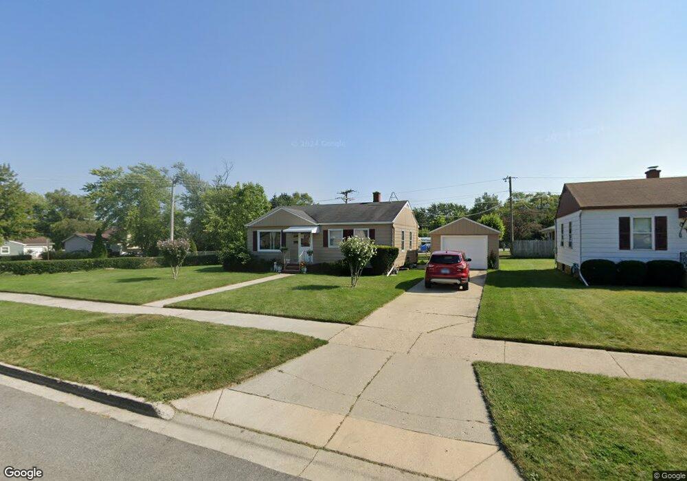
2001 Pearsall Pkwy Waukegan, IL 60085
Norshore Park NeighborhoodEstimated Value: $141,000 - $231,000
2
Beds
1
Bath
954
Sq Ft
$205/Sq Ft
Est. Value
About This Home
This home is located at 2001 Pearsall Pkwy, Waukegan, IL 60085 and is currently estimated at $195,509, approximately $204 per square foot. 2001 Pearsall Pkwy is a home located in Lake County with nearby schools including Clearview Elementary School, John R Lewis Middle School, and Waukegan High School.
Ownership History
Date
Name
Owned For
Owner Type
Purchase Details
Closed on
Jul 9, 2004
Sold by
Grum Helen M
Bought by
Aguinaga Manuel E and Aguinaga Manuelita
Current Estimated Value
Home Financials for this Owner
Home Financials are based on the most recent Mortgage that was taken out on this home.
Original Mortgage
$118,800
Outstanding Balance
$60,048
Interest Rate
6.4%
Mortgage Type
New Conventional
Estimated Equity
$135,461
Purchase Details
Closed on
Sep 9, 2003
Sold by
Grum Frances E and Grum Martin W
Bought by
Grum Frances E and Grum Helen M
Purchase Details
Closed on
May 24, 2002
Sold by
Grum Frances E
Bought by
Grum Frances E and Grum Martin W
Create a Home Valuation Report for This Property
The Home Valuation Report is an in-depth analysis detailing your home's value as well as a comparison with similar homes in the area
Home Values in the Area
Average Home Value in this Area
Purchase History
| Date | Buyer | Sale Price | Title Company |
|---|---|---|---|
| Aguinaga Manuel E | $148,500 | First American Title | |
| Grum Frances E | -- | -- | |
| Grum Frances E | -- | -- |
Source: Public Records
Mortgage History
| Date | Status | Borrower | Loan Amount |
|---|---|---|---|
| Open | Aguinaga Manuel E | $118,800 | |
| Closed | Aguinaga Manuel E | $29,700 |
Source: Public Records
Tax History Compared to Growth
Tax History
| Year | Tax Paid | Tax Assessment Tax Assessment Total Assessment is a certain percentage of the fair market value that is determined by local assessors to be the total taxable value of land and additions on the property. | Land | Improvement |
|---|---|---|---|---|
| 2024 | $3,328 | $50,552 | $12,682 | $37,870 |
| 2023 | $3,115 | $43,292 | $10,861 | $32,431 |
| 2022 | $3,115 | $37,863 | $9,418 | $28,445 |
| 2021 | $3,288 | $37,533 | $9,336 | $28,197 |
| 2020 | $3,284 | $34,967 | $8,698 | $26,269 |
| 2019 | $3,252 | $32,041 | $7,970 | $24,071 |
| 2018 | $2,955 | $29,237 | $10,255 | $18,982 |
| 2017 | $2,826 | $25,867 | $9,073 | $16,794 |
| 2016 | $2,546 | $22,477 | $7,884 | $14,593 |
| 2015 | $2,385 | $20,117 | $7,056 | $13,061 |
| 2014 | $2,282 | $19,024 | $5,604 | $13,420 |
| 2012 | $3,048 | $20,611 | $6,072 | $14,539 |
Source: Public Records
Map
Nearby Homes
- 819 S Fulton Ave
- 1712 11th St
- 12601 W Atlantic Ave
- 2116 & 2101 Williamsburg Dr
- 1511 14th St
- 910 Cummings Ave
- 446 S Jackson St
- 2726 W Hidden Glen Dr
- 815 Prescott St
- 1244 Victoria Ave
- 724 10th St
- 1521 Seymour Ave
- 1210 Park Ave
- 631 8th St
- 49 S Lewis Ave
- 842 Wadsworth Ave
- 1101 Adams St
- 1521 Catalpa Ave
- 3027 Belvidere Rd
- 600 Sunderlin St
- 2007 Pearsall Pkwy
- 2000 W Dugdale Rd
- 2011 Pearsall Pkwy
- 2000 Pearsall Pkwy
- 1928 9th Pkwy
- 2006 Pearsall Pkwy
- 1924 9th Pkwy
- 1924 Pearsall Pkwy
- 1931 W Dugdale Rd
- 2017 Pearsall Pkwy
- 2002 9th Pkwy
- 1919 W Dugdale Rd
- 1920 9th Pkwy
- 2010 Pearsall Pkwy
- 1918 W Dugdale Rd
- 2020 9th Pkwy
- 1916 9th Pkwy
- 2016 Pearsall Pkwy
- 2021 Pearsall Pkwy
- 1912 9th Pkwy