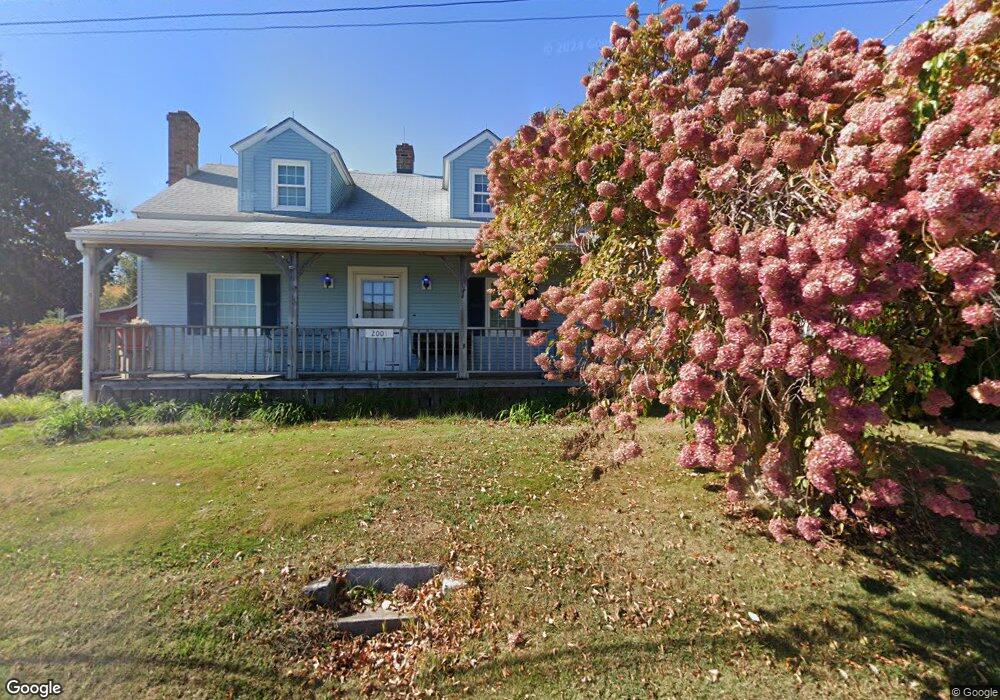
2001 Perkins St Bristol, CT 06010
North Bristol NeighborhoodEstimated Value: $398,278 - $663,000
2
Beds
1
Bath
1,837
Sq Ft
$261/Sq Ft
Est. Value
About This Home
This home is located at 2001 Perkins St, Bristol, CT 06010 and is currently estimated at $479,570, approximately $261 per square foot. 2001 Perkins St is a home located in Hartford County with nearby schools including Edgewood School, Chippens Hill Middle School, and Bristol Central High School.
Ownership History
Date
Name
Owned For
Owner Type
Purchase Details
Closed on
May 16, 2014
Sold by
Ziogas Tr Mark
Bought by
Malsheske Peter and Malsheske Nancy
Current Estimated Value
Home Financials for this Owner
Home Financials are based on the most recent Mortgage that was taken out on this home.
Original Mortgage
$132,000
Interest Rate
3.37%
Create a Home Valuation Report for This Property
The Home Valuation Report is an in-depth analysis detailing your home's value as well as a comparison with similar homes in the area
Home Values in the Area
Average Home Value in this Area
Purchase History
| Date | Buyer | Sale Price | Title Company |
|---|---|---|---|
| Malsheske Peter | -- | -- | |
| Malsheske Peter | -- | -- | |
| Ziogas Mark | -- | -- | |
| Ziogas Mark | -- | -- |
Source: Public Records
Mortgage History
| Date | Status | Borrower | Loan Amount |
|---|---|---|---|
| Open | Ziogas Mark | $125,000 | |
| Previous Owner | Ziogas Mark | $132,000 |
Source: Public Records
Tax History
| Year | Tax Paid | Tax Assessment Tax Assessment Total Assessment is a certain percentage of the fair market value that is determined by local assessors to be the total taxable value of land and additions on the property. | Land | Improvement |
|---|---|---|---|---|
| 2025 | $7,754 | $229,740 | $71,470 | $158,270 |
| 2024 | $7,317 | $229,740 | $71,470 | $158,270 |
| 2023 | $6,877 | $226,590 | $71,470 | $155,120 |
| 2022 | $6,840 | $178,360 | $56,280 | $122,080 |
| 2021 | $6,840 | $178,360 | $56,280 | $122,080 |
| 2020 | $6,840 | $178,360 | $56,280 | $122,080 |
| 2019 | $6,787 | $178,360 | $56,280 | $122,080 |
| 2018 | $6,578 | $178,360 | $56,280 | $122,080 |
| 2017 | $6,648 | $184,520 | $77,000 | $107,520 |
| 2016 | $6,648 | $184,520 | $77,000 | $107,520 |
| 2015 | $6,386 | $184,520 | $77,000 | $107,520 |
| 2014 | $6,340 | $183,190 | $75,670 | $107,520 |
Source: Public Records
Map
Nearby Homes
- 4 Southdown Dr
- 126 Harvard Place
- 68 Hart St
- 38 Eastwood Rd
- 0 Hart St Unit 170255530
- 62 (Lot 13-1) James P Casey Rd
- 35 James P Casey Rd
- 439 James P Casey Rd
- 15 Bittersweet Ln
- 209 Ashley Rd
- 454 Maple Ave
- 354 Maple Ave
- 19 Woodside Way
- 83 Lardner Rd
- 35 Lardner Rd
- 380 Burlington Ave
- 735 Matthews St
- 820 Matthews St Unit 19
- 6 Pine Hill Rd
- 565 Clark Ave Unit 13
- 1987 Perkins St
- 1985 Perkins St
- 2015 Perkins St
- 2010 Perkins St
- 2023 Perkins St
- 2020 Perkins St
- 1977 Perkins St
- 2030 Perkins St
- 2033 Perkins St
- 2044 Perkins St
- 1975 Perkins St
- 230 Chapel St
- 202 Chapel St
- 216 Chapel St
- 184 Chapel St
- 189 Chapel St
- 176 Chapel St
- 223 Chapel St
- 217 Chapel St
- 1960 Perkins St
Your Personal Tour Guide
Ask me questions while you tour the home.