2001 Queensgate Ln Columbus, OH 43235
The Gables NeighborhoodEstimated Value: $172,000 - $245,000
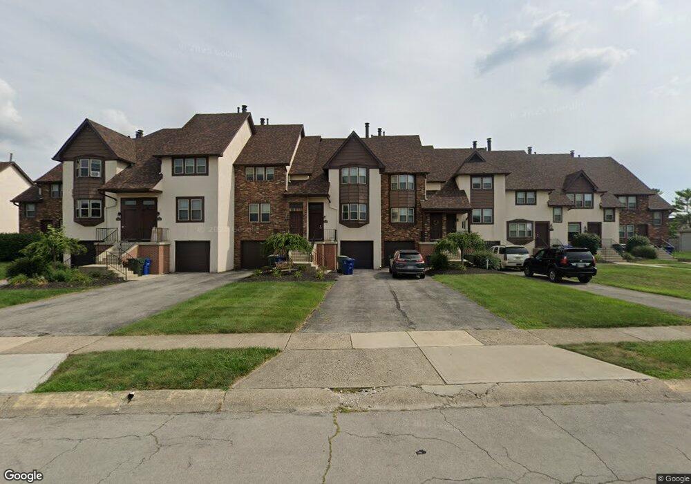
About This Home
***CURRENTLY TAKING A WAITING LIST***
Victoria Place Commons has an incredible location and if you want space, you have to see Victoria Place Commons Apartments. Our 1,900 sq ft townhouses are perfectly charming and beautifully designed. Our stunning townhouses have Hardwood Floors, Wood Burning Fireplaces, Partial Finished Basements, Updated Kitchens, Modern Lighting and tons of storage. Some units have an attached garage while others have a huge basement. This is all nestled into a peaceful subdivision with sidewalks and easy access to everything you could ever want. Victoria Place Commons offers you easy access to State Route 315, State Route 33, Bethal Road, and Sawmill Road. We are 10 minutes from OSU, Tuttle Mall and Antrim Park. We are located within the desirable Dublin School District we've got it all. Call today and I'll show you why our residents love to come home to Victoria Place Commons Apartments.
Ownership History
Purchase Details
Home Financials for this Owner
Home Financials are based on the most recent Mortgage that was taken out on this home.Purchase Details
Home Values in the Area
Average Home Value in this Area
Purchase History
| Date | Buyer | Sale Price | Title Company |
|---|---|---|---|
| Ssf Ii Victoria Place Llc | -- | Clean Title | |
| -- | $1,050,000 | -- |
Mortgage History
| Date | Status | Borrower | Loan Amount |
|---|---|---|---|
| Open | Ssf Ii Victoria Place Llc | $13,394,974 |
Property History
| Date | Event | Price | Change | Sq Ft Price |
|---|---|---|---|---|
| 04/04/2025 04/04/25 | Off Market | $1,505 | -- | -- |
| 08/07/2023 08/07/23 | For Rent | $1,505 | 0.0% | -- |
| 07/13/2023 07/13/23 | For Rent | $1,505 | 0.0% | -- |
| 06/21/2023 06/21/23 | For Rent | $1,505 | 0.0% | -- |
| 02/14/2023 02/14/23 | Price Changed | $1,505 | +17.1% | $1 / Sq Ft |
| 06/07/2022 06/07/22 | For Rent | $1,285 | 0.0% | -- |
| 05/18/2022 05/18/22 | For Rent | $1,285 | -- | -- |
Tax History Compared to Growth
Tax History
| Year | Tax Paid | Tax Assessment Tax Assessment Total Assessment is a certain percentage of the fair market value that is determined by local assessors to be the total taxable value of land and additions on the property. | Land | Improvement |
|---|---|---|---|---|
| 2024 | $1,855 | $30,040 | $4,030 | $26,010 |
| 2023 | $1,829 | $30,040 | $4,030 | $26,010 |
| 2022 | $1,746 | $26,570 | $4,450 | $22,120 |
| 2021 | $1,774 | $26,570 | $4,450 | $22,120 |
| 2020 | $1,764 | $26,570 | $4,450 | $22,120 |
| 2019 | $1,733 | $23,100 | $3,850 | $19,250 |
| 2018 | $1,698 | $23,100 | $3,850 | $19,250 |
| 2017 | $1,626 | $23,100 | $3,850 | $19,250 |
| 2016 | $1,645 | $22,230 | $3,500 | $18,730 |
| 2015 | $1,656 | $22,230 | $3,500 | $18,730 |
| 2014 | $1,657 | $22,230 | $3,500 | $18,730 |
| 2013 | $841 | $22,225 | $3,500 | $18,725 |
Map
- 5470 Baneberry Ave
- 5258 Captains Ct
- 5264 Parkcrest Ln Unit 5264
- 1961 Ramble Branch Dr Unit 30
- 2172 Hedgerow Rd Unit 2172G
- 2236 Victoria Park Dr Unit 2236
- 2245 Hedgerow Rd Unit C
- 2265 Teardrop Ave Unit 39C
- 2260 Lila Way Unit 62D
- 5396 Coral Berry Dr Unit 70E
- 4974 Willoway Ct E Unit 4974
- 5345 Coral Berry Dr Unit 82B
- 1865 Willoway Cir N Unit 1865
- 2480 Maxim Ln Unit 46A
- 1883 Willoway Cir N Unit 1883
- 2522 Gardenia Dr Unit 16C
- 5297 Brandy Oaks Ln Unit 5297
- 5277 Brandy Oaks Ln
- 2527 Maxim Ln Unit 40D
- 2550 Gardenia Dr Unit 13D
- 2001 Queensgate Ln
- 2003 Queensgate Ln
- 2005 Queensgate Ln
- 2007 Queensgate Ln
- 2009 Queensgate Ln
- 2011 Queensgate Ln
- 2013 Queensgate Ln
- 2015 Queensgate Ln
- 2017 Queensgate Ln
- 2019 Queensgate Ln
- 1996 Drury Ln
- 2012 Queensgate Ln
- 2014 Queensgate Ln Unit 2014
- 1994 Drury Ln Unit 1994
- 2018 Queensgate Ln Unit 2018
- 1990 Drury Ln Unit 1990
- 1992 Drury Ln Unit 1992
- 2020 Queensgate Ln Unit 2020
- 1988 Drury Ln
- 2033 Coleman Dr Unit 6A