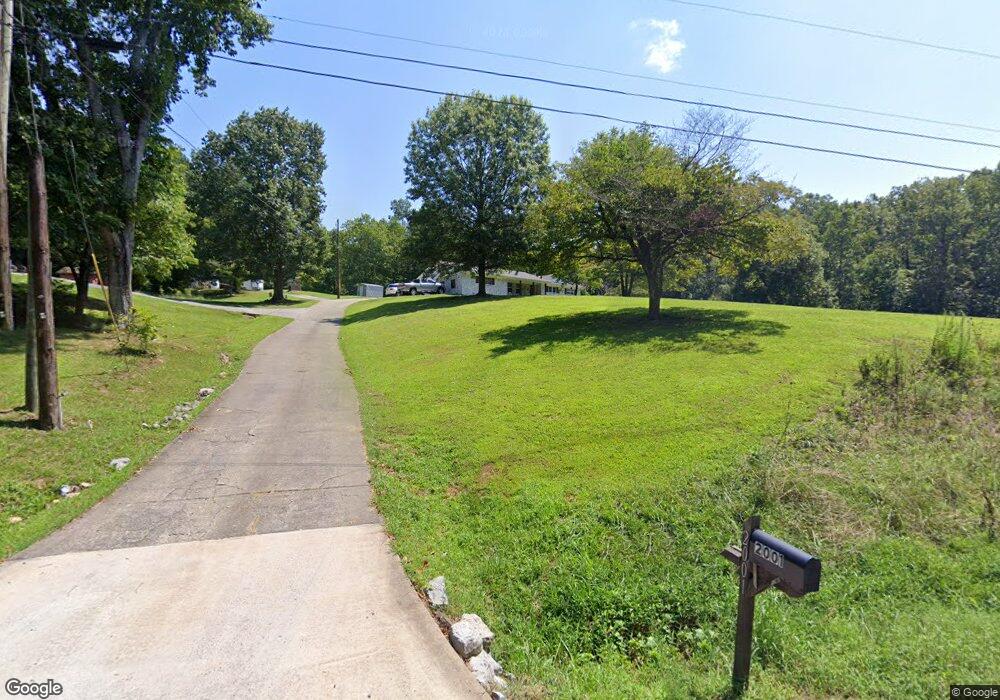
2001 Ridge Rd SE Dalton, GA 30721
Estimated Value: $292,000 - $331,000
3
Beds
2
Baths
2,304
Sq Ft
$134/Sq Ft
Est. Value
About This Home
This home is located at 2001 Ridge Rd SE, Dalton, GA 30721 and is currently estimated at $309,579, approximately $134 per square foot. 2001 Ridge Rd SE is a home located in Whitfield County with nearby schools including Antioch Elementary School, Eastbrook Middle School, and Southeast Whitfield County High School.
Ownership History
Date
Name
Owned For
Owner Type
Purchase Details
Closed on
Aug 26, 2020
Sold by
Chastine Leon Toby
Bought by
Chastine Stephen P
Current Estimated Value
Purchase Details
Closed on
Sep 26, 2006
Sold by
Magana Yolanda
Bought by
Burgess Fam Investments Llc
Purchase Details
Closed on
Jun 1, 2006
Sold by
Not Provided
Bought by
Chastine Maryann and Chastine Leon T
Purchase Details
Closed on
May 31, 2006
Sold by
Burgess Fam Investments
Bought by
Magana Yolanda
Create a Home Valuation Report for This Property
The Home Valuation Report is an in-depth analysis detailing your home's value as well as a comparison with similar homes in the area
Home Values in the Area
Average Home Value in this Area
Purchase History
| Date | Buyer | Sale Price | Title Company |
|---|---|---|---|
| Chastine Stephen P | -- | -- | |
| Burgess Fam Investments Llc | -- | -- | |
| Chastine Maryann | -- | -- | |
| Magana Yolanda | $121,500 | -- |
Source: Public Records
Tax History Compared to Growth
Tax History
| Year | Tax Paid | Tax Assessment Tax Assessment Total Assessment is a certain percentage of the fair market value that is determined by local assessors to be the total taxable value of land and additions on the property. | Land | Improvement |
|---|---|---|---|---|
| 2024 | $2,594 | $125,212 | $32,874 | $92,338 |
| 2023 | $2,594 | $86,511 | $21,039 | $65,472 |
| 2022 | $2,059 | $69,801 | $20,645 | $49,156 |
| 2021 | $2,060 | $69,801 | $20,645 | $49,156 |
| 2020 | $1,990 | $65,238 | $16,082 | $49,156 |
| 2019 | $2,023 | $65,238 | $16,082 | $49,156 |
| 2018 | $570 | $63,087 | $13,931 | $49,156 |
| 2017 | $570 | $63,087 | $13,931 | $49,156 |
| 2016 | $575 | $64,954 | $13,931 | $51,023 |
| 2014 | $515 | $68,329 | $17,306 | $51,023 |
| 2013 | -- | $68,329 | $17,306 | $51,023 |
Source: Public Records
Map
Nearby Homes
- 2200 Ridge Rd SE
- 1142 Ben Hill Rd SE
- 1271 Ridge Rd SE
- 296 Wagner Dr
- 215 Wagner Dr
- 3657 Airport Rd
- 00 Hill Rd
- 1401 Eastbrook Dr SE
- 2180 S Riverbend Rd
- 241 Angus Rd
- 01 Headrick Cir SE
- 00 Headrick Cir SE
- 1401 Eastbrook Rd SE
- 129 Hillwood Dr
- 1712 Wendell St
- 2132 Lawson Dr SE
- Lot 3 Riverbend Rd
- Lot 2 Riverbend Rd
- 945 Riverbend Rd
- 00 Tibbs Bridge Rd
- 2001 Ridge Rd SE Unit LWR
- 2001 Ridge Rd SE Unit LWR
- 1150 Callahan Dr
- 1967 Ridge Rd SE
- 208 Bassett Dr
- 183 Bassett Dr
- 241 Bassett Dr
- 2003 Ridge Rd SE
- 271 Bassett Dr
- 240 Bassett Dr
- 1142 Callahan Dr SE
- 1949 Ridge Rd SE
- 192 Bassett Dr
- 1953 Ridge Rd SE
- 2029 Ridge Rd SE
- 1138 Callahan Dr SE
- 1134 Callahan Dr SE
- 1145 Callahan Dr SE
- 2040 Upper Ridge Rd SE
- 2027 Ridge Rd SE