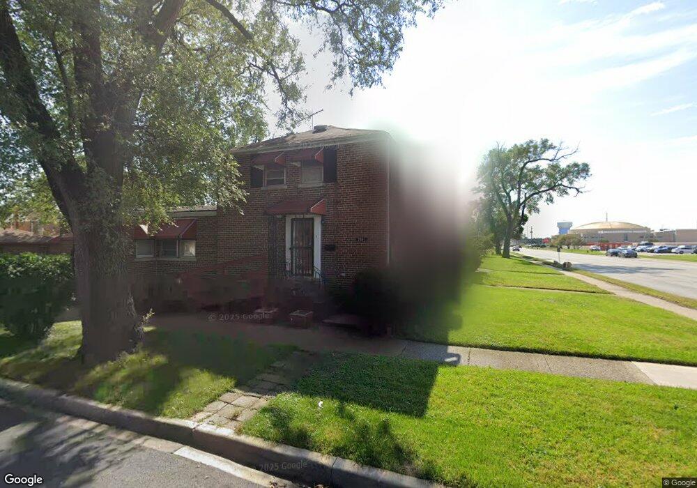
2001 S 25th Ave Broadview, IL 60155
South Maywood NeighborhoodEstimated Value: $171,000 - $212,000
2
Beds
2
Baths
880
Sq Ft
$212/Sq Ft
Est. Value
About This Home
This home is located at 2001 S 25th Ave, Broadview, IL 60155 and is currently estimated at $186,904, approximately $212 per square foot. 2001 S 25th Ave is a home located in Cook County with nearby schools including Thurgood Marshall Elementary School, Roosevelt Middle School, and Proviso West High School.
Create a Home Valuation Report for This Property
The Home Valuation Report is an in-depth analysis detailing your home's value as well as a comparison with similar homes in the area
Home Values in the Area
Average Home Value in this Area
Tax History
| Year | Tax Paid | Tax Assessment Tax Assessment Total Assessment is a certain percentage of the fair market value that is determined by local assessors to be the total taxable value of land and additions on the property. | Land | Improvement |
|---|---|---|---|---|
| 2025 | $4,959 | $15,000 | $1,966 | $13,034 |
| 2024 | $4,959 | $15,000 | $1,966 | $13,034 |
| 2023 | $3,401 | $15,000 | $1,966 | $13,034 |
| 2022 | $3,401 | $8,780 | $1,556 | $7,224 |
| 2021 | $3,265 | $8,780 | $1,556 | $7,224 |
| 2020 | $3,162 | $8,780 | $1,556 | $7,224 |
| 2019 | $3,905 | $9,972 | $1,392 | $8,580 |
| 2018 | $3,771 | $9,972 | $1,392 | $8,580 |
| 2017 | $3,660 | $9,972 | $1,392 | $8,580 |
| 2016 | $1,719 | $8,768 | $1,228 | $7,540 |
| 2015 | $3,276 | $8,768 | $1,228 | $7,540 |
| 2014 | $1,604 | $8,768 | $1,228 | $7,540 |
| 2013 | $3,281 | $9,712 | $1,228 | $8,484 |
Source: Public Records
Map
Nearby Homes
- 2007 S 25th Ave
- 1908 S 23rd Ave
- 1910 S 22nd Ave
- 1925 S 22nd Ave
- 1909 S 22nd Ave
- 1839 S 22nd Ave
- 2116 S 21st Ave
- 1909 S 20th Ave
- 1107 24th Ave
- 1908 S 18th Ave
- 2247 S 21st Ave
- 2325 S 25th Ave
- 1615 S 20th Ave
- 1924 S 17th Ave
- 1815 Harrison St
- 2341 S 24th Ave
- 814 Norfolk Ave
- 1427 S 21st Ave
- 1420 S 21st Ave
- 1124 31st Ave
- 2003 S 25th Ave
- 2005 S 25th Ave
- 2009 S 25th Ave
- 1941 S 25th Ave
- 1935 S 25th Ave
- 2000 S 24th Ave
- 2013 S 25th Ave
- 2002 S 24th Ave
- 2004 S 24th Ave
- 1940 S 24th Ave
- 2015 S 25th Ave
- 2006 S 24th Ave
- 1933 S 25th Ave
- 1936 S 24th Ave
- 2008 S 24th Ave
- 2019 S 25th Ave
- 2021 S 25th Ave
- 2010 S 24th Ave
- 1932 S 24th Ave
- 1931 S 25th Ave
Your Personal Tour Guide
Ask me questions while you tour the home.