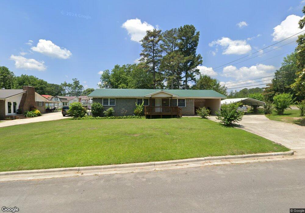
2001 Sandy Ave SW Cullman, AL 35055
Estimated Value: $235,000 - $293,000
4
Beds
2
Baths
1,642
Sq Ft
$159/Sq Ft
Est. Value
About This Home
This home is located at 2001 Sandy Ave SW, Cullman, AL 35055 and is currently estimated at $260,780, approximately $158 per square foot. 2001 Sandy Ave SW is a home located in Cullman County with nearby schools including Cullman Christian School, St. Paul's Lutheran School, and Sacred Heart Elementary School.
Ownership History
Date
Name
Owned For
Owner Type
Purchase Details
Closed on
Mar 15, 2024
Sold by
Hardin Edna
Bought by
Dodd Bobby and Dodd Pamela
Current Estimated Value
Home Financials for this Owner
Home Financials are based on the most recent Mortgage that was taken out on this home.
Original Mortgage
$195,605
Outstanding Balance
$192,168
Interest Rate
6.64%
Mortgage Type
New Conventional
Estimated Equity
$68,612
Purchase Details
Closed on
Mar 8, 2024
Sold by
Hardin Edna
Bought by
Dodd Bobby and Dodd Pamela
Home Financials for this Owner
Home Financials are based on the most recent Mortgage that was taken out on this home.
Original Mortgage
$195,605
Outstanding Balance
$192,168
Interest Rate
6.64%
Mortgage Type
New Conventional
Estimated Equity
$68,612
Create a Home Valuation Report for This Property
The Home Valuation Report is an in-depth analysis detailing your home's value as well as a comparison with similar homes in the area
Home Values in the Area
Average Home Value in this Area
Purchase History
| Date | Buyer | Sale Price | Title Company |
|---|---|---|---|
| Dodd Bobby | $180,000 | Tbx Title | |
| Dodd Bobby | $180,000 | Tbx Title |
Source: Public Records
Mortgage History
| Date | Status | Borrower | Loan Amount |
|---|---|---|---|
| Open | Dodd Bobby | $195,605 | |
| Closed | Dodd Bobby | $195,605 |
Source: Public Records
Tax History
| Year | Tax Paid | Tax Assessment Tax Assessment Total Assessment is a certain percentage of the fair market value that is determined by local assessors to be the total taxable value of land and additions on the property. | Land | Improvement |
|---|---|---|---|---|
| 2025 | $1,550 | $40,260 | $0 | $0 |
| 2024 | $727 | $18,880 | $0 | $0 |
| 2023 | $727 | $18,040 | $0 | $0 |
| 2022 | $592 | $15,380 | $0 | $0 |
| 2021 | $533 | $13,840 | $0 | $0 |
| 2020 | $506 | $13,140 | $0 | $0 |
| 2019 | $503 | $13,060 | $0 | $0 |
| 2018 | $482 | $12,520 | $0 | $0 |
| 2017 | $452 | $11,740 | $0 | $0 |
| 2016 | $452 | $11,740 | $0 | $0 |
| 2014 | -- | $11,820 | $0 | $0 |
Source: Public Records
Map
Nearby Homes
- 1807 Cherokee Ave SW
- 1925 Main Ave SW
- 1807 Cherokee
- 1109 Swafford Rd SW
- 2106 Dialsdale Dr SW
- 0 Miller St SW
- 1113 James St SW
- 911 Olive St SW
- 2113 Dialsdale Ave SW
- 2110 Wren Ave SW
- 2113 Wren Ave SW
- 2116 Wren Ave SW
- 1203 Morningside Dr SW
- 196 County Road 497
- 2122 Addison Way SW
- 2124 Addison Way SW
- 2126 Addison Way
- 2128 Addison Way
- 2130 Addison Way
- 2132 Addison Way
- 2003 Sandy Ave SW
- 2002 Sandy Ave SW
- 2004 Sandy Ave SW
- 2002 Mack Ave SW
- 2007 Sandy Ave SW
- 2004 Mack Ave SW
- 2008 Sandy Ave SW
- 2008 Mack Ave SW
- 2003 Larry Ave SW
- 2011 Sandy Ave SW
- 2012 Sandy Ave SW
- 2007 Larry Ave SW
- 2003 Mack Ave SW
- 2015 Sandy Ave SW
- 2012 Mack Ave SW
- 2011 Larry Ave SW
- 2016 Sandy Ave SW
- 2009 Mack Ave SW
- 2015 Larry Ave SW
- 2019 Sandy Ave SW
Your Personal Tour Guide
Ask me questions while you tour the home.