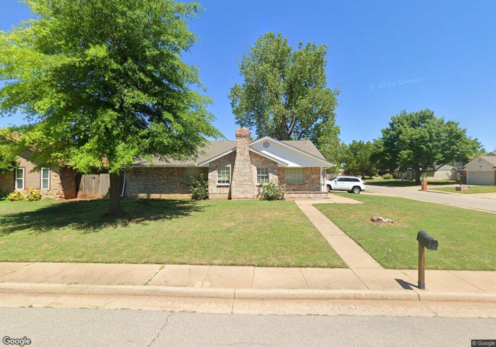
2001 Shamrock Dr Edmond, OK 73003
Oak Brook NeighborhoodEstimated Value: $223,656 - $237,000
3
Beds
2
Baths
1,472
Sq Ft
$154/Sq Ft
Est. Value
About This Home
This home is located at 2001 Shamrock Dr, Edmond, OK 73003 and is currently estimated at $227,164, approximately $154 per square foot. 2001 Shamrock Dr is a home located in Oklahoma County with nearby schools including Ida Freeman Elementary School, Cheyenne Middle School, and North High School.
Ownership History
Date
Name
Owned For
Owner Type
Purchase Details
Closed on
Aug 20, 2024
Sold by
Salami Ali and Salami Lynne E
Bought by
Ali And Lynne Salami Revocable Trust and Salami
Current Estimated Value
Purchase Details
Closed on
Oct 15, 2009
Sold by
Therrien Jr Conrad Real and Therrien Barbara A
Bought by
Salami Amir and Salami Ali
Home Financials for this Owner
Home Financials are based on the most recent Mortgage that was taken out on this home.
Original Mortgage
$119,700
Interest Rate
5.14%
Mortgage Type
New Conventional
Create a Home Valuation Report for This Property
The Home Valuation Report is an in-depth analysis detailing your home's value as well as a comparison with similar homes in the area
Home Values in the Area
Average Home Value in this Area
Purchase History
| Date | Buyer | Sale Price | Title Company |
|---|---|---|---|
| Ali And Lynne Salami Revocable Trust | -- | None Listed On Document | |
| Salami Amir | $126,000 | The Oklahoma City Abstract & |
Source: Public Records
Mortgage History
| Date | Status | Borrower | Loan Amount |
|---|---|---|---|
| Previous Owner | Salami Amir | $119,700 |
Source: Public Records
Tax History Compared to Growth
Tax History
| Year | Tax Paid | Tax Assessment Tax Assessment Total Assessment is a certain percentage of the fair market value that is determined by local assessors to be the total taxable value of land and additions on the property. | Land | Improvement |
|---|---|---|---|---|
| 2024 | $1,852 | $18,651 | $2,792 | $15,859 |
| 2023 | $1,852 | $17,762 | $2,817 | $14,945 |
| 2022 | $1,770 | $16,917 | $3,011 | $13,906 |
| 2021 | $1,678 | $16,112 | $3,288 | $12,824 |
| 2020 | $1,512 | $15,345 | $3,367 | $11,978 |
| 2019 | $1,508 | $15,235 | $3,367 | $11,868 |
| 2018 | $1,505 | $15,125 | $0 | $0 |
| 2017 | $1,475 | $14,904 | $3,367 | $11,537 |
| 2016 | $1,460 | $14,794 | $3,269 | $11,525 |
| 2015 | $1,429 | $14,520 | $3,229 | $11,291 |
| 2014 | $1,383 | $14,098 | $3,264 | $10,834 |
Source: Public Records
Map
Nearby Homes
- 1824 Woody Ln
- 301 Bluegrass Ln
- 1725 Shady Ct
- 613 Blue Ridge Dr
- 1821 Zion Place
- 84 Kimberly Dr
- 2112 W Rockypoint Dr
- 2016 Emerald Brook Ct
- 781 N Santa fe Ave
- 900 Blue Ridge Dr
- 2517 Antelope Cir
- 1717 Rocky Mountain Way
- 109 Woodbridge Cir
- 1716 Glacier Ln
- 1001 Glacier Ln
- 344 Abilene Ave
- 2604 Jeannes Trail
- 1308 Isabella Dr
- 1717 Park View Place
- 232 Dooley Creek Ln
- 2005 Shamrock Dr
- 405 N Lockeport Dr
- 416 N Lockeport Dr
- 2004 Castle Rock
- 2009 Shamrock Dr
- 400 N Lockeport Dr
- 404 N Lockeport Dr
- 312 N Lockeport Dr
- 2008 Castle Rock
- 308 N Grand Fork Dr
- 408 N Lockeport Dr
- 308 N Lockeport Dr
- 305 N Lockeport Dr
- 2013 Shamrock Dr
- 2012 Castle Rock
- 304 N Grand Fork Dr
- 304 N Lockeport Dr
- 1925 Castle Rock
- 401 Kimberly Dr
- 1921 Castle Rock