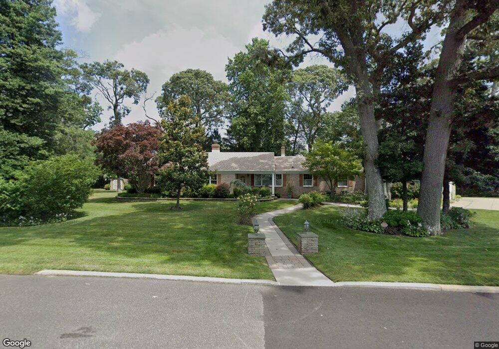
2001 Shepherd Dr Northfield, NJ 08225
Estimated Value: $585,000 - $624,000
Studio
--
Bath
2,554
Sq Ft
$234/Sq Ft
Est. Value
About This Home
This home is located at 2001 Shepherd Dr, Northfield, NJ 08225 and is currently estimated at $597,366, approximately $233 per square foot. 2001 Shepherd Dr is a home located in Atlantic County with nearby schools including Northfield Community Elementary School, Northfield Community Middle School, and Mainland Regional High School.
Ownership History
Date
Name
Owned For
Owner Type
Purchase Details
Closed on
Apr 30, 1999
Sold by
Bregar Kurt J and Bregar Karen
Bought by
Mazzeo Vincent Mario and Mazzeo Gerri Lynn
Current Estimated Value
Home Financials for this Owner
Home Financials are based on the most recent Mortgage that was taken out on this home.
Original Mortgage
$132,000
Outstanding Balance
$30,933
Interest Rate
6.88%
Estimated Equity
$566,433
Create a Home Valuation Report for This Property
The Home Valuation Report is an in-depth analysis detailing your home's value as well as a comparison with similar homes in the area
Home Values in the Area
Average Home Value in this Area
Purchase History
| Date | Buyer | Sale Price | Title Company |
|---|---|---|---|
| Mazzeo Vincent Mario | $165,000 | The Title Company |
Source: Public Records
Mortgage History
| Date | Status | Borrower | Loan Amount |
|---|---|---|---|
| Open | Mazzeo Vincent Mario | $132,000 |
Source: Public Records
Tax History Compared to Growth
Tax History
| Year | Tax Paid | Tax Assessment Tax Assessment Total Assessment is a certain percentage of the fair market value that is determined by local assessors to be the total taxable value of land and additions on the property. | Land | Improvement |
|---|---|---|---|---|
| 2025 | $10,952 | $304,900 | $100,500 | $204,400 |
| 2024 | $10,952 | $304,900 | $100,500 | $204,400 |
Source: Public Records
Map
Nearby Homes
- 1907 Merritt Dr
- 1801 Tilton Rd
- 2320 Shepherd Dr
- 19 Locust Dr
- 309 Clark Place
- 1805 Zion Rd
- 1611 Shore Rd
- 600 Hollywood Dr
- 2419 Cedarbridge Rd
- 403 Park Ln
- 219 Northfield Ave
- 221 Northfield Ave
- 102 E Glencove Ave
- 2514 Helen Dr W
- 41 E Vernon Ave
- 110 E Oakcrest Ave
- 133 E Vernon Ave
- 112 E Vernon Ave
- 1202 Shore Rd
- 110 Northwood Ct
- 2005 Shepherd Dr
- 2024 Cedarbridge Rd
- 2020 Cedarbridge Rd
- 2007 Shepherd Dr
- 2028 Cedarbridge Rd
- 2025 Cedarbridge Rd
- 2023 Cedarbridge Rd
- 2009 Shepherd Dr
- 2125 Merritt Dr
- 2027 Cedarbridge Rd
- 2008 Wabash Ave
- 2021 Cedarbridge Rd
- 2030 Cedarbridge Rd
- 2302 Shepherd Dr
- 2037 Shepherd Dr
- 2029 Cedarbridge Rd
- 2004 Wabash Ave
- 8 Forrest Dr
- 2130 Merritt Dr
- 6 Forrest Dr