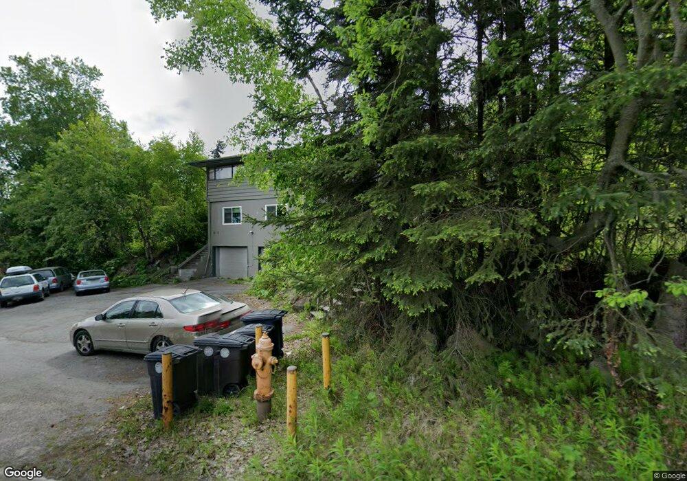
2001 Spenard Rd Unit 1 Anchorage, AK 99503
North Star NeighborhoodEstimated Value: $335,000 - $569,000
3
Beds
2
Baths
1,550
Sq Ft
$292/Sq Ft
Est. Value
About This Home
This home is located at 2001 Spenard Rd Unit 1, Anchorage, AK 99503 and is currently estimated at $452,000, approximately $291 per square foot. 2001 Spenard Rd Unit 1 is a home located in Anchorage Municipality with nearby schools including North Star Elementary School, Romig Middle School, and West High School.
Ownership History
Date
Name
Owned For
Owner Type
Purchase Details
Closed on
Nov 26, 2002
Sold by
Reeder Anita A and Mccoy George W
Bought by
Fink Matthew L
Current Estimated Value
Home Financials for this Owner
Home Financials are based on the most recent Mortgage that was taken out on this home.
Original Mortgage
$260,000
Outstanding Balance
$106,629
Interest Rate
6.12%
Mortgage Type
Purchase Money Mortgage
Estimated Equity
$345,371
Purchase Details
Closed on
Jul 14, 1995
Sold by
Smith Mary Mills and Smith Richard B
Bought by
Mccoy George W and Reeder Anita A
Home Financials for this Owner
Home Financials are based on the most recent Mortgage that was taken out on this home.
Original Mortgage
$243,917
Interest Rate
7.74%
Mortgage Type
FHA
Create a Home Valuation Report for This Property
The Home Valuation Report is an in-depth analysis detailing your home's value as well as a comparison with similar homes in the area
Home Values in the Area
Average Home Value in this Area
Purchase History
| Date | Buyer | Sale Price | Title Company |
|---|---|---|---|
| Fink Matthew L | -- | First American Title | |
| Mccoy George W | -- | -- |
Source: Public Records
Mortgage History
| Date | Status | Borrower | Loan Amount |
|---|---|---|---|
| Open | Fink Matthew L | $260,000 | |
| Previous Owner | Mccoy George W | $243,917 |
Source: Public Records
Tax History
| Year | Tax Paid | Tax Assessment Tax Assessment Total Assessment is a certain percentage of the fair market value that is determined by local assessors to be the total taxable value of land and additions on the property. | Land | Improvement |
|---|---|---|---|---|
| 2025 | $7,693 | $506,900 | $137,100 | $369,800 |
| 2024 | $7,693 | $476,500 | $137,100 | $339,400 |
| 2023 | $7,534 | $442,400 | $137,100 | $305,300 |
| 2022 | $7,458 | $442,900 | $137,100 | $305,800 |
| 2021 | $7,033 | $390,300 | $176,300 | $214,000 |
| 2020 | $6,630 | $390,000 | $176,300 | $213,700 |
| 2019 | $6,364 | $389,000 | $182,800 | $206,200 |
| 2018 | $8,338 | $508,400 | $177,000 | $331,400 |
| 2017 | $7,999 | $510,800 | $158,000 | $352,800 |
| 2016 | $6,592 | $527,600 | $160,600 | $367,000 |
| 2015 | $6,592 | $494,800 | $160,600 | $334,200 |
| 2014 | $6,592 | $480,000 | $160,600 | $319,400 |
Source: Public Records
Map
Nearby Homes
- 1945 Spenard Rd
- 2201 Romig Place Unit 105
- 1024 Potlatch Cir Unit 23
- 1113 W Fireweed Ln Unit 505
- 1113 W Fireweed Ln Unit 204
- 1113 W Fireweed Ln Unit 503
- 1327 W 25th Ave Unit 218
- 1435 W 25th Ave
- 1001 W Fireweed Ln
- 827 W 20th Ave
- 800 W 21st Ave
- 816 W 23rd Ave Unit 6
- 1936 Wildwood Ln
- 930 W 27th Ave
- 1434 I St
- 2201 Belmont Dr
- 2607 Arctic Blvd
- 2140 Dawson St
- 913 W 14th Ave
- 511 W 17th Ave
- 2001 Spenard Rd
- 1257 Hillcrest Dr
- 2008 Hillcrest Cir
- 1301 Hillcrest Dr
- 2000 Solstice Cir
- 1241 Hillcrest Dr
- 1241 Hillcrest Dr
- 1927 Spenard Rd
- 1927 Spenard Rd Unit 4
- 1231 Hillcrest Dr
- 1231 Hillcrest Dr
- 1925 Spenard Rd
- 1925 Spenard Rd
- 1925 Spenard Rd Unit 3
- 1309 Hillcrest Dr
- 1300 Hillcrest Dr
- 1923 Spenard Rd
- 1921 Spenard Rd
- 1242 Hillcrest Dr
- 2001 Solstice Cir
Your Personal Tour Guide
Ask me questions while you tour the home.