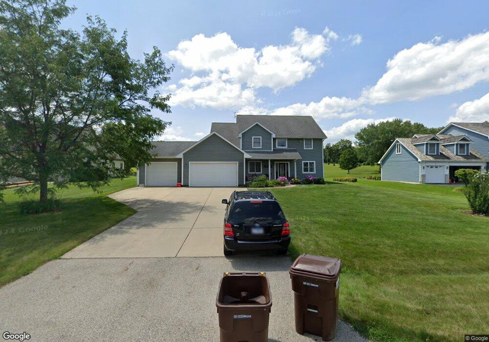
2001 Stone Dr McHenry, IL 60051
Estimated Value: $502,000 - $689,000
4
Beds
4
Baths
2,575
Sq Ft
$224/Sq Ft
Est. Value
About This Home
This home is located at 2001 Stone Dr, McHenry, IL 60051 and is currently estimated at $575,787, approximately $223 per square foot. 2001 Stone Dr is a home located in McHenry County with nearby schools including Chauncey H Duker School, Hilltop Elementary School, and Mchenry Middle School.
Ownership History
Date
Name
Owned For
Owner Type
Purchase Details
Closed on
Sep 16, 2024
Sold by
Wygrzyn James and Wygrzyn Dandra
Bought by
James Wygrzyn And Dandra Wygrzyn Joint Tenanc and Wygrzyn
Current Estimated Value
Purchase Details
Closed on
Mar 24, 2006
Sold by
Nelson Dandra and Wygrzyn James
Bought by
Wygrzyn Dandra and Wygrzyn James
Purchase Details
Closed on
Dec 14, 2004
Sold by
Concrete Forming Systems
Bought by
Nelson D Andra and Wygrzyn James
Purchase Details
Closed on
Sep 18, 2001
Sold by
Dream Development Corp
Bought by
Concrete Forming Systems Inc
Create a Home Valuation Report for This Property
The Home Valuation Report is an in-depth analysis detailing your home's value as well as a comparison with similar homes in the area
Home Values in the Area
Average Home Value in this Area
Purchase History
| Date | Buyer | Sale Price | Title Company |
|---|---|---|---|
| James Wygrzyn And Dandra Wygrzyn Joint Tenanc | -- | None Listed On Document | |
| Wygrzyn Dandra | -- | None Available | |
| Nelson D Andra | $138,001 | -- | |
| Concrete Forming Systems Inc | $65,000 | -- |
Source: Public Records
Tax History
| Year | Tax Paid | Tax Assessment Tax Assessment Total Assessment is a certain percentage of the fair market value that is determined by local assessors to be the total taxable value of land and additions on the property. | Land | Improvement |
|---|---|---|---|---|
| 2024 | $11,000 | $145,906 | $35,456 | $110,450 |
| 2023 | $10,702 | $130,845 | $31,796 | $99,049 |
| 2022 | $10,171 | $119,657 | $29,077 | $90,580 |
| 2021 | $9,762 | $112,185 | $27,261 | $84,924 |
| 2020 | $10,591 | $118,431 | $26,444 | $91,987 |
| 2019 | $10,327 | $112,599 | $25,142 | $87,457 |
| 2018 | $10,764 | $105,766 | $23,616 | $82,150 |
| 2017 | $10,590 | $101,328 | $22,625 | $78,703 |
| 2016 | $10,438 | $96,678 | $21,587 | $75,091 |
| 2013 | -- | $92,008 | $20,544 | $71,464 |
Source: Public Records
Map
Nearby Homes
- 2113 Highwood Rd
- 2165 Walnut Glen Blvd
- 2110 Silver Leaf Dr
- 2510 S Birchwood Ave
- 411 S Lily Lake Rd
- Lot 8 & 9 S Lily Lake Rd
- 720 Tulip Cir
- 244 Red Oak Ct
- Lot 20 Holiday Dr
- Lot 5 Tower Dr
- 588 Nantucket Way Unit 2
- 30280 N Darrell Rd
- 707 Nantucket Way
- 3203 S Bergman Dr
- 727 Nantucket Way Unit 1
- 610 W Wegner Rd
- lot 23 Park Dr
- 000 Carman Ave S
- 3323 Charles Ct
- 3003 Keene Ave
- 2005 Stone Dr
- 1917 Stone Dr
- 2009 Stone Dr
- 1913 Stone Dr
- 1920 Stone Dr
- 1918 Stone Dr
- 2004 Stone Dr
- 2013 Stone Dr
- 2010 Stone Dr
- 1909 Stone Dr
- 2014 Stone Dr
- 1908 Stone Dr
- 2018 Stone Dr
- 2020 Stone Dr
- 1907 Highwood Rd
- 1913 Highwood Rd
- 1819 Highwood Rd
- 2117 Highwood Rd Unit 2
- 2110 Highwood Rd
- 2007 Highwood Rd
Your Personal Tour Guide
Ask me questions while you tour the home.