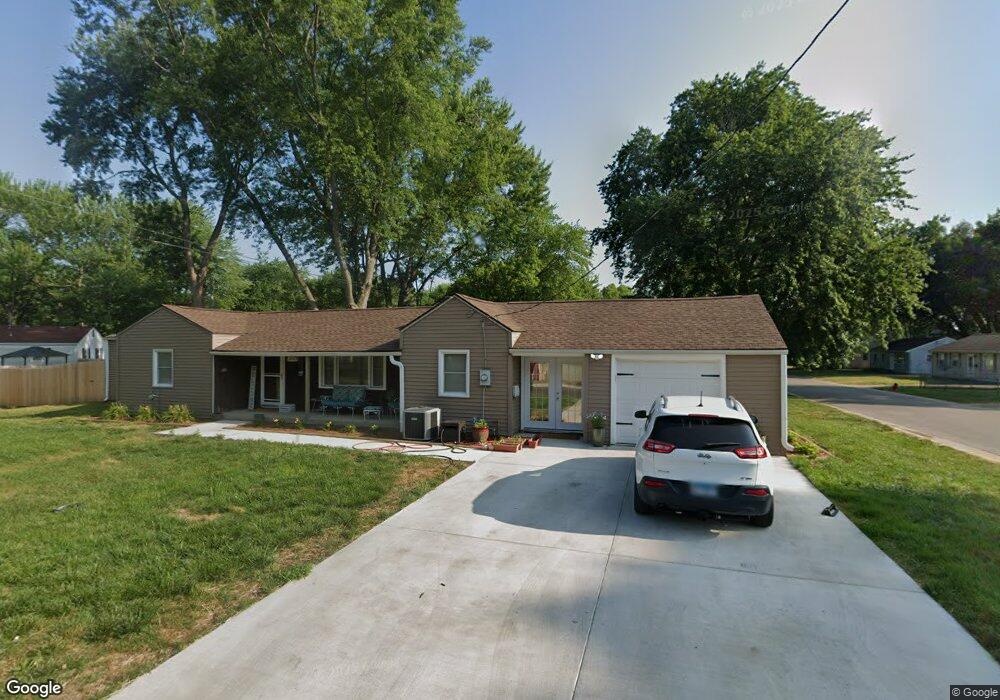
2001 W Calhoun Ave Springfield, IL 62702
Estimated Value: $87,000 - $165,000
Studio
--
Bath
--
Sq Ft
12,197
Sq Ft
About This Home
This home is located at 2001 W Calhoun Ave, Springfield, IL 62702 and is currently estimated at $121,608. 2001 W Calhoun Ave is a home located in Sangamon County with nearby schools including Jane Addams Elementary School, U.S. Grant Middle School, and Lanphier High School.
Ownership History
Date
Name
Owned For
Owner Type
Purchase Details
Closed on
Dec 20, 2021
Sold by
Newton Timothy S
Bought by
Murphy Dalton
Current Estimated Value
Home Financials for this Owner
Home Financials are based on the most recent Mortgage that was taken out on this home.
Original Mortgage
$70,000
Outstanding Balance
$64,269
Interest Rate
2.98%
Mortgage Type
New Conventional
Estimated Equity
$57,339
Create a Home Valuation Report for This Property
The Home Valuation Report is an in-depth analysis detailing your home's value as well as a comparison with similar homes in the area
Purchase History
| Date | Buyer | Sale Price | Title Company |
|---|---|---|---|
| Murphy Dalton | $35,000 | Barber Segatto Hoffee Wilke & |
Source: Public Records
Mortgage History
| Date | Status | Borrower | Loan Amount |
|---|---|---|---|
| Open | Murphy Dalton | $70,000 |
Source: Public Records
Tax History
| Year | Tax Paid | Tax Assessment Tax Assessment Total Assessment is a certain percentage of the fair market value that is determined by local assessors to be the total taxable value of land and additions on the property. | Land | Improvement |
|---|---|---|---|---|
| 2024 | $1,843 | $27,939 | $5,477 | $22,462 |
| 2023 | $1,726 | $25,520 | $5,003 | $20,517 |
| 2022 | $2,169 | $24,208 | $4,746 | $19,462 |
| 2021 | $1,557 | $23,301 | $4,568 | $18,733 |
| 2020 | $1,527 | $23,336 | $4,575 | $18,761 |
| 2019 | $1,497 | $23,255 | $4,559 | $18,696 |
| 2018 | $1,448 | $23,142 | $4,537 | $18,605 |
| 2017 | $1,412 | $22,842 | $4,478 | $18,364 |
| 2016 | $1,377 | $22,509 | $4,413 | $18,096 |
| 2015 | $1,357 | $22,240 | $4,360 | $17,880 |
| 2014 | $1,351 | $22,097 | $4,332 | $17,765 |
| 2013 | $1,321 | $22,308 | $4,333 | $17,975 |
Source: Public Records
Map
Nearby Homes
- 66 Dawn Dr
- 2011 W Jefferson St
- 1016 Johnson Ln
- 24 Wenzel Ln
- 2102 W Jefferson St
- 9 Bryant Ln
- 1319 Crestview Dr
- 904 Diane Ct
- 1921 Jeanette Ln Unit 2
- 1910 Jeanette Ln Unit 2
- 116 Shennadoh Dr
- 2553 Chapel Hill Dr
- 2612 Cedar Pond Dr
- 259 N Columbia Ave
- 1102 W North Grand Ave
- 2081 W Monroe St Unit 1 or A
- 107 Collier Dr
- 29 N Oxford Rd
- 1515 N Lincoln Ave Unit 63
- 1515 N Lincoln Ave Unit 14
- 907 Johnson Ln
- 1925 Bruns Lane Ct Unit 1
- 1917 Bruns Lane Ct
- 1905 W Calhoun Ave
- 2013 Bruns Lane Ct Unit 1
- 911 Johnson Ln
- 1913 Bruns Lane Ct Unit 1
- 20 Dawn Dr
- 26 Dawn Dr
- 908 Johnson Ln
- 1903 W Calhoun Ave
- 1909 Bruns Lane Ct Unit 1
- 14 Dawn Dr
- 915 Johnson Ln
- 912 Johnson Ln
- 32 Dawn Dr
- 2004 Bruns Lane Ct Unit 1
- 1924 Bruns Lane Ct Unit 1
- 2017 Bruns Lane Ct
- 1912 Bruns Lane Ct Unit 1
Your Personal Tour Guide
Ask me questions while you tour the home.