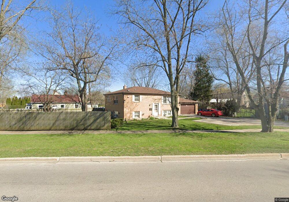
2001 W Dugdale Rd Waukegan, IL 60085
Norshore Park NeighborhoodEstimated Value: $251,000 - $299,000
4
Beds
3
Baths
1,120
Sq Ft
$246/Sq Ft
Est. Value
About This Home
This home is located at 2001 W Dugdale Rd, Waukegan, IL 60085 and is currently estimated at $275,135, approximately $245 per square foot. 2001 W Dugdale Rd is a home located in Lake County with nearby schools including Clearview Elementary School, John R Lewis Middle School, and Waukegan High School.
Ownership History
Date
Name
Owned For
Owner Type
Purchase Details
Closed on
Aug 16, 2012
Sold by
Avakian Isabel A and Avakian Leon S
Bought by
The Chicago Trust Company Na
Current Estimated Value
Purchase Details
Closed on
Mar 25, 2004
Sold by
Sanchez Roberto
Bought by
Avakian Leon S and Avakian Isabel A
Create a Home Valuation Report for This Property
The Home Valuation Report is an in-depth analysis detailing your home's value as well as a comparison with similar homes in the area
Home Values in the Area
Average Home Value in this Area
Purchase History
| Date | Buyer | Sale Price | Title Company |
|---|---|---|---|
| The Chicago Trust Company Na | -- | None Available | |
| Avakian Leon S | $170,000 | Attorneys Title Guaranty Fun | |
| Sanchez Roberto | -- | Attorneys Title Guaranty Fun |
Source: Public Records
Tax History Compared to Growth
Tax History
| Year | Tax Paid | Tax Assessment Tax Assessment Total Assessment is a certain percentage of the fair market value that is determined by local assessors to be the total taxable value of land and additions on the property. | Land | Improvement |
|---|---|---|---|---|
| 2024 | $6,634 | $78,628 | $12,339 | $66,289 |
| 2023 | $6,878 | $70,351 | $10,567 | $59,784 |
| 2022 | $6,878 | $70,357 | $10,575 | $59,782 |
| 2021 | $6,310 | $60,521 | $9,083 | $51,438 |
| 2020 | $6,391 | $56,383 | $8,462 | $47,921 |
| 2019 | $6,432 | $51,666 | $7,754 | $43,912 |
| 2018 | $5,826 | $45,064 | $9,977 | $35,087 |
| 2017 | $5,714 | $39,869 | $8,827 | $31,042 |
| 2016 | $5,354 | $34,644 | $7,670 | $26,974 |
| 2015 | $5,238 | $31,007 | $6,865 | $24,142 |
| 2014 | $4,810 | $28,435 | $5,757 | $22,678 |
| 2012 | $5,962 | $30,804 | $6,236 | $24,568 |
Source: Public Records
Map
Nearby Homes
- 819 S Fulton Ave
- 1712 11th St
- 12601 W Atlantic Ave
- 2116 & 2101 Williamsburg Dr
- 1511 14th St
- 910 Cummings Ave
- 2726 W Hidden Glen Dr
- 1244 Victoria Ave
- 1521 Seymour Ave
- 724 10th St
- 815 Prescott St
- 446 S Jackson St
- 1210 Park Ave
- 3027 Belvidere Rd
- 1617 Grove Ave
- 631 8th St
- 1101 Adams St
- 1423 Victoria Ave
- 842 Wadsworth Ave
- 720 13th St
- 2001 9th Pkwy
- 2012 Marshall Pkwy
- 2008 Marshall Pkwy
- 2016 Marshall Pkwy
- 1929 9th Pkwy
- 2004 Marshall Pkwy
- 2019 W Dugdale Rd
- 1928 Marshall Pkwy
- 1925 9th Pkwy
- 1924 Marshall Pkwy
- 1921 9th Pkwy
- 2002 9th Pkwy
- 1920 Marshall Pkwy
- 2103 9th Pkwy
- 1928 9th Pkwy
- 1917 9th Pkwy
- 2020 9th Pkwy
- 1916 Marshall Pkwy
- 1924 9th Pkwy
- 2000 W Dugdale Rd