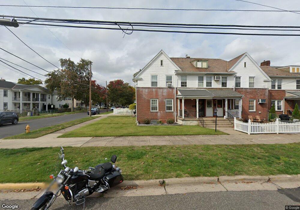
2001 Wilson Ave Bristol, PA 19007
Estimated Value: $309,000 - $352,000
3
Beds
2
Baths
1,692
Sq Ft
$192/Sq Ft
Est. Value
About This Home
This home is located at 2001 Wilson Ave, Bristol, PA 19007 and is currently estimated at $324,528, approximately $191 per square foot. 2001 Wilson Ave is a home located in Bucks County with nearby schools including Snyder-Girotti Elementary School, Bristol High School, and First Presbyterian Church School.
Ownership History
Date
Name
Owned For
Owner Type
Purchase Details
Closed on
Jan 14, 2010
Sold by
Molina Tammy and Werner Tammy L
Bought by
Patti Jon Christopher
Current Estimated Value
Home Financials for this Owner
Home Financials are based on the most recent Mortgage that was taken out on this home.
Original Mortgage
$147,283
Outstanding Balance
$95,515
Interest Rate
4.71%
Mortgage Type
FHA
Estimated Equity
$229,013
Purchase Details
Closed on
Sep 17, 1992
Bought by
Molina Tammy
Create a Home Valuation Report for This Property
The Home Valuation Report is an in-depth analysis detailing your home's value as well as a comparison with similar homes in the area
Home Values in the Area
Average Home Value in this Area
Purchase History
| Date | Buyer | Sale Price | Title Company |
|---|---|---|---|
| Patti Jon Christopher | $150,000 | None Available | |
| Molina Tammy | -- | -- |
Source: Public Records
Mortgage History
| Date | Status | Borrower | Loan Amount |
|---|---|---|---|
| Open | Patti Jon Christopher | $147,283 |
Source: Public Records
Tax History
| Year | Tax Paid | Tax Assessment Tax Assessment Total Assessment is a certain percentage of the fair market value that is determined by local assessors to be the total taxable value of land and additions on the property. | Land | Improvement |
|---|---|---|---|---|
| 2025 | $4,657 | $20,000 | $6,160 | $13,840 |
| 2024 | $4,657 | $20,000 | $6,160 | $13,840 |
| 2023 | $4,617 | $20,000 | $6,160 | $13,840 |
| 2022 | $4,617 | $20,000 | $6,160 | $13,840 |
| 2021 | $4,617 | $20,000 | $6,160 | $13,840 |
| 2020 | $4,747 | $20,000 | $6,160 | $13,840 |
| 2019 | $4,727 | $20,000 | $6,160 | $13,840 |
| 2018 | $4,727 | $20,000 | $6,160 | $13,840 |
| 2017 | $4,702 | $20,000 | $6,160 | $13,840 |
| 2016 | $4,702 | $20,000 | $6,160 | $13,840 |
| 2015 | -- | $20,000 | $6,160 | $13,840 |
| 2014 | -- | $20,000 | $6,160 | $13,840 |
Source: Public Records
Map
Nearby Homes
- 258 Mckinley St
- 2267 E Farragut Ave
- 1516 Wilson Ave
- 220 Jackson St
- 61 Green Ln
- 16422 River View Cir
- 16434 River View Cir
- 16444 River View Cir
- 104 Monroe St
- 16759 River View Cir
- 16124 River View Cir
- 16232 River View Cir
- 16242 River View Cir
- 16151 River View Cir
- 16122 River View Cir
- 16322 River View Cir
- 16134 River View Cir
- 16131 River View Cir
- 16323 River View Cir
- 16251 River View Cir
- 2005 Wilson Ave
- 2009 Wilson Ave
- 311 Hayes St
- 2015 Wilson Ave
- 1929 Wilson Ave
- 2017 Wilson Ave
- 317 Hayes St
- 2023 Wilson Ave
- 1925 Wilson Ave
- 290 Hayes St
- 310 Hayes St
- 2025 Wilson Ave Unit 1
- 2025 Wilson Ave
- 321 Hayes St
- 2027 Wilson Ave Unit 2
- 288 Hayes St
- 314 Hayes St
- 1923 Wilson Ave
- 312 Cleveland St
- 318 Hayes St
Your Personal Tour Guide
Ask me questions while you tour the home.