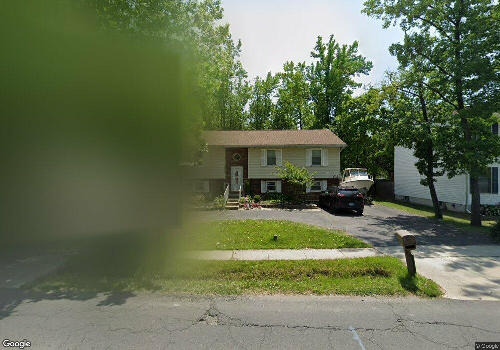
2001B Middleborough Rd Baltimore, MD 21221
Estimated Value: $386,848 - $416,000
--
Bed
--
Bath
1,338
Sq Ft
$300/Sq Ft
Est. Value
About This Home
This home is located at 2001B Middleborough Rd, Baltimore, MD 21221 and is currently estimated at $401,462, approximately $300 per square foot. 2001B Middleborough Rd is a home located in Baltimore County with nearby schools including Middleborough Elementary School, Deep Creek Middle, and Chesapeake High School.
Ownership History
Date
Name
Owned For
Owner Type
Purchase Details
Closed on
Feb 28, 2013
Sold by
Bernard Lloyd G and Bernard Lloyd E
Bought by
Jones Daniel Ryan and Tinelli Cara Lynn
Current Estimated Value
Home Financials for this Owner
Home Financials are based on the most recent Mortgage that was taken out on this home.
Original Mortgage
$222,323
Outstanding Balance
$156,887
Interest Rate
3.54%
Mortgage Type
FHA
Estimated Equity
$244,575
Purchase Details
Closed on
Jan 4, 2002
Sold by
Secretary Of Housing
Bought by
Bernard Lloyd E
Purchase Details
Closed on
Aug 23, 2001
Sold by
Goodwin Pamela Carter
Bought by
Secretary Of Housing
Purchase Details
Closed on
May 22, 1996
Sold by
Mcelwee Robert D
Bought by
Goodwin Pamela Carter
Create a Home Valuation Report for This Property
The Home Valuation Report is an in-depth analysis detailing your home's value as well as a comparison with similar homes in the area
Home Values in the Area
Average Home Value in this Area
Purchase History
| Date | Buyer | Sale Price | Title Company |
|---|---|---|---|
| Jones Daniel Ryan | $228,500 | Real Estate Title & Escrow L | |
| Bernard Lloyd E | $144,000 | -- | |
| Secretary Of Housing | $194,043 | -- | |
| Goodwin Pamela Carter | $156,300 | -- |
Source: Public Records
Mortgage History
| Date | Status | Borrower | Loan Amount |
|---|---|---|---|
| Open | Jones Daniel Ryan | $222,323 |
Source: Public Records
Tax History Compared to Growth
Tax History
| Year | Tax Paid | Tax Assessment Tax Assessment Total Assessment is a certain percentage of the fair market value that is determined by local assessors to be the total taxable value of land and additions on the property. | Land | Improvement |
|---|---|---|---|---|
| 2025 | $4,542 | $334,067 | -- | -- |
| 2024 | $4,542 | $313,633 | $0 | $0 |
| 2023 | $2,177 | $293,200 | $74,600 | $218,600 |
| 2022 | $4,135 | $285,867 | $0 | $0 |
| 2021 | $3,718 | $278,533 | $0 | $0 |
| 2020 | $3,718 | $271,200 | $74,600 | $196,600 |
| 2019 | $3,551 | $255,667 | $0 | $0 |
| 2018 | $3,491 | $240,133 | $0 | $0 |
| 2017 | $3,220 | $224,600 | $0 | $0 |
| 2016 | $2,823 | $218,533 | $0 | $0 |
| 2015 | $2,823 | $212,467 | $0 | $0 |
| 2014 | $2,823 | $206,400 | $0 | $0 |
Source: Public Records
Map
Nearby Homes
- 316 Wye Rd
- 2023 Middleborough Rd
- 319 Sassafras Rd
- 203 Oak Ave
- 200 West Rd
- 1811 Hilltop Ave
- Parcel 943 Browns Rd
- 528 Waters Landing Dr
- 84 Kingston Park Ln
- 116 Kingston Park Ln
- 608 Hopkins Landing Dr
- 1698 Poles Rd
- 2 Sidewell Ct
- 1534 Hudson View Rd
- 1937 Cape May Rd
- 1634 Cape May Rd
- 356 Delano Way
- 1643 Riverwood Rd
- 1432 Shore Rd
- 78 W Kingston Park Ln
- 2001 Middleborough Rd Unit B
- 301 Worton Rd
- 2003 Middleborough Rd
- 305 Worton Rd
- 2005 Middleborough Rd
- 1929 Middleborough Rd
- 307 Worton Rd
- 2004 Middleborough Rd
- 309 Worton Rd
- 264 Nanticoke Rd
- 2006 Middleborough Rd
- 2000 Middleborough Rd
- 1927 Middleborough Rd
- 304 Worton Rd
- 308 Worton Rd
- 2008 Middleborough Rd
- 311 Worton Rd
- 2013 Middleborough Rd
- 262 Nanticoke Rd
- 1928 Middleborough Rd