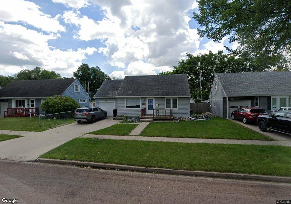
2002 11th Ave S Fargo, ND 58103
Jefferson-Carl NeighborhoodEstimated Value: $189,000 - $243,000
4
Beds
2
Baths
1,301
Sq Ft
$169/Sq Ft
Est. Value
About This Home
This home is located at 2002 11th Ave S, Fargo, ND 58103 and is currently estimated at $219,967, approximately $169 per square foot. 2002 11th Ave S is a home located in Cass County with nearby schools including Jefferson Elementary School, Carl Ben Eielson Middle School, and South High School.
Ownership History
Date
Name
Owned For
Owner Type
Purchase Details
Closed on
Nov 1, 2023
Sold by
Stengrim Jessica and Meyer Jessica Amber
Bought by
Stengrim Scott Isaac
Current Estimated Value
Purchase Details
Closed on
Jan 21, 2022
Sold by
Stengrim and Jessica
Bought by
Stengrim Scott I and Stengrim Jessica
Home Financials for this Owner
Home Financials are based on the most recent Mortgage that was taken out on this home.
Original Mortgage
$162,800
Interest Rate
3.22%
Mortgage Type
FHA
Purchase Details
Closed on
Mar 17, 2006
Sold by
Schwan Patrick S and Estate Of Myron J Schwan
Bought by
Tulibaski Brian R
Home Financials for this Owner
Home Financials are based on the most recent Mortgage that was taken out on this home.
Original Mortgage
$91,800
Interest Rate
10.97%
Mortgage Type
Adjustable Rate Mortgage/ARM
Create a Home Valuation Report for This Property
The Home Valuation Report is an in-depth analysis detailing your home's value as well as a comparison with similar homes in the area
Home Values in the Area
Average Home Value in this Area
Purchase History
| Date | Buyer | Sale Price | Title Company |
|---|---|---|---|
| Stengrim Scott Isaac | -- | None Listed On Document | |
| Stengrim Scott I | -- | New Title Company Name | |
| Stengrim Scott I | -- | New Title Company Name | |
| Tulibaski Brian R | -- | -- |
Source: Public Records
Mortgage History
| Date | Status | Borrower | Loan Amount |
|---|---|---|---|
| Previous Owner | Stengrim Scott I | $162,800 | |
| Previous Owner | Tulibaski Brian R | $91,800 |
Source: Public Records
Tax History
| Year | Tax Paid | Tax Assessment Tax Assessment Total Assessment is a certain percentage of the fair market value that is determined by local assessors to be the total taxable value of land and additions on the property. | Land | Improvement |
|---|---|---|---|---|
| 2024 | $3,339 | $108,400 | $21,050 | $87,350 |
| 2023 | $3,586 | $98,550 | $21,050 | $77,500 |
| 2022 | $3,637 | $97,550 | $21,050 | $76,500 |
| 2021 | $3,336 | $87,100 | $21,050 | $66,050 |
| 2020 | $3,209 | $87,100 | $21,050 | $66,050 |
| 2019 | $3,141 | $84,100 | $12,500 | $71,600 |
| 2018 | $3,137 | $84,100 | $12,500 | $71,600 |
| 2017 | $2,169 | $81,650 | $12,500 | $69,150 |
| 2016 | $1,908 | $79,250 | $12,500 | $66,750 |
| 2015 | $1,711 | $66,450 | $8,550 | $57,900 |
| 2014 | $1,598 | $60,400 | $8,550 | $51,850 |
| 2013 | $1,585 | $60,400 | $8,550 | $51,850 |
Source: Public Records
Map
Nearby Homes
- 1129 22nd St S Unit B09
- 1129 22nd St S Unit B12
- 1101 22nd St S Unit 6
- 1909 9th Ave S
- 1421 19th St S
- 1334 17th St S
- 1407 17th St S
- 1337 16 1 2 St S
- 1625 9th Ave S
- 702 21st St S
- 1622 7th Ave S
- 2202 15th Ave S
- 2209 6th Ave S
- 2126 5th Ave S
- 2402 N Flickertail Dr S Unit 1
- 1526 16 1 2 St S
- 719 15th St S
- 1011 14th St S
- 1329 14th St S
- 1613 5th Ave S
- 1918 11th Ave S
- 2006 11th Ave S
- 2001 12th Ave S
- 2010 11th Ave S
- 1914 11th Ave S
- 1917 12th Ave S
- 2005 12th Ave S
- 1913 12th Ave S
- 2009 12th Ave S
- 2014 11th Ave S
- 1910 11th Ave S
- 2001 11th Ave S
- 2005 11th Ave S
- 1909 12th Ave S
- 2009 11th Ave S
- 1913 11th Ave S
- 1906 11th Ave S
- 2013 11th Ave S
- 1909 11th Ave S
- 1905 12th Ave S
Your Personal Tour Guide
Ask me questions while you tour the home.