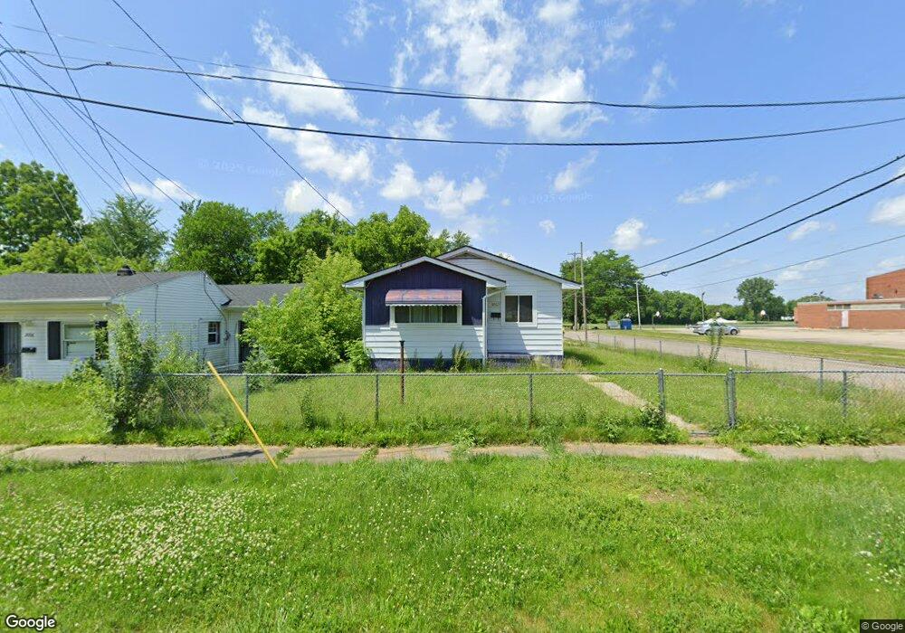
2002 Burr Blvd Flint, MI 48503
South Parks NeighborhoodEstimated Value: $40,613 - $62,000
3
Beds
2
Baths
978
Sq Ft
$56/Sq Ft
Est. Value
About This Home
This home is located at 2002 Burr Blvd, Flint, MI 48503 and is currently estimated at $55,153, approximately $56 per square foot. 2002 Burr Blvd is a home located in Genesee County with nearby schools including Freeman Elementary School, Flint Southwestern Classical Academy, and International Academy of Flint (K-12).
Ownership History
Date
Name
Owned For
Owner Type
Purchase Details
Closed on
Sep 15, 2020
Sold by
The Genesee County Land Bank Authority
Bought by
Lunnell Ricky
Current Estimated Value
Home Financials for this Owner
Home Financials are based on the most recent Mortgage that was taken out on this home.
Original Mortgage
$3,500
Outstanding Balance
$3,100
Interest Rate
2.8%
Mortgage Type
Land Contract Argmt. Of Sale
Estimated Equity
$52,053
Purchase Details
Closed on
Dec 19, 2019
Sold by
Genesee County Treasurer
Bought by
Genesee County Land Bank Authority
Purchase Details
Closed on
Nov 19, 2014
Sold by
Cherry Deboray L
Bought by
Adams Victor B
Purchase Details
Closed on
Jun 28, 2006
Sold by
Wansley Timmie M
Bought by
Wansley Timmie M
Create a Home Valuation Report for This Property
The Home Valuation Report is an in-depth analysis detailing your home's value as well as a comparison with similar homes in the area
Home Values in the Area
Average Home Value in this Area
Purchase History
| Date | Buyer | Sale Price | Title Company |
|---|---|---|---|
| Lunnell Ricky | $4,500 | None Available | |
| Genesee County Land Bank Authority | -- | None Available | |
| Adams Victor B | $250 | None Available | |
| Wansley Timmie M | -- | None Available |
Source: Public Records
Mortgage History
| Date | Status | Borrower | Loan Amount |
|---|---|---|---|
| Open | Lunnell Ricky | $3,500 |
Source: Public Records
Tax History
| Year | Tax Paid | Tax Assessment Tax Assessment Total Assessment is a certain percentage of the fair market value that is determined by local assessors to be the total taxable value of land and additions on the property. | Land | Improvement |
|---|---|---|---|---|
| 2025 | $768 | $14,900 | $0 | $0 |
| 2024 | $704 | $12,700 | $0 | $0 |
| 2023 | $696 | $10,800 | $0 | $0 |
| 2022 | $0 | $9,400 | $0 | $0 |
| 2021 | $718 | $8,300 | $0 | $0 |
| 2020 | $268 | $0 | $0 | $0 |
| 2019 | $1,345 | $7,000 | $0 | $0 |
| 2018 | $884 | $9,500 | $0 | $0 |
| 2017 | $1,019 | $0 | $0 | $0 |
| 2016 | $871 | $0 | $0 | $0 |
| 2015 | -- | $0 | $0 | $0 |
| 2014 | -- | $0 | $0 | $0 |
| 2012 | -- | $12,700 | $0 | $0 |
Source: Public Records
Map
Nearby Homes
- 2033 Seymour Ave
- 1851 Seymour Ave
- 2029 Winans Ave
- 1840 Mcphail St
- 2010 Crocker Ave
- 1930 Owen St
- 1814 Mcphail St
- 9211 Owen St
- 2221 Howard Ave
- 2224 Crocker Ave
- 2050 Ferris Ave
- 1510 S Franklin Ave
- 420 Pingree Ave
- 1720 Park St
- 1701 Park St
- 1210 Blanchard Ave
- 2910 Shawnee Ave
- 149 E Tobias St
- 149 E Linsey Blvd
- 915 E 8th St
- 2006 Burr Blvd
- 2010 Burr Blvd
- 1402 Pingree Ave
- 2014 Burr Blvd
- 2013 Maybury Ave
- 2018 Burr Blvd
- 2001 Burr Blvd
- 2017 Maybury Ave
- 2005 Burr Blvd
- 2009 Burr Blvd
- 1941 Burr Blvd
- 2022 Burr Blvd
- 2015 Burr Blvd
- 2002 Maybury Ave
- 1937 Burr Blvd
- 2021 Maybury Ave
- 1933 Burr Blvd
- 2026 Burr Blvd
- 2014 Maybury Ave
- 2010 Mcavoy St
Your Personal Tour Guide
Ask me questions while you tour the home.