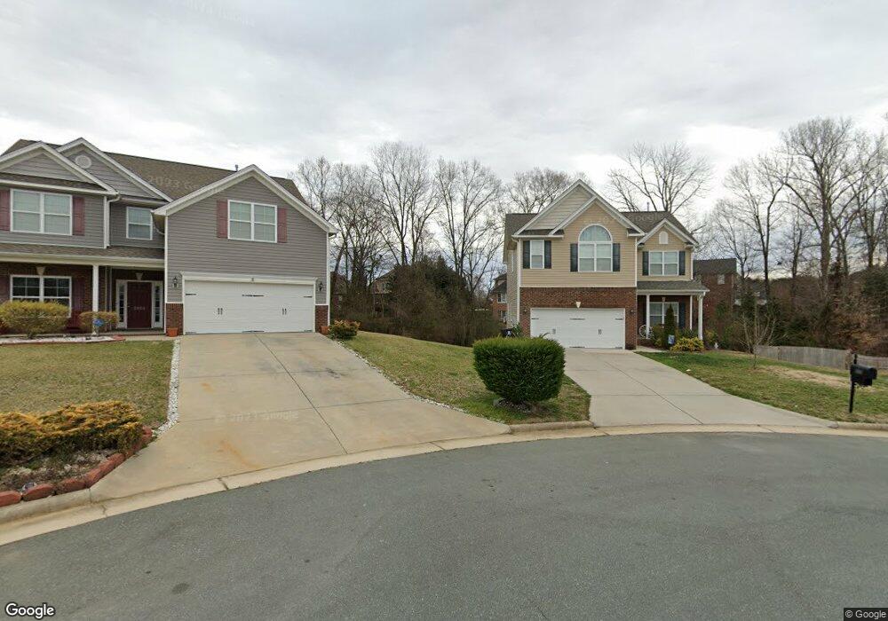
2002 Heron Pointe Dr Whitsett, NC 27377
Estimated Value: $392,000 - $444,000
4
Beds
3
Baths
2,198
Sq Ft
$189/Sq Ft
Est. Value
About This Home
This home is located at 2002 Heron Pointe Dr, Whitsett, NC 27377 and is currently estimated at $415,666, approximately $189 per square foot. 2002 Heron Pointe Dr is a home with nearby schools including Sedalia Elementary School, Eastern Guilford Middle School, and Eastern Guilford High School.
Ownership History
Date
Name
Owned For
Owner Type
Purchase Details
Closed on
May 5, 2017
Sold by
Keystone Group Inc
Bought by
Clifton Robert S and Clifton Janet G
Current Estimated Value
Home Financials for this Owner
Home Financials are based on the most recent Mortgage that was taken out on this home.
Original Mortgage
$208,905
Outstanding Balance
$174,346
Interest Rate
4.23%
Mortgage Type
New Conventional
Estimated Equity
$241,320
Purchase Details
Closed on
Jul 1, 2011
Bought by
Keystone Group Inc
Create a Home Valuation Report for This Property
The Home Valuation Report is an in-depth analysis detailing your home's value as well as a comparison with similar homes in the area
Home Values in the Area
Average Home Value in this Area
Purchase History
We collect this data history from publicly available records. To have your information removed, we recommend requesting removal directly through your county’s website.
| Date | Buyer | Sale Price | Title Company |
|---|---|---|---|
| Clifton Robert S | $220,000 | None Available | |
| Keystone Group Inc | -- | -- |
Source: Public Records
Mortgage History
We collect this data history from publicly available records. To have your information removed, we recommend requesting removal directly through your county’s website.
| Date | Status | Borrower | Loan Amount |
|---|---|---|---|
| Open | Clifton Robert S | $208,905 |
Source: Public Records
Tax History
| Year | Tax Paid | Tax Assessment Tax Assessment Total Assessment is a certain percentage of the fair market value that is determined by local assessors to be the total taxable value of land and additions on the property. | Land | Improvement |
|---|---|---|---|---|
| 2025 | $2,115 | $261,000 | $48,000 | $213,000 |
| 2024 | $2,115 | $261,000 | $48,000 | $213,000 |
| 2023 | $2,115 | $261,000 | $48,000 | $213,000 |
| 2022 | $2,115 | $261,000 | $48,000 | $213,000 |
| 2021 | $1,719 | $212,100 | $35,000 | $177,100 |
| 2020 | $1,719 | $212,100 | $35,000 | $177,100 |
| 2019 | $1,719 | $212,100 | $0 | $0 |
| 2018 | $1,710 | $212,100 | $0 | $0 |
| 2017 | $568 | $70,400 | $0 | $0 |
| 2016 | $292 | $35,000 | $0 | $0 |
| 2015 | $294 | $35,000 | $0 | $0 |
| 2014 | $298 | $35,000 | $0 | $0 |
Source: Public Records
Map
Nearby Homes
- 6604 Barton Creek Ct
- 1907b Whisper Lake Dr
- 1907 Whisper Lake Dr Unit B
- 1963 Whisper Lake Dr
- 6548 Donahue Dr
- 1904 Brant Pointe Ct
- 2610 MacKintosh Lake Ln
- 1337 Village Rd Unit 229
- 1161 Glory Vine Rd
- 1176 Brooksridge Way
- 1122 Brooksridge Way
- 1120 Brooksridge Way
- 1118 Brooksridge Way
- 1116 Brooksridge Way
- 1126 Oak Blossom Way
- 1112 Brooksridge Way
- 1108 Brooksridge Way
- 1118 Glory Vine Rd
- 942 Boone Valley Rd
- 971 Wyckshire Ct
- 2000 Heron Pointe Dr
- 2004 Heron Pointe Dr
- 2001 Heron Pointe Dr
- 1914 Wake Bridge Dr
- 2005 Heron Pointe Dr
- 1916 Wake Bridge Dr Unit 9
- 1916 Wake Bridge Dr
- 1912 Wake Bridge Dr
- 2003 Heron Pointe Dr
- 6711 Laurel Fork Dr
- 6715 Laurel Fork Dr
- 6713 Laurel Fork Dr
- 2007 Heron Pointe Dr
- 1918 Wake Bridge Dr
- 1910 Wake Bridge Dr
- 2009 Heron Pointe Dr
- 6709 Laurel Fork Dr
- 1920 Wake Bridge Dr
- 78 Wake Bridge Dr
- 1908 Wake Bridge Dr
Your Personal Tour Guide
Ask me questions while you tour the home.