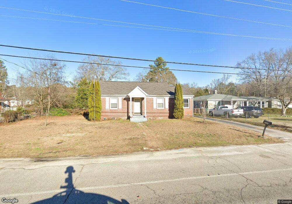
2002 Holland St West Columbia, SC 29169
Estimated Value: $184,000 - $241,000
2
Beds
2
Baths
1,435
Sq Ft
$142/Sq Ft
Est. Value
About This Home
This home is located at 2002 Holland St, West Columbia, SC 29169 and is currently estimated at $203,327, approximately $141 per square foot. 2002 Holland St is a home located in Lexington County with nearby schools including Riverbank Elementary, Northside Middle, and Brookland-Cayce High School.
Ownership History
Date
Name
Owned For
Owner Type
Purchase Details
Closed on
Jun 10, 2011
Sold by
Jackson Bennie W and Jackson Timothy B
Bought by
Fisher John M and Fisher Betty S
Current Estimated Value
Home Financials for this Owner
Home Financials are based on the most recent Mortgage that was taken out on this home.
Original Mortgage
$68,730
Outstanding Balance
$47,559
Interest Rate
4.71%
Mortgage Type
Future Advance Clause Open End Mortgage
Estimated Equity
$155,768
Purchase Details
Closed on
Jan 24, 2011
Sold by
Estate Of Annie R Jackson and Jackson Bennie W
Bought by
Jackson Bennie W and Jackson Timothy B
Create a Home Valuation Report for This Property
The Home Valuation Report is an in-depth analysis detailing your home's value as well as a comparison with similar homes in the area
Home Values in the Area
Average Home Value in this Area
Purchase History
| Date | Buyer | Sale Price | Title Company |
|---|---|---|---|
| Fisher John M | $87,000 | -- | |
| Jackson Bennie W | -- | -- |
Source: Public Records
Mortgage History
| Date | Status | Borrower | Loan Amount |
|---|---|---|---|
| Open | Fisher John M | $68,730 |
Source: Public Records
Tax History Compared to Growth
Tax History
| Year | Tax Paid | Tax Assessment Tax Assessment Total Assessment is a certain percentage of the fair market value that is determined by local assessors to be the total taxable value of land and additions on the property. | Land | Improvement |
|---|---|---|---|---|
| 2024 | $2,741 | $6,365 | $1,800 | $4,565 |
| 2023 | $2,515 | $4,243 | $1,200 | $3,043 |
| 2022 | $818 | $4,243 | $1,200 | $3,043 |
| 2020 | $786 | $4,243 | $1,200 | $3,043 |
| 2019 | $756 | $4,002 | $1,151 | $2,851 |
| 2018 | $764 | $4,002 | $1,151 | $2,851 |
| 2017 | $733 | $4,002 | $1,151 | $2,851 |
| 2016 | $2,116 | $6,000 | $1,726 | $4,274 |
| 2014 | $499 | $3,479 | $1,200 | $2,279 |
| 2013 | -- | $3,480 | $1,200 | $2,280 |
Source: Public Records
Map
Nearby Homes
- 2004 Dew Ave
- 415 Graham St
- 207 Woodhaven Dr
- 215 Sandel Ln
- 165 Cavendish Dr
- 0 Platt Springs Rd Unit 606355
- 623 Hook Ave
- 617 Holland Cir
- 529 Finnegan Ln
- 106 Earl Ct
- 1615 Holland St
- 500 Finnegan Ln
- 116 Silver Run Place
- 212 Alexandria St
- 135 Silver Run Place
- 339 Gum Swamp Trail
- 349 Gum Swamp Trail
- 1734 C Ave
- 1513 Gambrell St
- 1802 D Ave
- 2000 Holland St
- 2004 Holland St
- 2015 Dew Ave
- 2008 Holland St
- 2003 Holland St
- 223 Hendrix St
- 304 Hendrix St
- 302 Hendrix St
- 306 Hendrix St
- 300 Hendrix St
- 2017 Dew Ave
- 310 Hendrix St
- 1 Hooklawn Dr
- 2005 Holland St
- 2007 Holland St
- 224 Hendrix St
- 2023 Dew Ave
- 221 Hendrix St
- 2014 Holland St
- 2012 Holland St